Colorado Daily Snow

By Joel Gratz, Founding Meteorologist Posted 10 years ago June 20, 2013
Hi folks...sorry for being MIA over the last week. I was on a three day rafting trip and then spent two days chasing storms. I'll post pictures from the storm chasing over the next few days, but the big story for Colorado right now is, once again, the fires.
While the bigger fires from last week are mostly contained, new fires have grown today. It seems like today's fires were started naturally by lightning over the last few days or weeks, and then really kicked into high gear today due to wind, warmer temperatures, and drier air. Let's hope that these fires cause no loss of life and limited property damage. That said, if the fires were started naturally by lightning, this is a process that is normal for the arid western states.
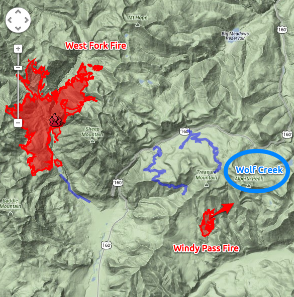
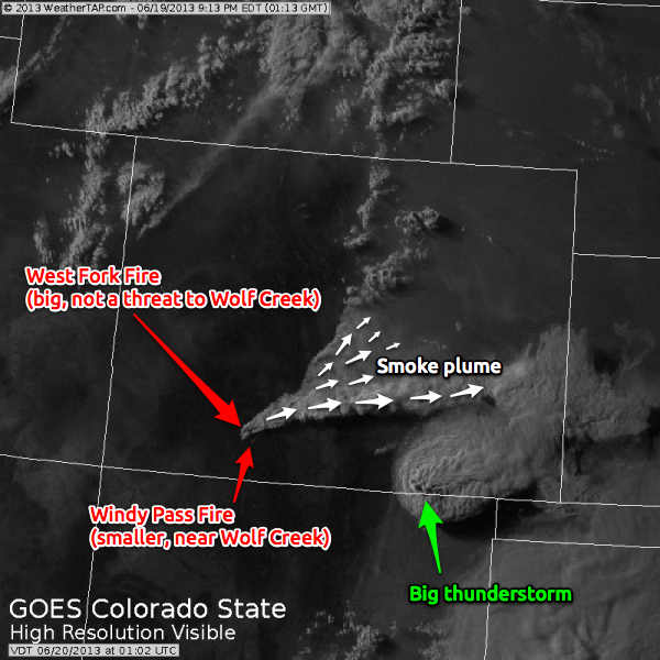
There is a ~500 acre fire west of Denver called the Lime Creek Fire. I don't want to minimize this one, but the most visibile and fastest growing fire is the West Fork Fire near Wolf Creek in south western Colorado. This is actually two fires, the "West Fork" and the "Windy Pass" fire. The West Fork fire is much bigger and growing rapidly (see the smoke plume on the satellite image below) but the Windy Pass fire is the one that is threatening Wolf Creek Ski Area. The map below shows the fire in relation to the ski area, and since the wind is blowing from southwest to northeast, the ski area is in the path of the fire. Crews are focused on protecting the ski area, and I'll keep you posted with the latest. At this moment, the fire still seems to be in the bowl to the west of the ski area, but with high winds, the fire can spread quickly. You can open this file (KML) in Google Earth to see the perimeter of the Windy Pass fire and zoom around to understand its proximity to Wolf Creek ski area. Keep in mind that the perimeter shown below and in the file is from Tuesday night, June 18th. The fire has grown considerably today, Wednesday, and we should get a new perimeter map by Thursday morning.

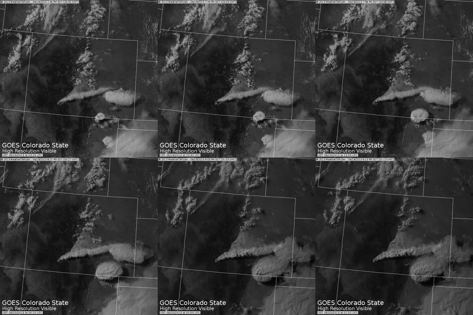
I am truly amazed by the satellite images from this evening. The smoke plume from the West Fork fire extends high into the sky and over a vast area of southern and eastern Colorado. I've never seen a plume of smoke so thick from the perspective of a satellite image. The winds around 18,000 feet are blowing west to east, while winds closer to the ground are blowing southwest to northeast and even south to north. This explains why the higher elevation smoke is quickly moving to the east while the lower elevation smoke is moving more to the northeast. The first image is a still and the second image shows an animated image.


JOEL GRATZ
About Our Forecaster


