Colorado Daily Snow

By Joel Gratz, Founding Meteorologist Posted 11 years ago October 17, 2012
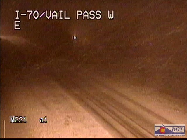
As promised a nice little cold front moved through Colorado late on Tuesday night. Heavier snow showers fell for a few hours and left anywhere from a dusting to about 3" along I-70 from Breckenridge over to Copper and Vail. In fact the snow caused some accidents and a temporary closure east of the tunnel on Wednesday morning (no surprise:-). Here is a webcam image from Vail Pass at around midnight on Tuesday night -- what a snowy scene!

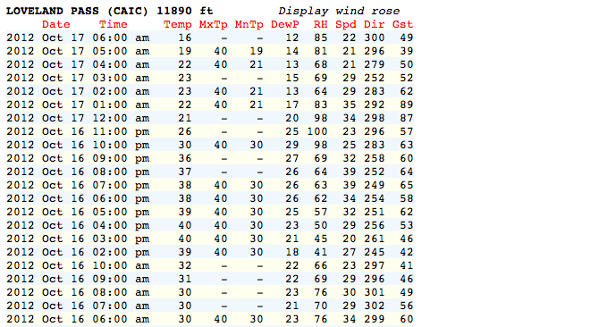
Also as promised, the wind picked up yesterday and peaked last night just after the cold front moved through. A weather station near the top of Loveland Pass recorded a gust to 89mph at around 1am (see the far right column).

And in other great news, Abasin is open for the season...let' the good times roll!
The rest of this week will be dry with some wind hanging on during Wednesday and Thursday morning before relaxing heading into the weekend. The weekend also looks dry.
Far into the future (i.e. next week), the forecast is a mess. There are a few models that I and most other meteorologists use to look at the 5-10 day forecast (American, Canadian, European, Navy, British). Sometimes, many of the models agree on the general nature of the forecast. But many times they do not, and this is one of those times.
There are two chances for storminess over the next 10 days.
The first is on Sunday night through Monday. I think this is going to be a non-event as most of the moisture will stay to the north and west of Colorado and even if the moisture gets closer, temperatures will be warm and snow levels will be above 10,000ft.
The second chance for a storm still looks like sometime next Thursday through next Friday (25th-26th). This storm looks more likely to pay off with colder air and snow, and most of the models agree that there will be "something" during this time but they disagree on all the details. Such is life when forecasting for the long term.
If you're looking for snow, British Columbia is getting hit this week, and heavier snow and colder air will head south into Washington State early this weekend. Early next week, most of the moisture and colder air will be north and west of Colorado which means that Tahoe, Oregon, Washington, Idaho, Montana, and the Tetons in Wyoming should see some accumulating snow and pictures will be flying on Facebook.
The Long Range Forecast page on our Powder Finder updates daily with weather maps showing the outlook for snow for the next 5 days and the general weather pattern for the next 6-10 days. Check it out!
JOEL GRATZ
About Our Forecaster


