Colorado Daily Snow

By Joel Gratz, Founding Meteorologist Posted 9 years ago March 4, 2015
Powder today, then snow returns late next week
Summary:
- A few big snow reports on Wednesday morning!
- Lingering snow showers on Wednesday
- Dry from Thursday to next Wednesday
- Snow likely from late next week through next weekend (March 12-15)
Details:
The forecast for Tuesday and Tuesday night did not go perfectly, but I don't think that many people will be complaining about the following 24-hour snow totals (and, the vast majority of this snow fell on Tuesday night, so it'll be untracked on Wednesday morning):
Irwin: 15" (estimate from pow cam)
Beaver Creek: 12"
Aspen Mountain: 11"
Snowmass: 11"
Sunlight: 11"
Crested Butte: 10"
Aspen Highlands: 9"
Powderhorn: 9"
Steamboat: 9"
You can see a full list for Colorado, ordered from high-to-low, here:
http://opensnow.com/powder/now?state=CO
There was a band of heavier snow during the day on Tuesday, but this only targeted Beaver Creek and Sunlight it seemed. Then, on Tuesday night, as the last push of cold air and storm energy (vorticity, which is spin in the atmosphere that helps to lift the air) moved across the northern half of the state, things came together perfectly to create rather heavy snow for a few areas of the central and northern mountains. On the satellite image below, blue and green colors show thicker clouds, and we can infer that these clouds could produce moderate to heavy snow. This image is from about midnight on Tuesday night, and shows one band of energy across the middle of the state, with another moving in from the northwest. No doubt, it was a complicated setup that offered plenty of surprises. Enjoy the pow!
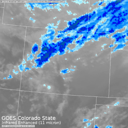
Source: Weathertap.com
Today, Wednesday:
Expect lingering clouds, a few snow showers, light accumulations, and cold temperatures. I could see a few spots getting another 1-2 inches of snow from these snow showers, but overall, accumulations will be from zero to an inch.
Tonight, Wednesday night, through next Wednesday, March 11th:
It'll be dry and progressively warmer during this time. There could be times of cloudiness, especially during the weekend over the northern mountains, but I don't think we'll see any precipitation during this seven-day stretch.
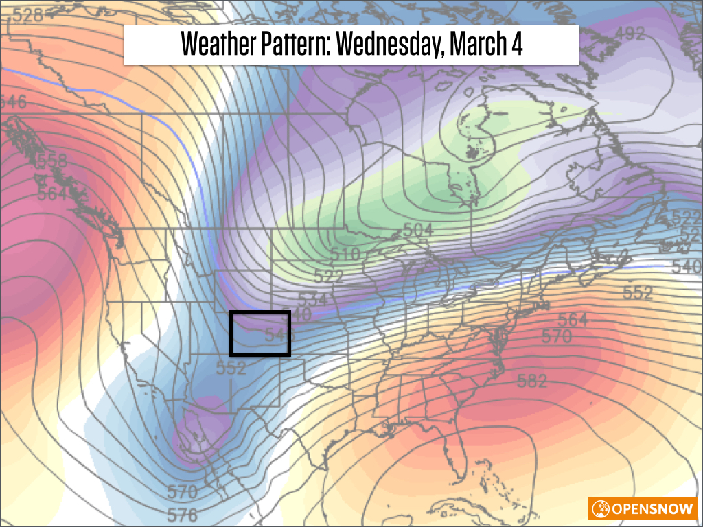
Compare the trough, creating today's weather cold weather ...
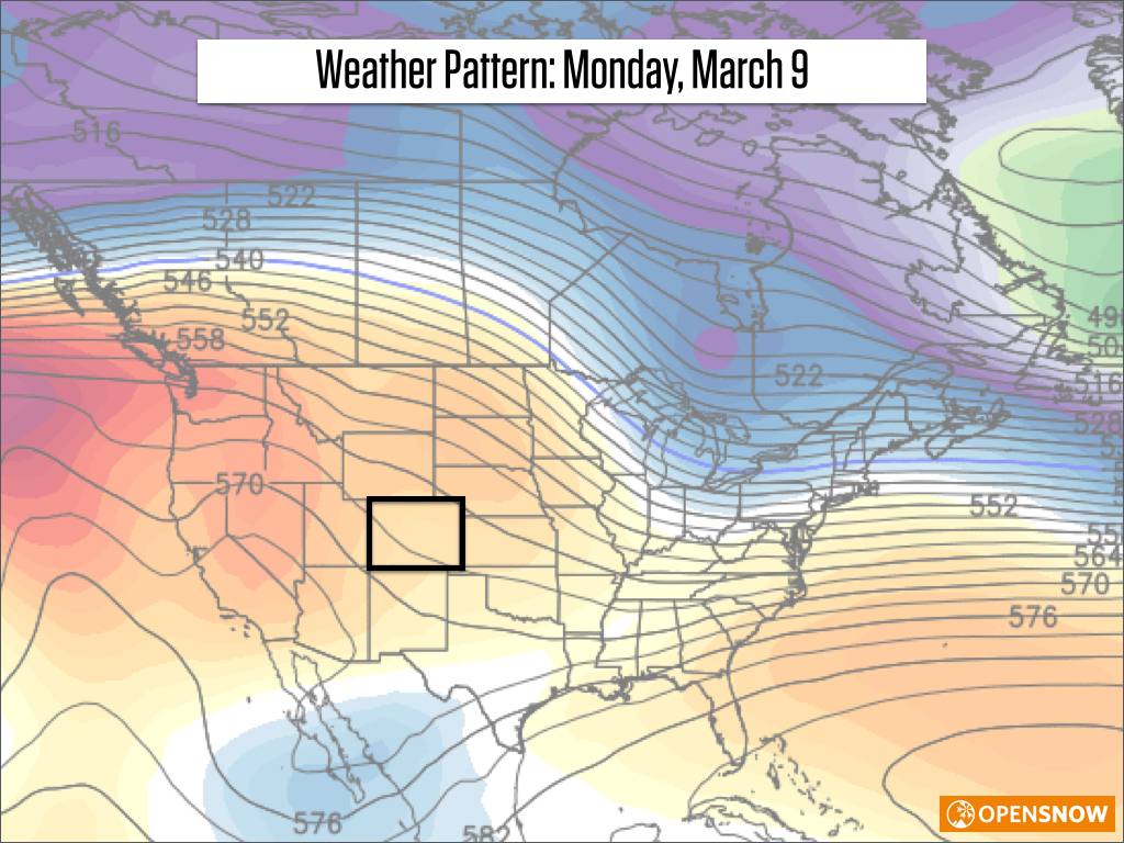
... with the ridge of high pressure that will replace this trough over the weekend and into early next week.
Next Thursday through the following weekend (March 12-15):
I have relatively high confidence that we'll see snow during this period, though these days are still much too far away to offer a detailed forecast. Most models do show a storm, or more likely, multiple storms affecting Colorado late next week and next week. A trough will try to reestablish itself over the western US and Canada, and this should allow colder air and snow to return.
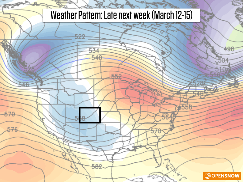
This and the previous two maps courtesy of Weatherbell.com
The past 12 days have been very kind to Colorado, with the snowpack making serious gains after a very lackluster stretch from early January through mid February. I'll share some of those numbers in Thursday' post.
JOEL GRATZ
Win two passes to the Talons Challenge, held at Beaver Creek on Saturday, March 7th!
EDIT: The contest is closed as of 830am because we have a winner, and it only took 15 minutes! I need to create a harder question next time. The winning answer is: "Mammatus Clouds. Unfortunately there are a lot of differing theories as to why they form but they are uneven so it is obviously a method that does not ski with symmetrical turns." Here is a photo of these clouds: http://opsw.co/1wV0iXd
1) Go here to read more about the event and to be sure you can participate. These passes do NOT include a lift ticket to Beaver Creek, just an entry to the event, so you'll need to already have a pass or lift ticket to Beaver Creek. More details: http://opsw.co/1EgXWbe
2) To win the passes, email the answer to the following question to [email protected]:
Many of the runs at the Talons Challenge will be filled with moguls. What type of cloud in the sky most closely resembles the look of a mogul run? Explain why, and include a link to a picture of these clouds.
3) The first person with the correct (or well-explained!) answer will win, and I will update this post when there is a winner.
Good luck!
Geography Key:
Northern Mountains
Steamboat, Granby, Beaver Creek, Vail, Ski Cooper, Copper, Breckenridge, Keystone, Loveland, Abasin, Winter Park, Berthoud Pass, Eldora, Rocky Mountain National Park, Cameron Pass
Along the Divide
Loveland, Abasin, Winter Park, Berthoud Pass
East of the Divide
Eldora, Rocky Mountain National Park, Cameron Pass
Central Mountains
Aspen, Sunlight, Monarch, Crested Butte, Irwin, Powderhorn
Southern Mountains
Telluride, Silverton, Durango, Wolf Creek (Telluride and Silverton are on the northern side of the southern mountains)
About Our Forecaster
Joel Gratz
Founding Meteorologist
Joel Gratz is the Founding Meteorologist of OpenSnow and has lived in Boulder, Colorado since 2003. Before moving to Colorado, he spent his childhood as a (not very fast) ski racer in eastern Pennsylvania.
Free OpenSnow App


