Colorado Daily Snow

By Joel Gratz, Founding Meteorologist Posted 9 years ago April 20, 2015
Afternoon showers this week
Summary:
- Another few inches of snow fell on Sunday night
- Most days this week will feature sun + afternoon pop-up showers
- We may see a chance for steadier snow sometime Thu/Fri/Sat/Sun
- Another storm possible around April 30th
Details:
Snow showers fell off-and-on during the day on Sunday, and a wave of heavier precipitation moved across the state on Sunday night, dropping a couple of inches of snow, mostly on the northern mountains. The resorts that remain open (Abasin, Loveland, Winter Park) are reporting 3-4 inches over the past 24 hours.
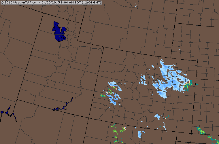
The Monday morning radar over Colorado shows that Sunday night's snow showers have now pushed east of the mountains and are drifting over the eastern plains.
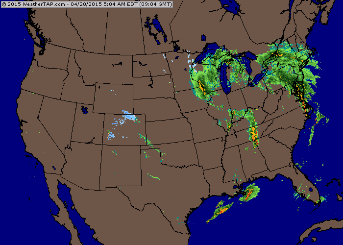
The wider radar animation over the United States shows that most of the action is well to our east, as the storm that affected us from Thursday through Sunday has now pushed into the midwest.
Images courtesy of weathertap.com
Monday and Tuesday will likely offer a combination of sun plus afternoon pop-up snow showers. Accumulations should be rather light and quite variable as the showers will pop up in some places and not others.
On Wednesday, the afternoon showers could be more numerous, though with warmer temperatures, any accumulation will likely stay at or above 10,000ft.
Between Thursday and Sunday, two weak and warm storms will move across or near Colorado. I only put an inch in the forecast each day and night for most mountains during this time as it's unclear if these storms will be strong enough or cold enough to create widespread accumulating snowfall. It's possible that we will see a period or two of heavier snow between Thursday and Sunday, but I have no clue about the timing or location of the steadier snow at this point. Temperatures will be spring-like, so the best snowfall will occur at the higher elevations, above about 10,000 feet.
Next week should start calm and dry, then we might see another storm around April 30th or May 1st, ish.
JOEL GRATZ
End of Season Survey - 5 to 10 minutes could win you $100 (stole that from GEICO). Thanks for your help!
http://opsw.co/season-survey
Corn Harvest THIS weekend at Loveland - CAIC Fundraiser
Come support the Avalanche Center, ski with your friends - have a great lunch, a couple beers and be a part of one of the best raffles around; skis, packs, avy gear, prizes galore!! More info: http://opsw.co/1HLzl0c
Geography Key:
Northern Mountains
Steamboat, Granby, Beaver Creek, Vail, Ski Cooper, Copper, Breckenridge, Keystone, Loveland, Abasin, Winter Park, Berthoud Pass, Eldora, Rocky Mountain National Park, Cameron Pass
Along the Divide
Loveland, Abasin, Winter Park, Berthoud Pass
East of the Divide
Eldora, Rocky Mountain National Park, Cameron Pass
Central Mountains
Aspen, Sunlight, Monarch, Crested Butte, Irwin, Powderhorn
Southern Mountains
Telluride, Silverton, Durango, Wolf Creek (Telluride and Silverton are on the northern side of the southern mountains)
About Our Forecaster
Joel Gratz
Founding Meteorologist
Joel Gratz is the Founding Meteorologist of OpenSnow and has lived in Boulder, Colorado since 2003. Before moving to Colorado, he spent his childhood as a (not very fast) ski racer in eastern Pennsylvania.
Free OpenSnow App


