Colorado Daily Snow

By Joel Gratz, Founding Meteorologist Posted 8 years ago October 8, 2015
Let’s circle back around
Summary
- Snow on the peaks
- Dry weather through about October 20th
- Long-range models still pointing toward active end of month
Details
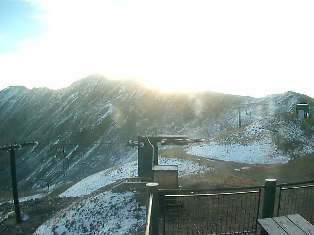
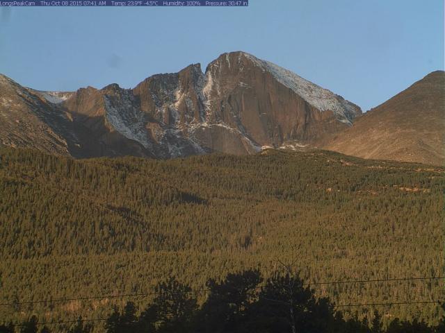
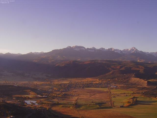
The moisture that pushed into Colorado from the south on Monday, Tuesday, and Wednesday left a nice dusting of snow over 12,000 feet on most mountains. Pictures below are from webcams on Thursday morning.
ABasin:
Longs Peak:
Telluride area:
Also, as I predicted (:-) in last Saturday’s post (October 2nd, link here: http://opensnow.com/dailysnow/colorado/post/4153), Silverton Mountain sent a few of their patrollers to ski the high-elevation snow. As they said, faceshots and baseshots during these early-season turns! More pictures here: http://opensnow.com/news/post/latest-early-october-snow-blankets-the-san-juans
Looking at the next few days, we’ll see plenty of sun and very little adverse weather. On Thursday night, a cold front will push clouds into the front range, east of the divide, and there could be a few showers along and east of the divide, north of I-70. If you get up to elevations around 9-10,000 feet, you might be able to catch a nice sunrise above the clouds on Friday morning.
Saturday and Sunday should be nice days as a storm passes by well to our north. This storm will bring no precipitation to Colorado but should create gusty winds along the divide north of I-70 on Sunday afternoon, Sunday night, and Monday night.
Next week the beautiful fall weather will continue with plenty of sun and no precipitation through at least Wednesday or Thursday.
Interestingly, the cut-off storm that brought rain and snow to Colorado earlier this week from Monday October 5 to Wednesday October 7 is going to move south, then west, and then back north again. In short, it’s going to circle back around and potentially bring showers back to Colorado later next week. I hate the phrase “circle back around” as it reminds me of the corporate buzzword style of communication, and I never thought I would write it about the weather. So it is. Watch the storm make the circle by paying attention to blue area in the gif below:
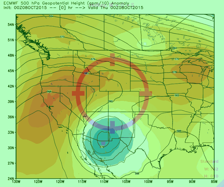
Source: Weatherbell.com
As I mentioned, this cut-off storm might bring some showers back to Colorado later next week, but there’s really nothing that interesting on the horizon for the next 10-15 days.
The European Ensemble is still showing the ridge pushing back west from the west coast into the Pacific Ocean by later this month, so my hopes are inching up that we’ll see cooler weather and more storms by the last week of October into early November. In the mean time, over the next two weeks, temperatures will continue to be pretty warm and I think it’s going to be tough to consistently make snow for Abasin, Loveland, and Copper. October openings may not occur this year unless we get very lucky during the last week.
That’s all for now … have a great weekend and I’ll chat with you again on Monday!
JOEL GRATZ
PS - I’m giving at talk at Walking Mountains Science Center in Avon (near Vail) on Wednesday, October 14th at 630pm. I’ll present our new long range (6 month) forecast method for snowfall over Colorado and the US, as well as talk about El Nino and a few tricks to scoring powder days. More details here: http://www.walkingmountains.org/2015/09/science-behind-weather/
About Our Forecaster
Joel Gratz
Founding Meteorologist
Joel Gratz is the Founding Meteorologist of OpenSnow and has lived in Boulder, Colorado since 2003. Before moving to Colorado, he spent his childhood as a (not very fast) ski racer in eastern Pennsylvania.
Free OpenSnow App


