Colorado Daily Snow

By Joel Gratz, Founding Meteorologist Posted 8 years ago January 6, 2016
Complicated
Summary
Multiple storms moving in from the southwest will deliver powder days to the southern mountains on Thursday and Friday with 12+ inch totals. The central and northern mountains should see a low-end powder day on Thursday morning and then potentially better snow on Saturday and Sunday. Most of next week looks dry.
A Special Thanks to Our Sponsor
Taos Ski Valley, New Mexico - El Niño is here and we have received over 2 feet of snow in the last week. Now is the time to grab your lift tickets! Buy online and save up to 25%. Buy now and save here: http://opsw.co/1VzZGna
Details
After 1-4 inches of snow in the southern mountains on Monday night, Tuesday and Tuesday night were relatively quiet across Colorado as we only experienced a few snow showers and minimal accumulation.
Most of the action during the last 24 hours has been to our southwest and west. The map below shows the change in SWE, or snow-water equivalent. This is the amount of water you’d measure if you melted the fresh snowfall. Many mountain weather stations in California, southern Utah, and Arizona are reporting 1.0+ inches of SWE in the last 24 hours, which roughly equates to 12+ inches of snow.
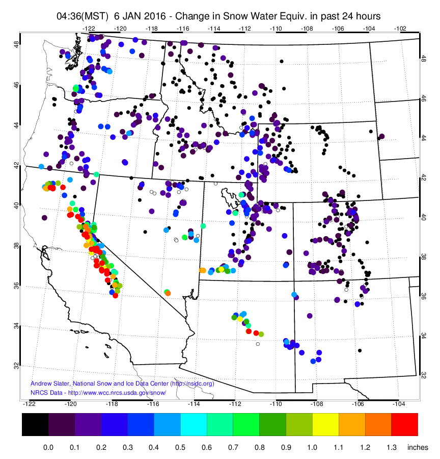
Source: Dr. Andrew Slater
This action to our west and southwest is heading toward Colorado and will deliver snow to most mountains through the end of the week.
The radar animation on Wednesday morning clearly shows two systems. The first is over Arizona, and the second is just moving into California from the Pacific Ocean.
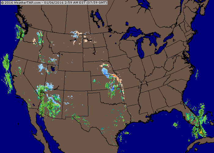
Source: Weathertap.com
Below I’ll talk about the specific forecast for the next five days, though I want to say that I have lower than average confidence in this forecast. In the past I’ve noticed that the computer weather models struggle to make accurate predictions when we see moisture surges from the southwest, like we will see from these storms. And indeed the models are struggling with these systems as there are subtle differences between the forecast models for Thursday and Friday especially.
That caveat aside, here’s how I think things will play out…
Wednesday and Wednesday night: The first storm moves through southern Colorado during Wednesday and then across the entire state on Wednesday night. The southern mountains should see the most snow, maybe in the 5-10 inch range, with the best powder on Wednesday afternoon or most likely Thursday first chair. The central and northern mountains will see the most snow on Wednesday night into Thursday morning, so Thursday should offer the softest turns with a general 2-4 inches of new snow. I do see hints in some models that areas closest to the divide maybe see a little ‘pop’ in snowfall from this event, so I’ll be watching the webcams on Wednesday late night to see what happens.
Thursday and Thursday night: This might be a lull in between systems. We could still see some snow accumulation on Thursday, but I think it’ll be light. Then by Thursday night the next storm should start to bring heavier snow to the southern mountains.
Friday and Friday night: The southern mountains should see heavier snow during the day with another potential powder day. The central and northern mountains may not see much snow during the day, and then the flakes could fly once again later on Friday night as the wind direction switches to blow from the west or northwest, which is more favorable for the northern half of the state.
Saturday through Sunday: We should see at least a couple inches of snow on Saturday as moisture lingers and a wind blows from the west and northwest. This light to moderate snowfall should continue on Saturday night and Sunday, with perhaps a ‘pop’ in snowfall during Sunday morning or midday as a wave of energy passes through the northwest flow. If you’re looking for a powder day in the central or northern mountains, I would keep an eye on Saturday afternoon or Sunday. I can’t promise big totals, but the slopes should ski well after a few days with fresh snow. The northwest part of the San Juans (Telluride and Silverton) could also do OK during these days, but most of the snow should be focused on central and northern Colorado.
Then the longer range outlook shows drier than average weather for next week.
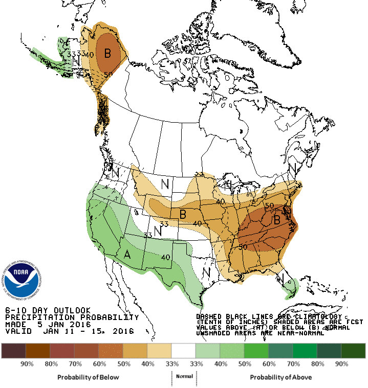
Source: NOAA
We could get lucky and see a rogue storm bust through the west-coast ridge later next week, but I wouldn’t count on it. In Colorado, January during an El Nino winter is a “take what we can get” type of month. If the southern mountains see a couple rounds of good snow, and at least some flakes fall in the central and northern mountains now and again, I would call this a pretty normal month. Our snowpack is near or above average across most regions of the state, so I’m hopeful that we can get through January with cool temperatures and enough snow to preserve the snowpack that’s on the ground, and then we can begin to really add to our numbers during the second half of February through April when historical El Nino years and the models point to a higher chance of significant snowfall.
JOEL GRATZ
PS - here’s a picture sent to me by a reader. It was taken on Tuesday, January 5th at Loveland. “We skinned up early in the AM (thanks to their uphill access policy) and got two laps in. There was a crust, but on the north-facing slopes the snow was in great condition!”
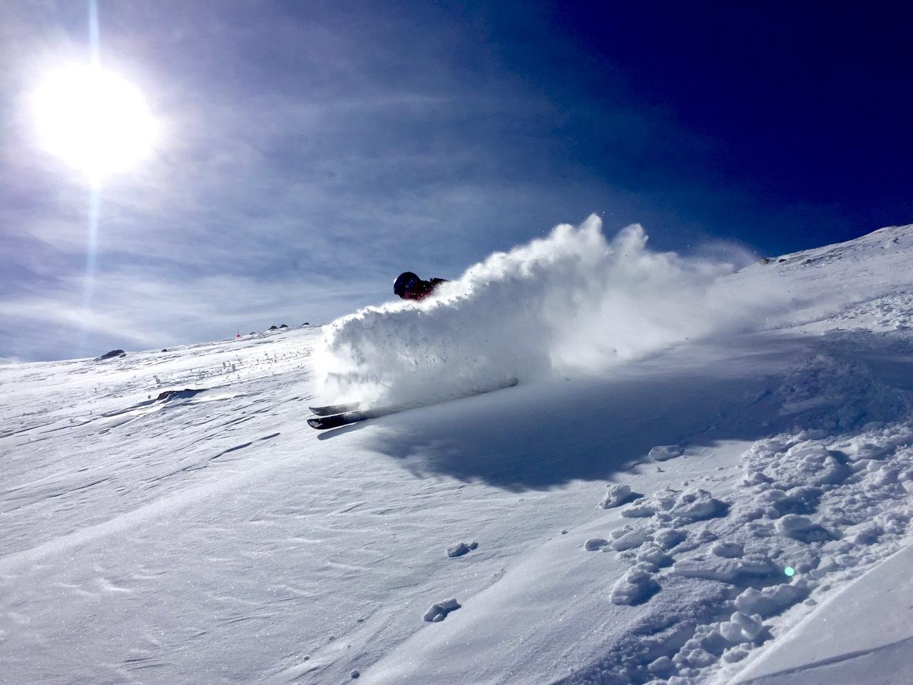
Skier: Andrew Belus, Photo: Chris Whitcomb
Geography Key
Northern Mountains
Steamboat, Granby, Beaver Creek, Vail, Ski Cooper, Copper, Breckenridge, Keystone, Loveland, Abasin, Winter Park, Berthoud Pass, Eldora, Rocky Mountain National Park, Cameron Pass
Along the Divide
Loveland, Abasin, Winter Park, Berthoud Pass
East of the Divide
Eldora, Rocky Mountain National Park, Cameron Pass
Central Mountains
Aspen, Sunlight, Monarch, Crested Butte, Irwin, Powderhorn
Southern Mountains
Telluride, Silverton, Durango, Wolf Creek (Telluride and Silverton are on the northern side of the southern mountains)
About Our Forecaster
Joel Gratz
Founding Meteorologist
Joel Gratz is the Founding Meteorologist of OpenSnow and has lived in Boulder, Colorado since 2003. Before moving to Colorado, he spent his childhood as a (not very fast) ski racer in eastern Pennsylvania.
Free OpenSnow App


