Colorado Daily Snow

By Joel Gratz, Founding Meteorologist Posted 10 years ago January 6, 2014
Summary
The wind will relax this afternoon and temperatures will warm up. Monday and Tuesday will be dry, then we'll have a chance of snow Wednesday, Thursday, Friday, and Sunday. I have lower confidence in the strength of the storms from Wednesday through Friday, though I have higher confidence that any snow from these storms will target the northern half of the state. I have the most confidence that the Sunday storm will impact most mountains of Colorado.
Details
It's cold and windy this morning. Temperatures are around 0F or colder for many mountains, and the northern mountains are continuing to see wind gusts over 40mph. The jet stream was directly overhead yesterday, last night, and is still with us this morning, which is the reason for the winds. The winds will subside by later today as the jet stream moves east.
Monday and Tuesday will be dry and mostly sunny.
Moisture will return on Tuesday night and should stay around through Friday. What this means for snowfall is hard for me to figure out right now.
Moisture is the essence of wetness (Zoolander!), and it's also the fuel for snowfall. The fact that we'll have moisture in Colorado for the last three days of the week is great, but we need some energy to lift the air and convert this moisture into snow.
Weak energy will move across northern Colorado Tuesday night through Thursday. Right now the models aren't forecasting much snow because this energy is weak. However, with good moisture (fuel) over the state, it doesn't take much energy to make snow, so even though my forecast is for just a few inches of accumulation, I wouldn't be surprised to see more. The best chances of snow Tuesday night through Thursday will be around Steamboat and the western mountains along I-70.
Friday is a big wildcard right now. The moisture is still with us, but the models differ on how much energy we get and if this energy splits around Colorado. If we get a direct hit, it will snow a lot. If the energy splits, we will see much less snow. I have no idea what will happen, so I left some snow in the forecast and will keep an eye on this through the week.
Saturday should be dry, then we'll see a stronger system on Sunday into Sunday night. Most models are predicting that this storm will make direct strike on Colorado, which would mean significant snow totals of about 6-12 inches. However I don't want to get too excited because sometimes these storms wind up splitting and that would mean less snow.
Here's what all of this looks like on the forecast map for vorticity, which is a measure of spin in the atmosphere and is what I look at to figure out how much "storm energy" we'll get. The colors and dipping black lines (highlighed by my blue line) show each ripple of energy moving across the country.
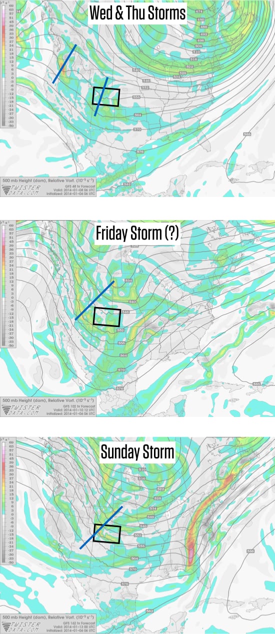
500mb vorticity map from Twisterdata.com.
Overall I'm excited for the next week because we have multiple chances for snow. Stay tuned as we figure out the details.
JOEL GRATZ
About Our Forecaster
Joel Gratz
Founding Meteorologist
Joel Gratz is the Founding Meteorologist of OpenSnow and has lived in Boulder, Colorado since 2003. Before moving to Colorado, he spent his childhood as a (not very fast) ski racer in eastern Pennsylvania.
Free OpenSnow App


