Upper Midwest Daily Snow

By Andrew Murray, Technical Founder & Meteorologist Posted 10 years ago April 2, 2014
Summary
I am now every confident that we have a large snowstorm headed right for our doorstep, as a low pressure system looks to slowly make its way across the Midwest tomorrow bring heavy snow to the entire region.
Details
While the models still disagree on exactly where the heaviest snow is going set up during the day tomorrow, it looks like for everywhere north of a line matching the Minnesota/Iowa state line is in for quite the snowstorm tomorrow.
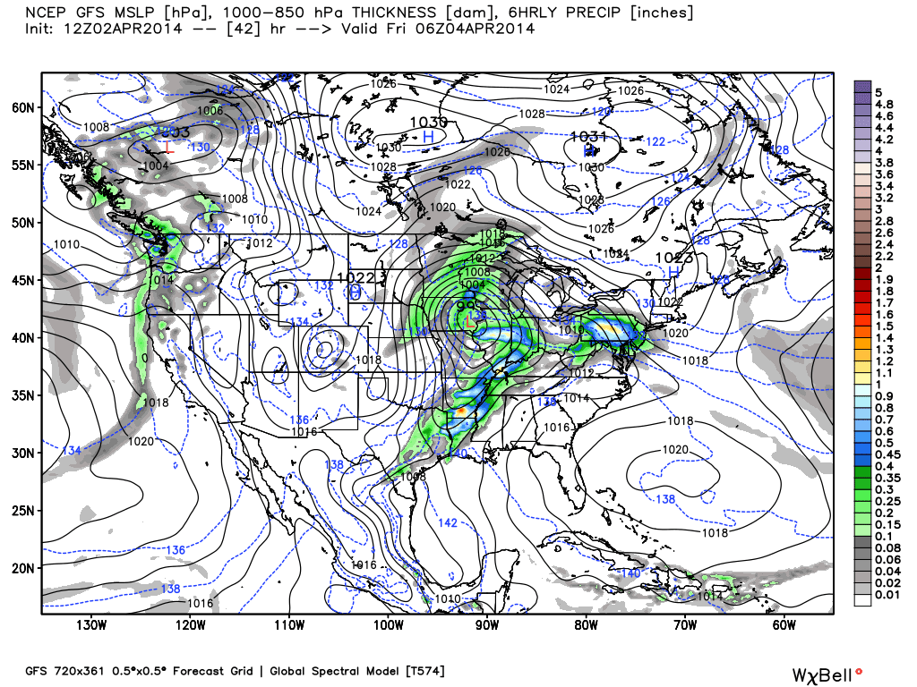
Low Pressure on Thursday night. Credit: WeatherBell
Snow should start in earnest tomorrow morning, especially right around the noon hour, and taper off during the early morning hours of Friday. This sets up the heaviest snowfall to come during the evening hours, and finish up right in time to hit the slope for some early weekend skiing on Friday.
Precipitation type should not be too big of this issue, especially in the heavier bands, as the atmosphere pulls in colder air from the north before the heaviest precipitation moves on during the evening hours. That said, seeing rain showers first in central/southern Minnesota would not be too surprising before switching over to snow.
Right now I am most confident with the European model verifying (sorry, don’t have the rights to share that model’s images) its snow amounts. That puts the heaviest snow band right through the Twin Cities, up through Northern Wisconsin along the north shore, and then through the Keweenaw on the UP. Location in these areas could easily see a foot of snow (8-14”). However, as with any convergence zone, these bands can shift by 50-100 miles and can mean the difference between 12” of snow and 4” of snow.
As for the North Shore, Northwoods, and Central Wisconsin, these areas should still see decent snow amounts, but they should hang around more in the 4-8” range. Not too shabby for the beginning of April.
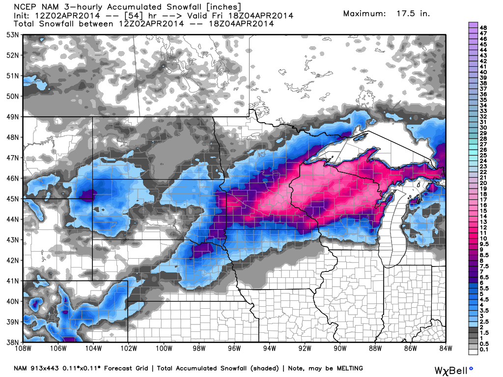
Model snowfall forecast (different model, I think these numbers are high). Credit: WeatherBell
Long Term
As I said before, this low moves off to the north during the day on Friday with little accumulation expected after sunrise, except further east over the UP.
Quickly looking ahead to this weekend, it looks very similar to last with warmer temperatures and clear skies. However, there looks to be another storm system on the horizon for Sunday night into Monday.
Enjoy the snow!
Cheers,
Andrew
About Our Forecaster
Andrew Murray
Technical Founder & Meteorologist
Andrew manages the technology that powers OpenSnow, and he also keeps an eye on the weather for the Upper Midwest from his home base in Minneapolis since 2015.
Free OpenSnow App


