Colorado Daily Snow

By Joel Gratz, Founding Meteorologist Posted 10 years ago April 9, 2014
Summary:
Dry through Saturday for most of Colorado with a few showers across northern Colorado Wednesday through Thursday. The next significant storm will bring snow from late Saturday night through Sunday night, with up to 12 inches east of the divide (ie. Eldora and eastern foothills), about 6-10 inches along the divide (Winter Park, Loveland, Abasin), and 3-6 inches for the rest of the mountains and the eastern plains. Next week we'll likely see another storm around Wednesday the 16th, then the following weekend looks dry (April 19/20).
Details:
Yesterday we had clear skies and the midday satellite image revealed a beautiful sight with thick snowcover over the higher mountains and remaining snow over the lower slopes and foothills. Can you pick out your favorite mountain range?
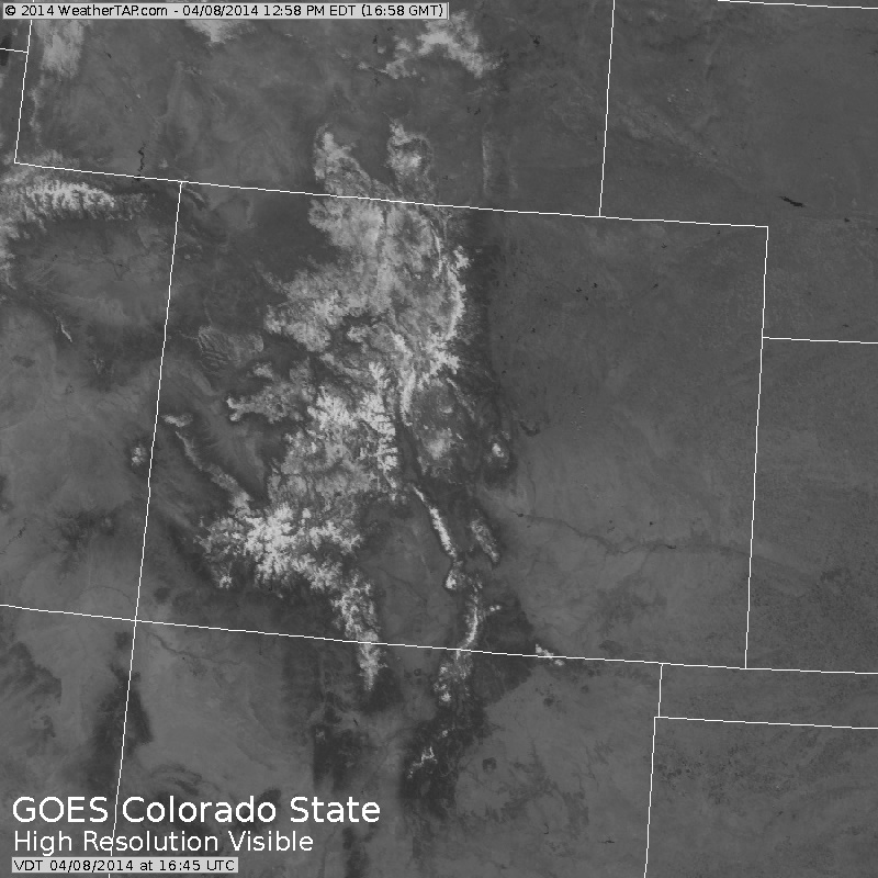
Visibile satellite from 10:45am yesterday (Tuesday, April 8th). Source: Weathertap.com
The rest of this week's weather will be mundane with mostly sunny skies. Two weak storms will pass well to the north of Colorado on Wednesday and Thursday, and some energy from these systems will help to create scattered showers Wednesday afternoon, Wednesday night, and Thursday, generally from I-70 north to the Wyoming border. Most areas will not see any precipitation, but there could be a few rain drops (or snow flakes at the highest elevations).
Saturday will be another mostly dry day, though we'll likely see a few more rain and snow showers in the afternoon.
Our next storm will move in from the north late Saturday night into Sunday morning, and snow will fall through the day on Sunday into Sunday evening. The heaviest snow will fall east of the divide, with Eldora and surrounding foothills potentially seeing 12+ inches from early Sunday through Sunday evening. The ski areas along the divide should do pretty well with 6-10 inches (Abasin, Loveland, Winter Park), and areas west of the divide will see respectable but lower totals, likely around 3-6 inches. The eastern cities and plains (Denver metro) could also see about 3-6 inches, but I doubt the roads will get cold enough for any hassles ... perhaps some slush.
In short, Sunday should be a fun day to ski with some freshies during the day.
Snow will end Sunday evening, and Monday will be dry. There might be a few inches of snow that falls after the lifts close on Sunday, so Monday morning first chair might offer a bit more powder, but the majority of the snow will likely fall and be skied on Sunday.
Long Range:
We should see another weak to moderate storm during the middle of next week, but details on that are still sketchy. Most models do agree that we'll see warm and sunny weather over the weekend of April 19/20, so get your sunscreen ready and enjoy!
JOEL GRATZ
About Our Forecaster
Joel Gratz
Founding Meteorologist
Joel Gratz is the Founding Meteorologist of OpenSnow and has lived in Boulder, Colorado since 2003. Before moving to Colorado, he spent his childhood as a (not very fast) ski racer in eastern Pennsylvania.
Free OpenSnow App


