Colorado Daily Snow

By Joel Gratz, Founding Meteorologist Posted 9 years ago September 7, 2014
Summary:
A few scattered showers on Sunday, then steady rain and thunderstorms will hit most Colorado mountains from Monday afternoon through Wednesday morning with significant rain. Wednesday afternoon through Saturday will then be dry over the mountains with chilly air and some clouds / drizzle over the eastern plains and front range cities.
Details:
Sunday will be much like Saturday with midday and afternoon showers and a quick thunderstorm. Nothing too interesting.
The fun, or perhaps flooding, will start on Monday and last through Wednesday morning. A ton of tropical moisture from the southwest will cover Colorado during this time, with some of the moisture coming from Hurricane Norbet which will slowly dissipate off the Baja coast.
From Monday afternoon through Wednesday morning, look for 1-3 inches of rain for most of the mountain areas of Colorado, with less than that east of the mountains. The rain will come in a few waves of steady precipitation and thunderstorms, and it will fall both during the day and during the nights. Some areas could see flooding, while most should just see beneficial rains.
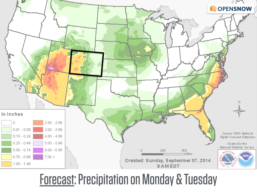
Total rainfall forecast from the storm. Areas of Nevada, Arizona, and Utah may get double the amount of rainfall received in Colorado. Source: NOAA
Most of the moisture and rainfall will be over by Wednesday morning or midday, though the mountains along the divide and mostly along and north of I-70 could see showers persist on Wednesday afternoon and Wednesday evening.
Then after the storm, the big story for Thursday, Friday, and Saturday will be cold air covering the plains east of the mountains. A cold front should move through on Thursday morning-ish, and low temperatures on Friday morning east of the mountains will likely be in the upper 30s and low 40s, with perhaps below-freezing temperatures in the foothills above 7,000ft or so. Also, expect some low clouds / fog / drizzle east of the mountains on Thursday afternoon perhaps into Friday morning. In contrast, the mountains west of the divide will not see this cold air and will record normal September-like temperatures.
In terms of snowfall, there might be a bit on the highest peaks on Monday and Tuesday, with the best chance of a mountain dusting coming on Tuesday night into Wednesday morning for the northern half of Colorado (roughly from Crested Butte north to Wyoming).
Have a great Sunday and go Broncos!
JOEL GRATZ
About Our Forecaster
Joel Gratz
Founding Meteorologist
Joel Gratz is the Founding Meteorologist of OpenSnow and has lived in Boulder, Colorado since 2003. Before moving to Colorado, he spent his childhood as a (not very fast) ski racer in eastern Pennsylvania.
Free OpenSnow App


