Tahoe Daily Snow

By Bryan Allegretto, Forecaster Posted 9 years ago September 26, 2014
In last week's post I mentioned the first precip producing cold front of the season would come through the second half of this week possibly bringing the first dusting of the season to the higher elevations. That front moved through this afternoon and the precip fell apart as it reached the Sierra. Some rain fell around the basin especially on the Western side and over the fire which will help to slow its progress. Reports of a half inch to an inch of rain fell on the fire this afternoon and containment jumped to 55%. That should continue to increase over the weekend as more precip moves in.
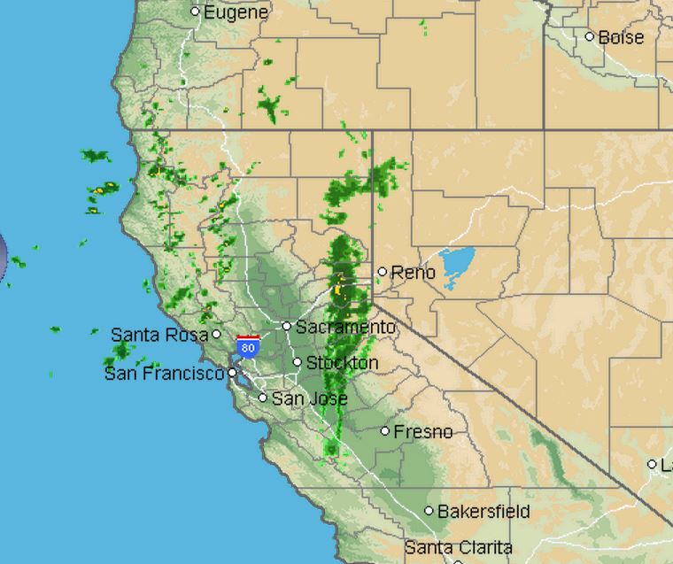
Here is a look at the radar this afternoon as the front approached. The snow levels with the front are still high but that will change this weekend.
I would have liked to update earlier this week, but it being the beginning of Fall the forecast models can struggle more than a few days out. Things will get interesting this weekend as it now looks like low pressure will will cut-off and sit over the Sierra bringing in colder air aloft and precip for the weekend. It is looking more and more likely that we will see accumulating snows on top of the mountains.
The forecast models are showing anything from a half inch to over an inch of liquid over the Tahoe area from Friday night through Sunday. Snow levels may drop to 8000 ft. or slightly lower with a few inches of snow above that. The GFS is showing up to a half inch of liquid over the basin with slightly more South of the lake.
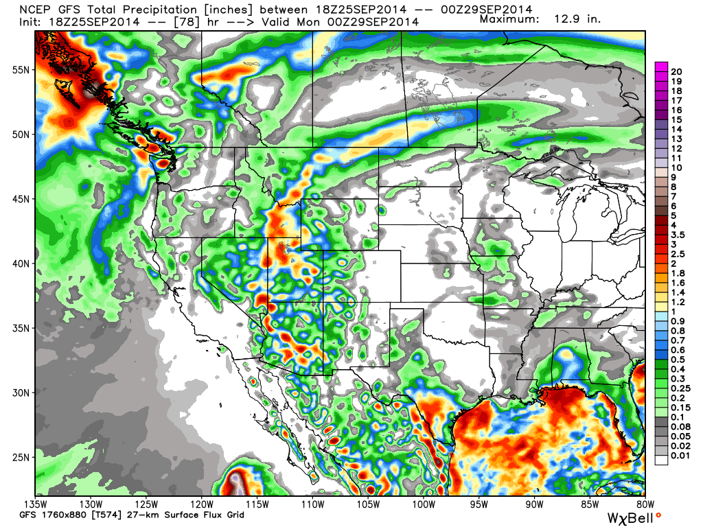
It has snow levels dropping down near 8,000 ft. by Saturday morning. With this scenario we could see a few inches of snow above 8,000 ft. on the higher peaks by Sunday morning.
The European model has about twice as much precip falling over the weekend. It keeps the precip going through Sunday and brings colder air in aloft with snow levels dropping below 7000 ft. Saturday morning. That would bring several inches of snow to the mountains. Not buying into this scenario yet but somthing to watch tomorrow with the next couple of model runs.
Either way much colder air is moving in for the weekend with much needed precip. At the very least we should see white on the peaks Saturday and Sunday. I will be posting through the weekend to keep you up to date on any snowfall.
After this system the ridge builds back in off the West Coast with warmer and drier weather returning next week.
Stay tuned....BA
About Our Forecaster
Bryan Allegretto
Forecaster
Bryan Allegretto has been writing insightful posts about snow storms for over the last 15 years and is known as Tahoe's go-to snow forecaster. BA grew up in south Jersey, surfing, snowboarding, and chasing down the storms creating the epic conditions for both.
Free OpenSnow App


