Tahoe Daily Snow

By Bryan Allegretto, Forecaster Posted 9 years ago September 30, 2014
The system from the weekend cleared out to our East today. It ended up dropping several inches of snow above 8000 ft. as expeceted. The ski resorts took the opportunity to snap some photos on the upper mountains to get some early marketing going. These shots are from Saturday.
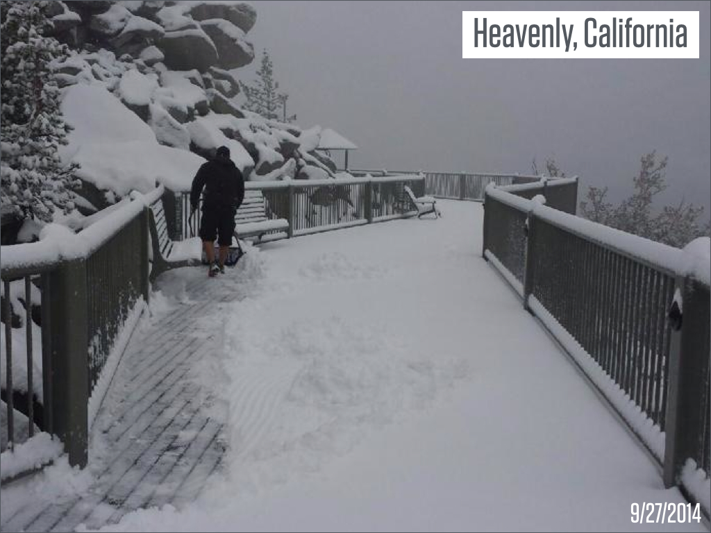
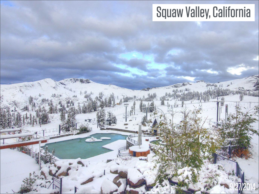
Does that get you in the mood for skiiing? Nothing more dramatic than going from wildfires, dry conditions, and temps in the 80's to snowcapped mountains.
High pressure is building back in off the coast. That will bring drier and warmer weather as the week goes on. That should last through next week.
The GFS and European forecast model runs have been hinting at a pattern change the second week of October. The long-range on the models this time of year with the change of the seasons can be less reliable. It is something to watch over the next week. Here is the CFS forecast for the 7th - 12th showing the ridge along the West Coast, and then the 12th to the 17th the ridge shifting up towards Alaska with a West Coast trough.
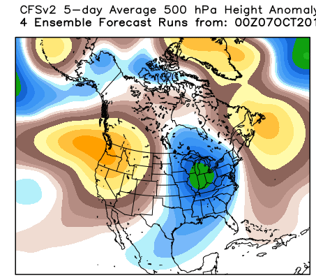
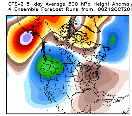
More early season snow? Maybe.... It's not uncommon for early snow during weak El Nino conditions, we'll see.
Stay tuned....BA
About Our Forecaster
Bryan Allegretto
Forecaster
Bryan Allegretto has been writing insightful posts about snow storms for over the last 15 years and is known as Tahoe's go-to snow forecaster. BA grew up in south Jersey, surfing, snowboarding, and chasing down the storms creating the epic conditions for both.
Free OpenSnow App


