Tahoe Daily Snow

By Bryan Allegretto, Forecaster Posted 9 years ago October 21, 2014
From 8 a.m. Forgot to hit Submit...
Summary:
The first system moved through overnight leaving a dusting of snow on the mountains and cold air in its wake. The jestream will setup over Northern CA on Thursday with rain just to our North. Over the weekend low pressure moving into the Pacific NW will push a front and the precip through the area with rain and mountain snow with falling snow levels.
Details:
Woke up to a very light dusting on the mountains West of the basin along the crest. Temperatures this morning are only in the 20's in Truckee. The weather will stay active this week with the jetstream setting up a river or moisture across Northern CA Thursday. The models all keep the precip just to our North through Friday so we should stay dry but may have some clouds and windy conditions.
Friday night an upper low approaches the Pacific NW and moves inland over the weekend. This will push a front and precip through the area. The GFS forecast model pushes the precip through Friday night into Saturday with most of the precip to our North. The European and Canadian models show the system possibly splitting with the precip pushing further South into our area and down the Sierra. They are also slower with the precip coming Saturday into Saturday night.
The snow levels will start high but could drop down near 7000 ft. during the event and to lake level at the end as the colder air behind the front moves through. Here is the GFS precip forecast with light amounts for us.
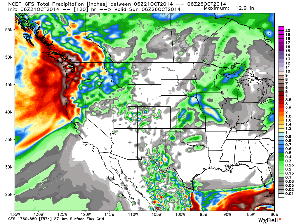
This scenario would be similar to last night with a dusting of snow possible for the mountain tops. Now here is the normally over aggressive Canadian forecast model for total precip through Sunday.
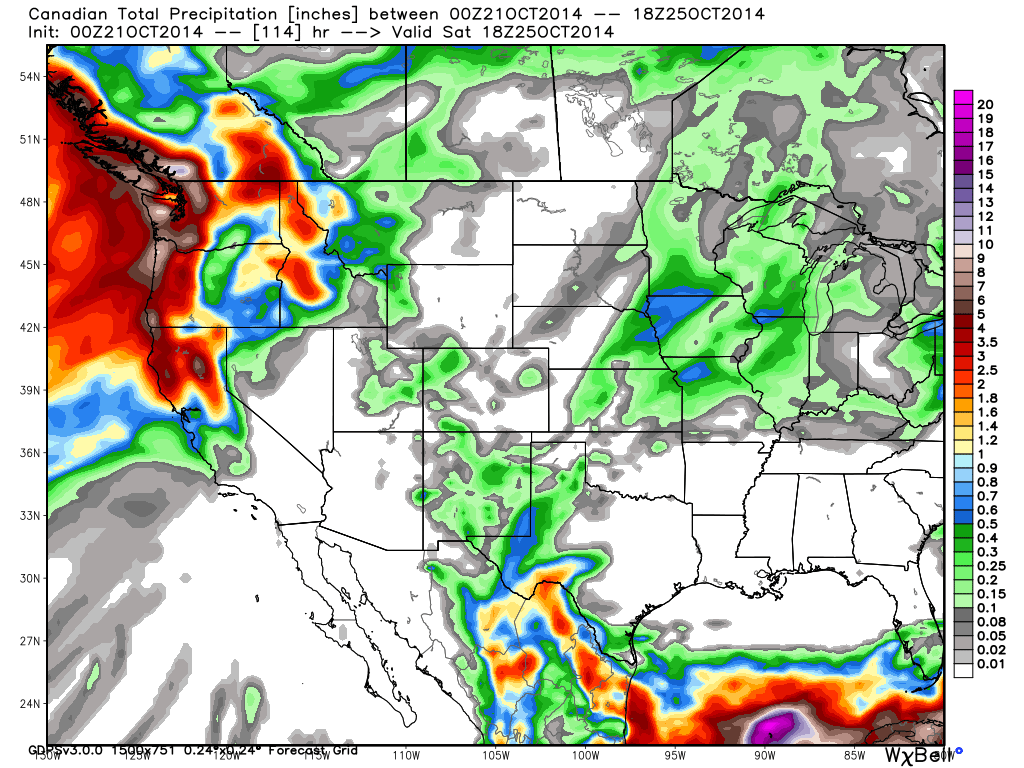
Not buying this much precip. The Euro is in the middle of the road with around a half inch of liquid possible. If the system starts to split and more precip makes its way further South we could see several inches of snow on the mountains above 7000 ft. Saturday into Saturday night.
Long Range:
The pattern looks like it will stay active to our North in the Pacific NW week 2. This is normal in the early season as the jetstream is still further North. I showed the CFS November forecast for precip in the last post which this week has been showing a wet month for CA against the average.
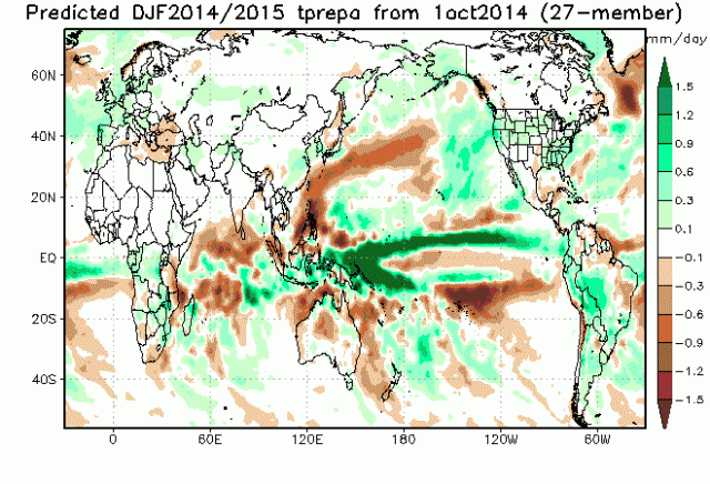
We can also look at a few of the latest model forecasts for Winter precip Dec-Feb. First here is the latest JAMSTEC run showing the above average precip further North now into Northern CA vs. some of its previous runs.
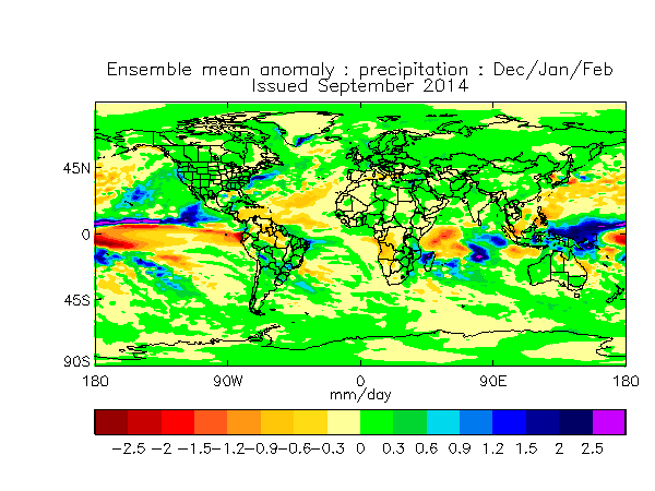
And the UKMET showing a similar pattern with a Northern CA bullseye.
And the CFSv2 with a wet CA.
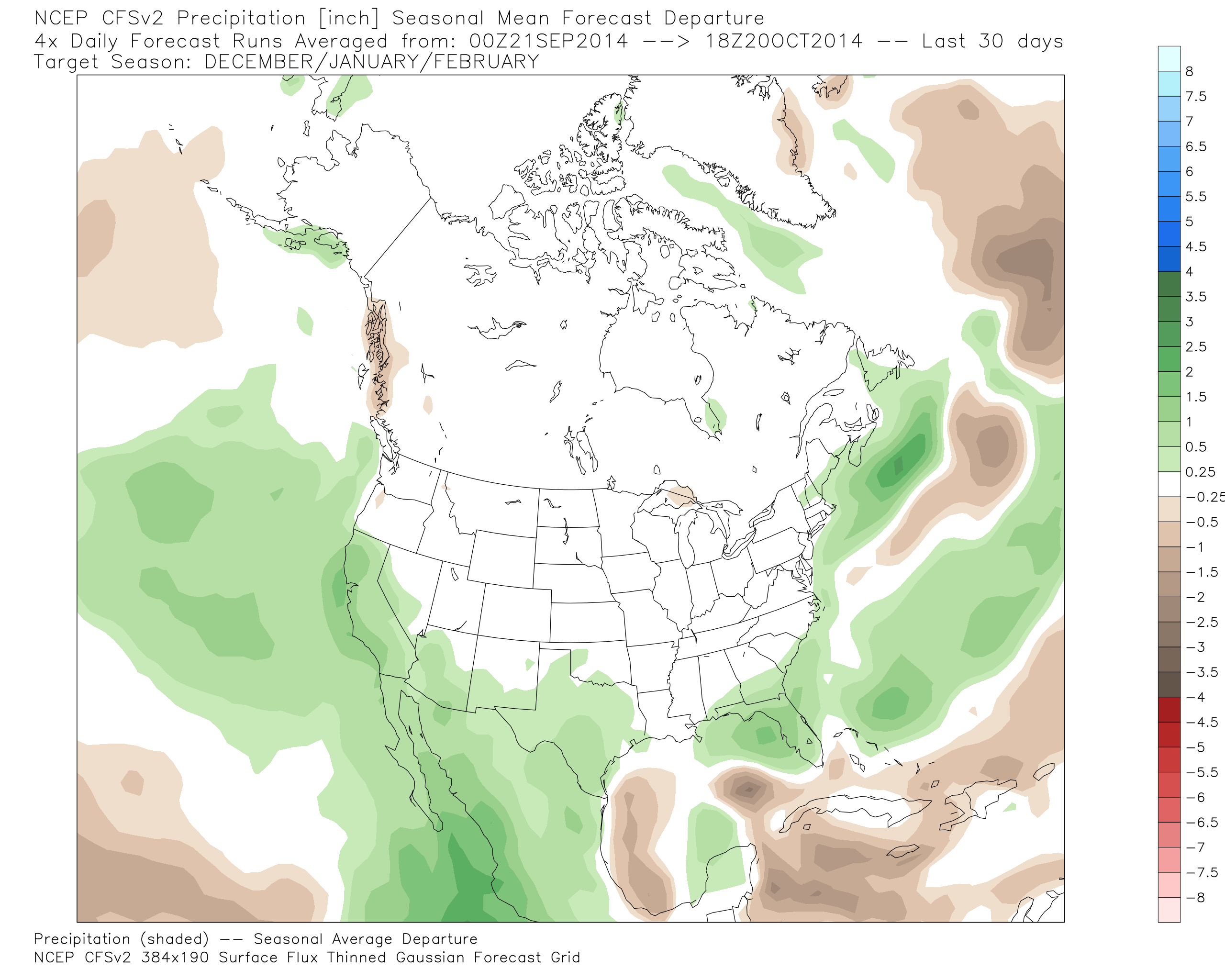
So some good signs on the climate model forecasts coming out this week. The problem with long-range climate models though is that you should trust them as far as you can throw them. They miss the mark often in the Fall.
One of the big differences this season is that there is not a warm pool of water off the coast. It is along the West Coast. The climate models have a trough off the coast for the Winter and not a ridge. They have the ridge along over the Pacific NW up into Western Canada and try to push the trough into CA for the Winter.
On the other side looking at the analog years 03-04 and 76-77 look very similar to the pattern we could have this Winter and both were below average snowfall year. Like the Winter forecast showed in the last post the SW has a much better chance of seeing above average precip. For Northern CA it still looks like there are as many factors that could bring us a dry Winter as a wet one. For now let’s at least hope for an average precip season and snowfall season.
Stay tuned….BA
About Our Forecaster
Bryan Allegretto
Forecaster
Bryan Allegretto has been writing insightful posts about snow storms for over the last 15 years and is known as Tahoe's go-to snow forecaster. BA grew up in south Jersey, surfing, snowboarding, and chasing down the storms creating the epic conditions for both.
Free OpenSnow App


