Colorado Daily Snow

By Joel Gratz, Founding Meteorologist Posted 9 years ago October 24, 2014
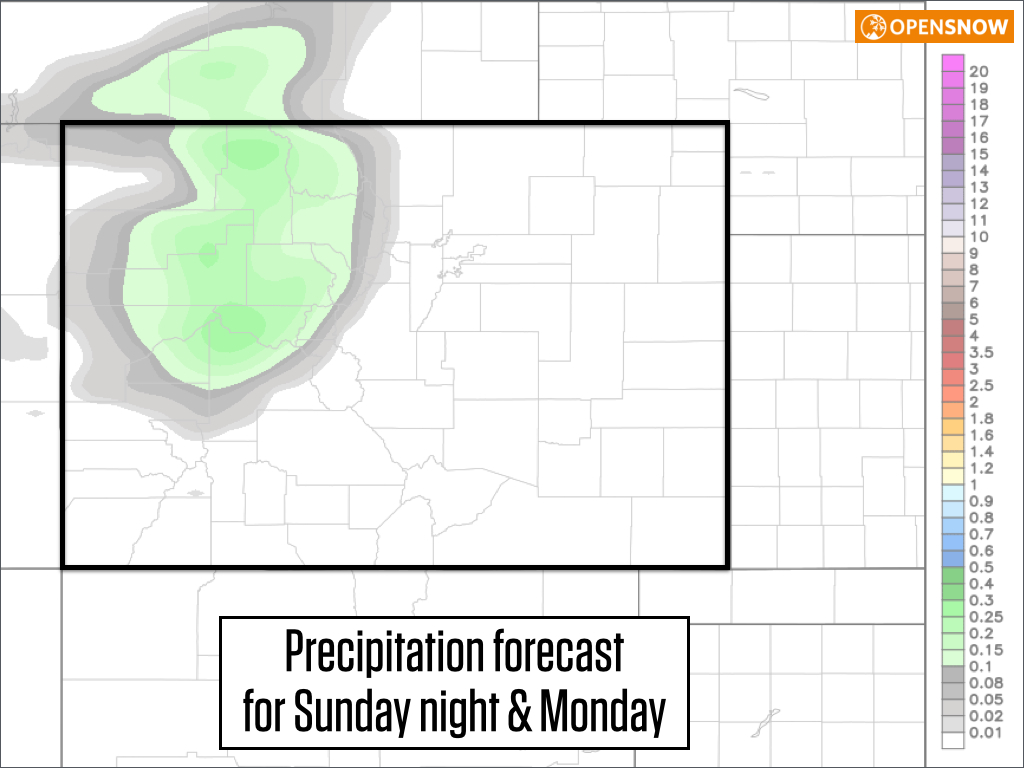
A few inches of snow on Sunday night and Monday
Summary:
Sunny and dry Friday and Saturday. A few showers on Sunday afternoon, then a few inches of snow Sunday night into Monday for northern and central Colorado. The middle and end of next week should be dry.
Details:
Enjoy the sun today and Saturday! There will be a few high altitude wave clouds on Friday morning which should make for an amazing sunrise near the front range and continental divide.
The next storm will affect Colorado on Sunday evening through Monday though don't get your hopes up because it doesn't look like a significant snow producer. Expect more clouds on Sunday afternoon with a random shower here or there, then likely a line of rain and snow will move through areas near Aspen and north to I-70 and Steamboat on Sunday night into early Monday morning. Most models are forecasting about 0.1-0.3 inches of liquid equivalent precipitation, which would translate into about 1-3 or 2-4 inches of snow on Sunday night into Monday. The snow level will start around 11,000ft on Sunday night and then drop to 7,000-8,000ft by Monday morning so there will likely be accumulations on the higher passes and down into the higher valleys.
Monday will likely be a cloudy and cool day across the northern half of Colorado with leftover snow showers. Tuesday will warm up a bit with more sun but temperatures will still be chilly, or around normal. The end of next week, Wednesday through Saturday, should warm much more and the weather will be dry. In the long range, we might see something around the first week of November, perhaps the 3-5th.
For snowmaking, conditions will be good on Monday and Monday night, marginal on Tuesday, and likely good again on Tuesday night. After that temperatures again look marginal with overnight lows hovering around freezing.
This forecast is a bit of a bummer since there is no significant storm on tap for at least the next 7 days. But hopefully you're finding a way to enjoy the nice fall weather, and I'm having a bit of fun back on the east coast at Penn State this weekend. Any Pennsylvania folks reading this? I started skiing at Shawnee Mountain in 1985 at the age of 4:-)
JOEL GRATZ
About Our Forecaster
Joel Gratz
Founding Meteorologist
Joel Gratz is the Founding Meteorologist of OpenSnow and has lived in Boulder, Colorado since 2003. Before moving to Colorado, he spent his childhood as a (not very fast) ski racer in eastern Pennsylvania.
Free OpenSnow App


