Colorado Daily Snow

By Joel Gratz, Founding Meteorologist Posted 9 years ago October 27, 2014
Nice totals in northern Colorado
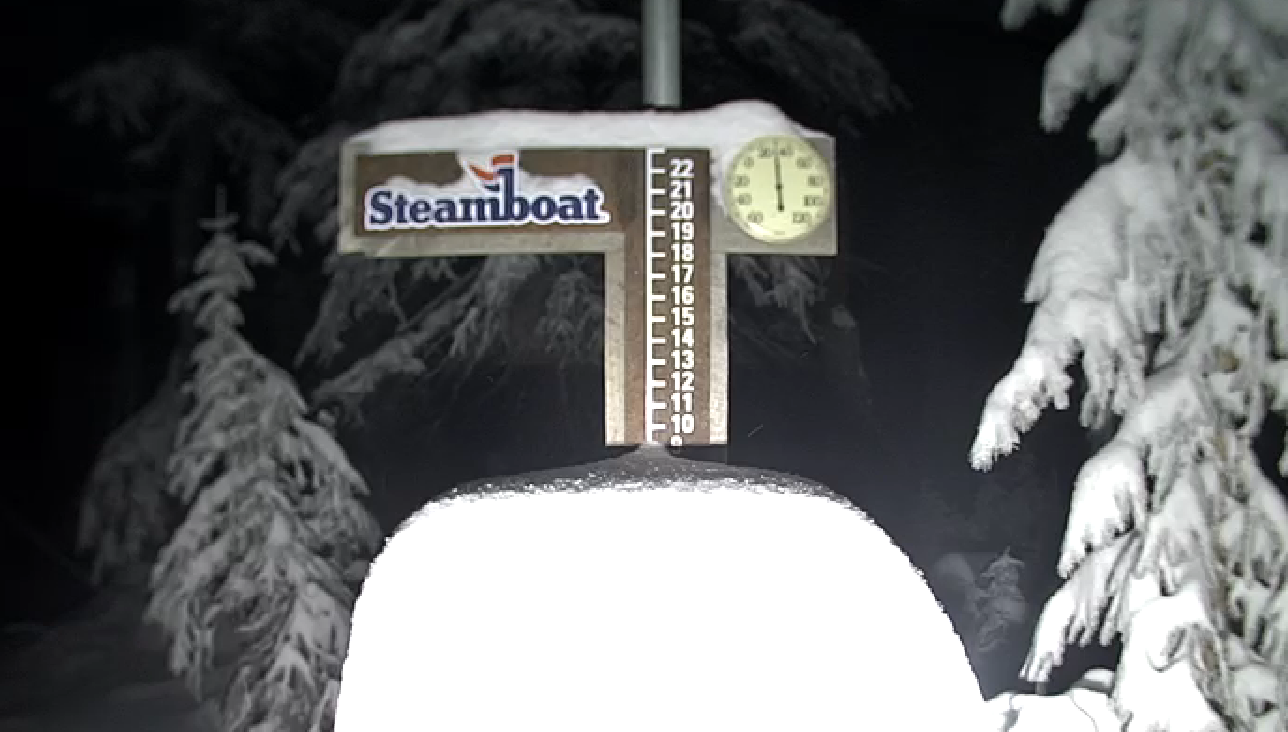
As of 7am Monday the snow band is moving through the I-70 corridor and down into Aspen. Overnight, the band put down some hefty totals in a few areas that were lucky enough to see the heavier cells. One of these areas was Steamboat where the summit pow cam shows about 8 inches.
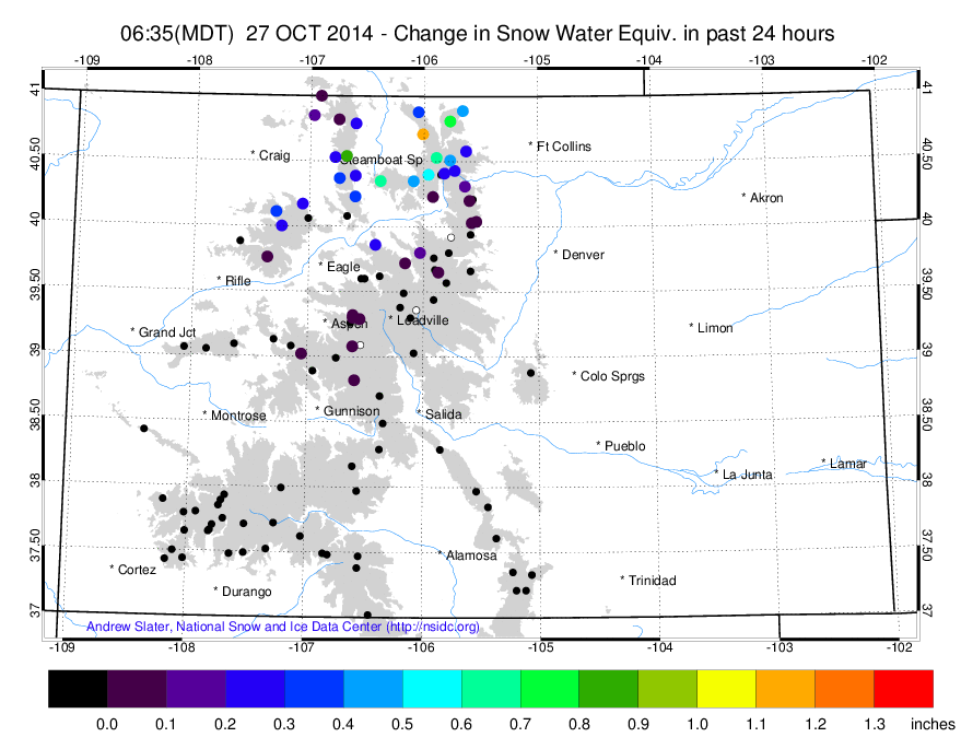
The 24-hour SNOTEL precipitation measurements show about 0.4 inches of liquid equivalent as an average across northern Colorado (about 4 inches) though a few spots measured closer to 0.8-1.0 inches, which likely equates to about 10 inches.
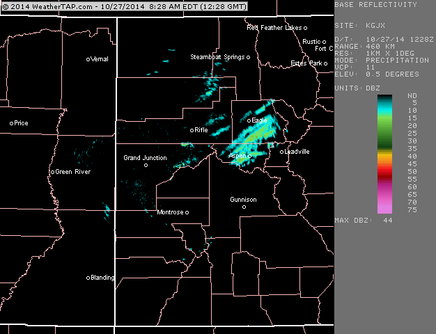
The 7am Monday morning radar shows the band moving southeast over Aspen, Beaver Creek / Vail, and into Summit County.
Who's making turns with the rock skis in Steamboat?
JOEL GRATZ
About Our Forecaster
Joel Gratz
Founding Meteorologist
Joel Gratz is the Founding Meteorologist of OpenSnow and has lived in Boulder, Colorado since 2003. Before moving to Colorado, he spent his childhood as a (not very fast) ski racer in eastern Pennsylvania.
Free OpenSnow App


