Tahoe Daily Snow

By Bryan Allegretto, Forecaster Posted 9 years ago October 28, 2014
Summary:
Nice weather this week will quickly change on Friday as a cold front pushes through bringing snow to all elevations in the Tahoe basin and much colder air. The weather looks quiet again week 2, but more active as we move into November.
Details:
We saw snow showers down near lake level on Saturday. On the mountains above 7000 ft. we saw an inch or two of snow, including over some of the passes. Some people were not watching the forecasts and were caught off-guard.
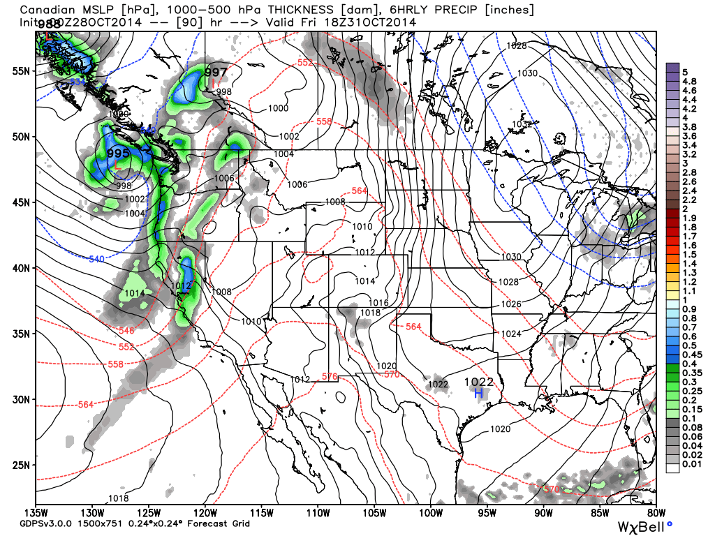
The ridge has built in off the coast and the weather has turned dry and warm again this week. That will change this weekend. The ridge will slide East with the Pacific ridge to the North of Hawaii. Low pressure will drop down from the Gulf of Alaska into the Pacific NW with lots of cold air as a cold trough digs down the West Coast. The latest model runs have the system pushing moisture in along the crest as early as Friday morning and into the basin by afternoon. Snow levels will quickly drop to lake level as the cold front pushes through Friday afternoon.
Here is a look at the system pushing in Friday on the Canadian forecast model.
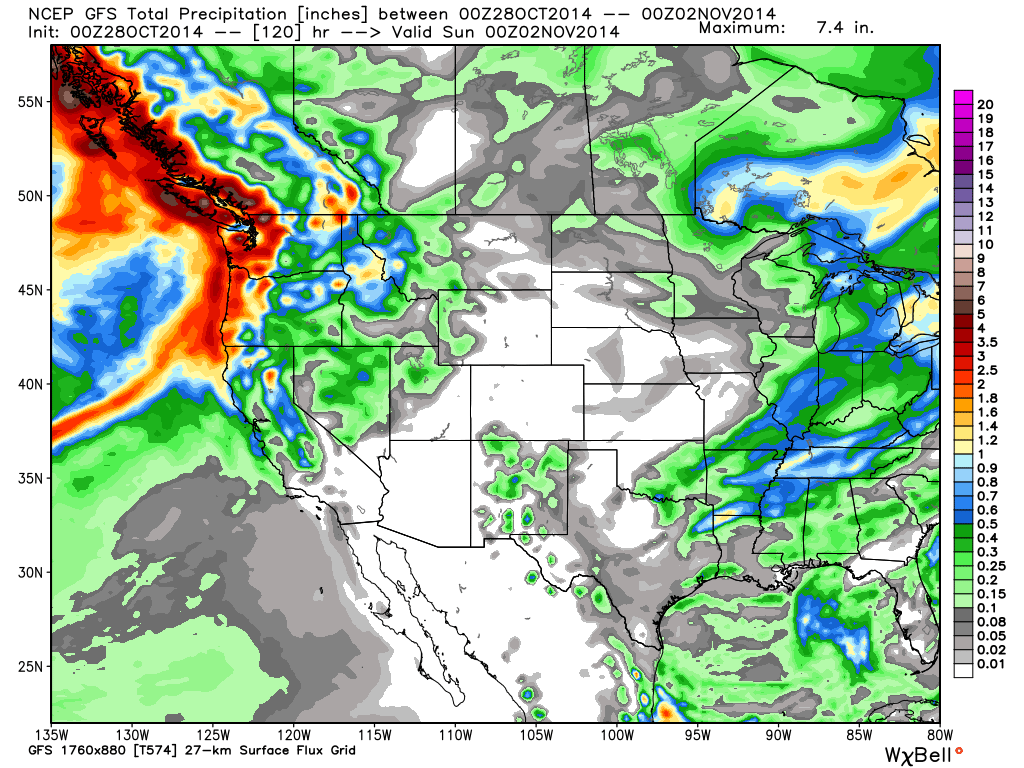
Total precip on the models is not that impressive, but we could see accumulating snow for all elevations. Snow showers could last Friday night into Saturday morning. Total snowfall guestimates based on the latest model runs is 1-3 inches at lake level, 3-6 inches above 7000 ft., and up to 9 inches West of the lake along the Sierra Crest. Those are subject to change of course as we get closer. The GFS forecast model was a bit wetter earlier today but has pulled back more in line with the European model this evening.
GFS total precip forecast
Candian total precip forecast
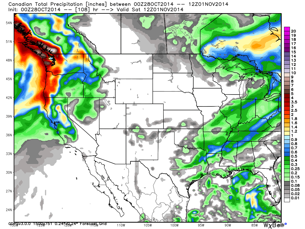
As usual the Canadian is the most agressive with a few extra inches for each elevation.
Long-Range:
Models are showing the ridge building back in off the coast pushing the storm track back to the North to start week 2. Then the pattern setting up similar to this weekend by the end of the week with another system possibly bringing more snow.
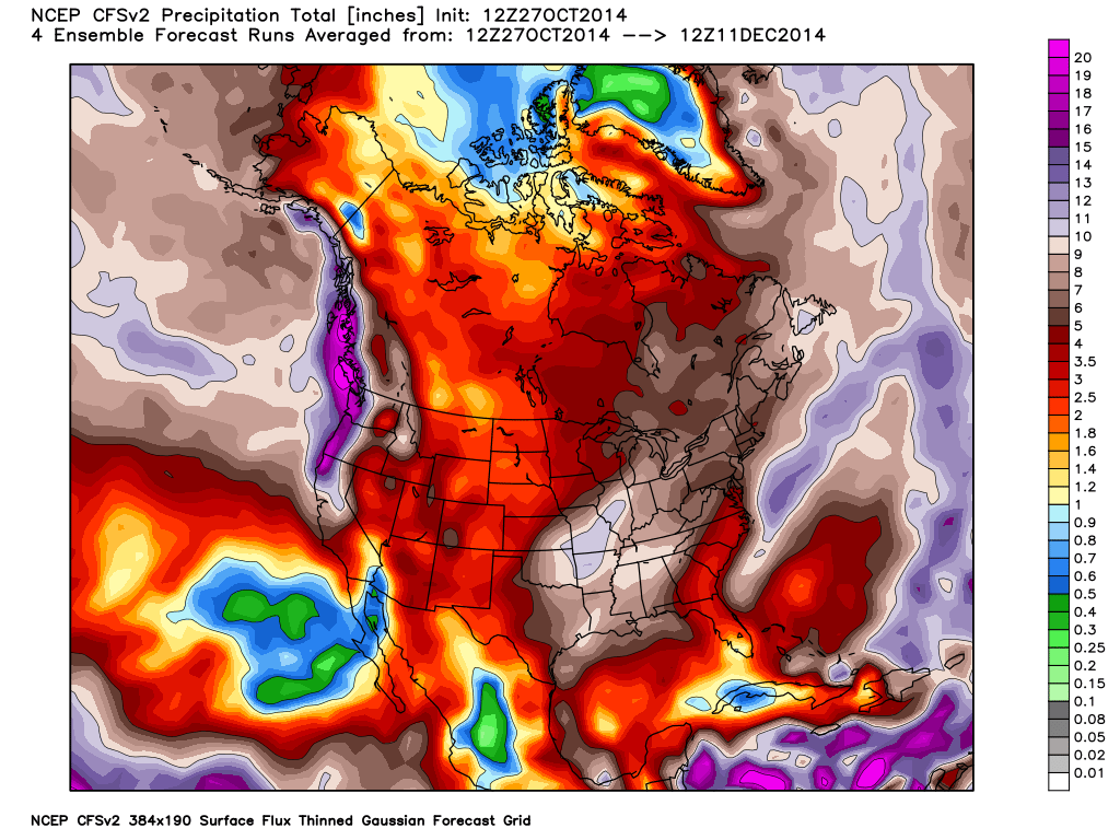
As we have been discussing the climate models continue show a wet November for Northern CA. It could be a good start to the season if it pans out. I meant to show the CFSv2 total precip forecast for the next 45 days on Saturday but forecast to add it to the post. It looks even better today showing up to 9 inches of liquid near the Tahoe Basin.
Trying not to get too excited, especially after the last few years. We will watch closely over the next few weeks.
Pray for snow....BA
About Our Forecaster
Bryan Allegretto
Forecaster
Bryan Allegretto has been writing insightful posts about snow storms for over the last 15 years and is known as Tahoe's go-to snow forecaster. BA grew up in south Jersey, surfing, snowboarding, and chasing down the storms creating the epic conditions for both.
Free OpenSnow App


