Tahoe Daily Snow

By Bryan Allegretto, Forecaster Posted 9 years ago October 30, 2014
Summary:
Storm pushes in Friday with falling snow levels and several inches of snow possible for all elevations by Saturday morning. Snow showers around Saturday and then clearing and warming Sunday into next week. Next chance of snow is the following weekend.
Details:
A few positive changes in the past 24 hours. The forecast models are holding the system together a little better. Still the most snow is expected to our South near Mammoth, but higher amounts are possible further North now. Take a look at the dramatic change on the Canadian model for total precip forecasted. Here is yesterday morning....
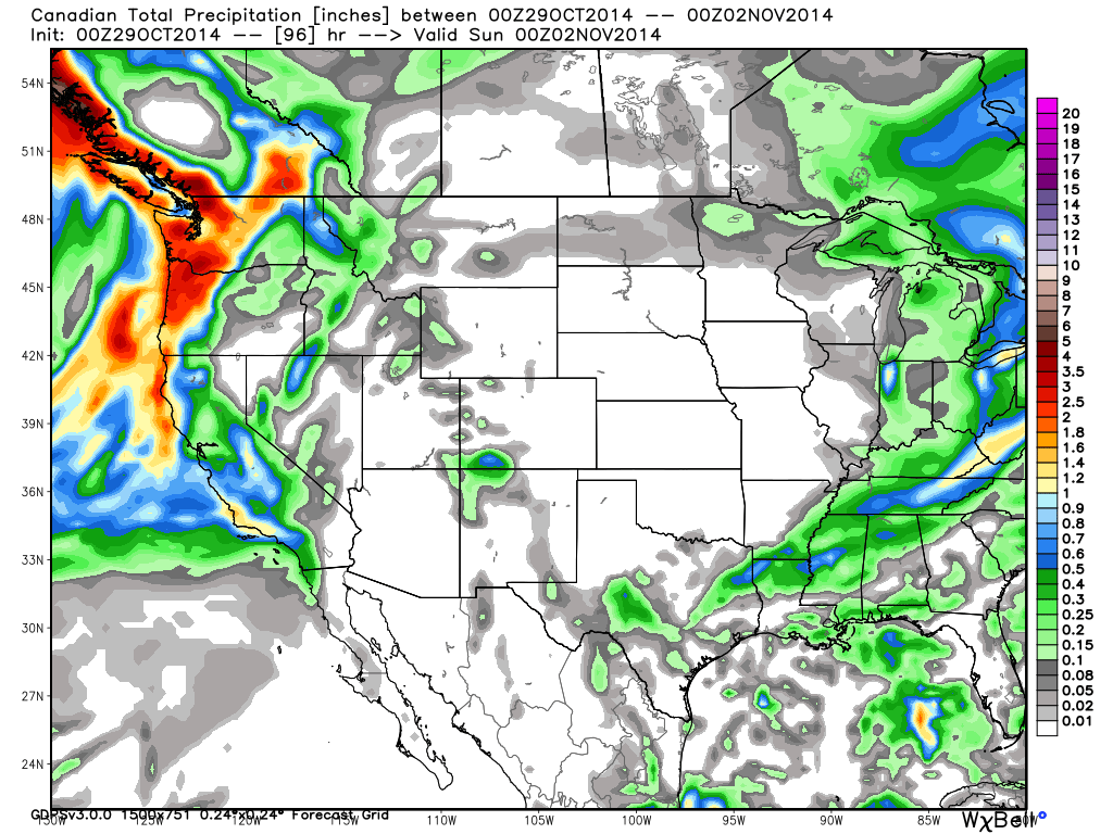
And now this morning from the same model.....
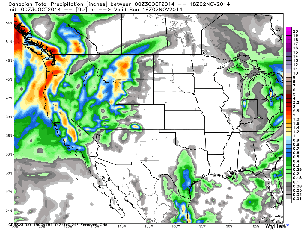
The main reason the precip forecasts are increasing on the Canadian and European forecast models is that they have a second wave moving through on Saturday adding to what falls Friday afternoon and night with the cold front. Using just these 2 models I would put the snowfall forecast at 6-9 inches above 7000 ft. on the East side of the Tahoe basin, 9-12 inches on the West side, with the highest peaks West of the lake along the crest possibly hitting 15 inches. The snow levels will fall below lake level Friday night but some of the precip falls as rain initially so the snowfall amounts will be less. The snowfall during the day Saturday may also have a harder time sticking if temperatures are above freezing. Still, 3-6 inches could fall at lake level possibly up to 9 inches along and West of highway 89.
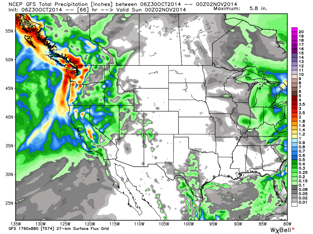
Looking at the low end of the spectrum the GFS model is still pushing most of the precip to the South of us, and it doesn't bring in another wave of snow on Saturday just scattered showers. The GFS only has enough total precip forecasted for 3-6 inches above 7000 ft. on the East side of the Tahoe basin and 6-9 inches on the West side, with up to 12 inches on the highest peaks along the crest West of the lake. At lake level 1-3 inches with up to 6 along and West of 89. This is the forecast I was going with yesterday, but now the Euro and Canadian are the middle ground. Here is the GFS precip forecast.
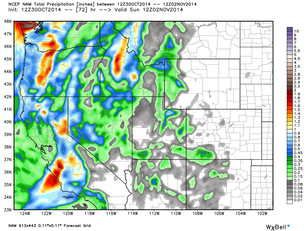
What is most interesting is the outlier to the high side. The NAM also has snowfall through Saturday but it has up to an inch and a half of total liquid in a bullseye near Donner Summit. If this were to verify we could see 9-12 inches above 7000 ft. on the East side of the Tahoe basin above 7000 ft., 12-15 inches on the West side, and up to 18 inches in the bullseye near Donner Summit above 8000 ft. At lake level 6-9 inches with up to 12 Along and West of 89. Here is the NAM total precip forecast through Saturday.
I don't always go through every model in the forecast, but I like to show what I am seeing. The GFS is the outlier on the low end and the NAM on the high end, but either could happen. I normally go with the average or the models in the middle for my resort specific snowfall forecasts. This time being the European and Canadian models.
So for now I am expecting rain and snow to arrive by Friday afternoon. Turning to snow overnight for all elevetions. Then another wave of snow or snow showers through the day on Saturday. 3-6 inches of total snowfall is possible at lake level. 6-9 inches is possible on the mountains above 7000 ft. on the East side of the basin and 9-12 on the West side. A few peaks could pick up to 15 inches on the West side of the basin above 8000 ft. along the crest. The NWS has a Winter Storm Watch posted currently for the Tahoe area for Friday into Saturday.
We clear out by Sunday and warm up into next week, back near 60 by Wednesday.
Long-Range:
The next chance of precip looks to be the weekend of the 7th -9th. The ridge may breakdown again allowing another trough to push through the West Coast.
Stay tuned.....BA
About Our Forecaster
Bryan Allegretto
Forecaster
Bryan Allegretto has been writing insightful posts about snow storms for over the last 15 years and is known as Tahoe's go-to snow forecaster. BA grew up in south Jersey, surfing, snowboarding, and chasing down the storms creating the epic conditions for both.
Free OpenSnow App


