I-70 Daily Snow

By Sam Collentine, Meteorologist Posted 8 years ago March 25, 2016
Miracle March Continues!
Summary
Periods of moderate to heavy snow will continue through Friday night. The storm will then shift to our south and southeast late Friday night and into Saturday but light snow will fall through Saturday night. Expect icy and snow-packed road surfaces during the overnight and early morning hours, with improved conditions during the daylight hours on Friday and Saturday. Dry weather will prevail on Sunday and remain in place through Monday. Our attention will then turn to the middle of next week as another storm takes aim for Colorado.
Details
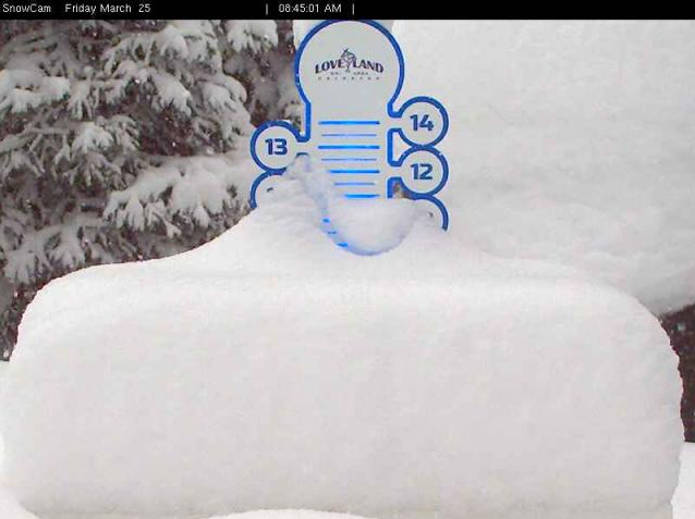
All areas are reporting fresh snow on Friday morning but the storm has really cranked up since the reports came in. Just take a look at Loveland's snow stake cam as of 8:45am.
Winter Park looks very similar to Loveland, along with lighter amounts for all other areas. All road surfaces from roughly Georgetown through Avon are under a wet, icy, and snow-packed mix. Expect reduced travel speeds through the rest of Friday morning.
- I-70 Powder Report: http://opsw.co/i70report
- CDOT Travel Alerts: http://opsw.co/cdotalerts
Friday: Bands of moderate to heavy will continue though the rest of Friday and into early Friday night as our current storm cranks up over Colorado. The road surfaces will improve during the afternoon thanks to the high March sun angle but icy and snow-packed surfaces will remain in spots along the mountain passes and near the Eisenhower Tunnel. Like Friday morning, some areas will receive heavier amounts of snow compared to others but in total, anticipate an additional 3-6 inches by Friday evening.
Friday Evening - Saturday: This will be an interesting time to watch the storm continue to develop across Colorado. Between 6pm and midnight on Friday night, it looks the best accumulations will be focused on areas right along the I-70 corridor. Here's a look at the last three runs of the high-resolution forecasted radar for 9pm on Friday evening.

You can see the bright greens and dark blues hovering right over the I-70 mountain corridor, indicating a period of very heavy snow. During the 6pm to midnight timeframe, expect all road surfaces from Georgetown through Avon to be completely snow-packed. I highly recommend that all vehicles traveling along the corridor during this time have snow tires AND all-wheel/four-wheel drive. The passenger traction law will almost certainly be put in place by CDOT so at the bare minimum, you must have snow/mud tires, use chains/alternative traction devices, or four-wheel/all-wheel drive if you are traveling along the corridor. As always, keep an eye on CDOT for the latest road conditions and travel information.
- CDOT Travel Alerts: http://opsw.co/cdotalerts
After midnight on Friday night, the storm will begin to shift its attention to areas east of the divide and south of the corridor. Snow will continue for areas along the corridor but the heaviest snow will be behind us. This will remain the case as we enter the morning hours and through the rest of Saturday. Here's a look at the last three runs of the forecasted radar for 11am on Saturday.

The storm has dived further south by this time, moving the heaviest snow to our southeast. All road surfaces will remain under an icy and snow-packed mix on Saturday morning but they should become only wet by Saturday afternoon. The mountain passes will likely keep a few icy and snow-packed spots so expect slightly reduced travel speeds through Saturday night.
Just for reference, here's what you can expect for traffic this weekend:
- Friday Evening: 30+ minute delays are possible from 4pm through 8pm on westbound I-70, especially between Golden and Idaho Springs. Traffic will begin to ease after the Empire exit to Winter Park but remember to always keep an eye on CDOT for the latest. Wet, icy, and snow-packed road surfaces will also slow travel speeds so give yourself plenty of extra travel time.
- Saturday Morning: Traffic will be encountered on westbound I-70 from 6am through 11am. The longest delays (30-60 minutes) are likely between 8am and 10am from Idaho Springs through the Empire exit to Winter Park so avoid this timeframe if possible. Wet and icy road surfaces will also be a factor so give yourself plenty of time.
- Saturday Evening: Traffic will transition to eastbound I-70 by 2pm on Saturday afternoon and remain in place through 6pm. Short delays (20-30 minutes) are possible from Georgetown through Idaho Springs.
- Sunday: Traffic will begin to form on eastbound I-70 by 12-noon and remain in place though about 7pm. The longest delays (~30 minutes) can be expected from the Eisenhower Tunnel through Idaho Springs.
Next Week: Dry weather and much warmer temperatures will prevail on Sunday and remain in place through Monday. All road surfaces will become completely clear and dry, with travel cruising along at normal speeds. Our next storm will then begin to make its way into the West and return snow to Colorado during the middle to end of the work week. I'll have more details by Sunday and Monday morning.
Enjoy the snow, travel safe, and have a great Easter weekend!
SAM COLLENTINE
PS - When you are taking a break from skiing, we’d be very appreciative if you could respond to our end-of-season survey here: http://opsw.co/season-survey-2016
About Our Forecaster
Sam Collentine
Meteorologist
Sam Collentine is the Chief Operating Officer of OpenSnow and lives in Basalt, Colorado. Before joining OpenSnow, he studied Atmospheric Science at the University of Colorado, spent time at Channel 7 News in Denver, and at the National Weather Service in Boulder.
Free OpenSnow App


