Tahoe Daily Snow

By Bryan Allegretto, Forecaster Posted 9 years ago November 25, 2014
First Significant Storm of the Season Possible
Summary:
High pressure is sitting along the West Coast bringing dry conditions. Temperatures will warm to near 60 degrees for Wednesday and Thursday. By Friday a system will begin to push into the West Coast bringing light amounts of precip into the area through Sunday. We could see a few inches of snow on the mountains. Sunday night into Tuesday a strong storm pushes through with heavy snowfall for all elevations. We could see a foot or more at lake level and a couple of feet or more on the mountains. It's still early so the forecast could vary as we get closer.
Details:
Let's skip over the nice weather this week as I know all you care about is the potential for significant snow this weekend. The forecast models have been in decent agreement for a few days now which builds some confidence in the forecast even though we are still 4-7 days away. The main culprit for the weather we will see over the weekend into early next week can already be seen off the coast on satellite.
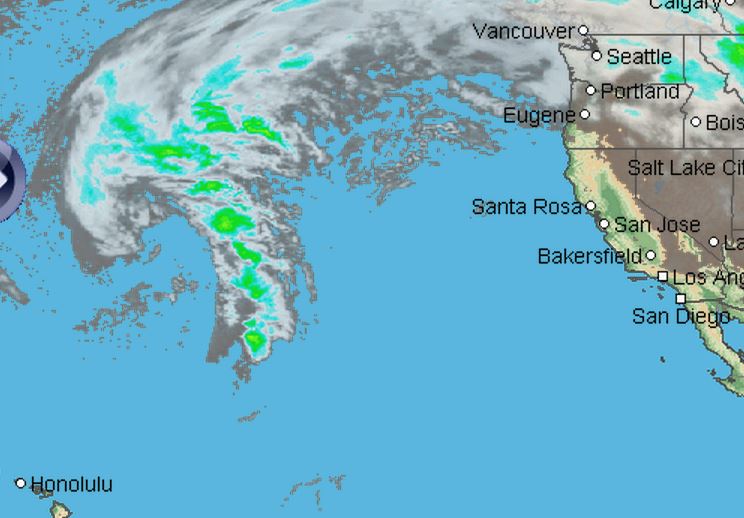
This area of low pressure will slowly make its way towards the West Coast all week. By Friday night into Saturday the first wave of precip that will eject out in front of the main low will move into Northern CA. This wave is pretty weak and we should only see some light precip. Snow levels will be around 7000 ft. so we could see a few inches of snow on the mountains.
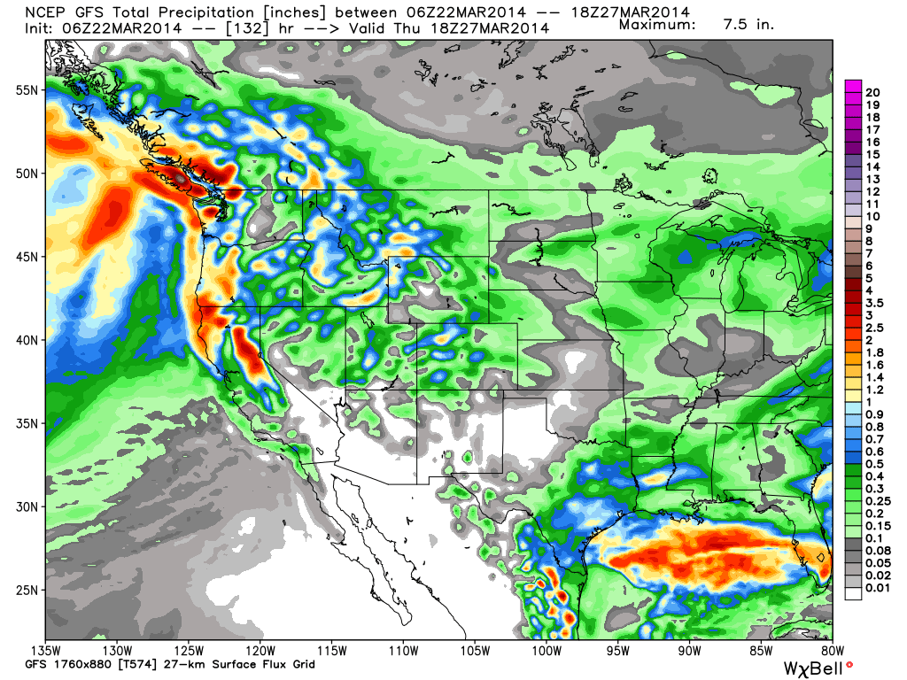
Saturday night into Sunday the main low approaches the coast as it pulls in moisture from the subtropics. The flow is out of the South ahead of the low and as I have been explaining the last couple of days that normally prevents the heavy precip from pushing into the basin. We need a Westerly push to get the precip over the crest into the basin. So Sunday may just be a cloudy and breezy day with some light showers around.
Here you can see on the GFS total precip forecast through Sunday the amount of heavy precip in Northern CA but not making it into the basin yet.
Sunday night through Tuesday the main area of low pressure is forecast to slowly make its way onshore and across CA. This will push the heavy precip into the basin and drop snow levels to lake level. This is the time period that is just outside the 5 day window where I feel comfortable making a snowfall forecast, but it is the period where we could see the heavy snowfall for all elevations. If the forecast holds this has the potential to be the first significant snowfall of the season.
Here is the GFS updated through Tuesday...
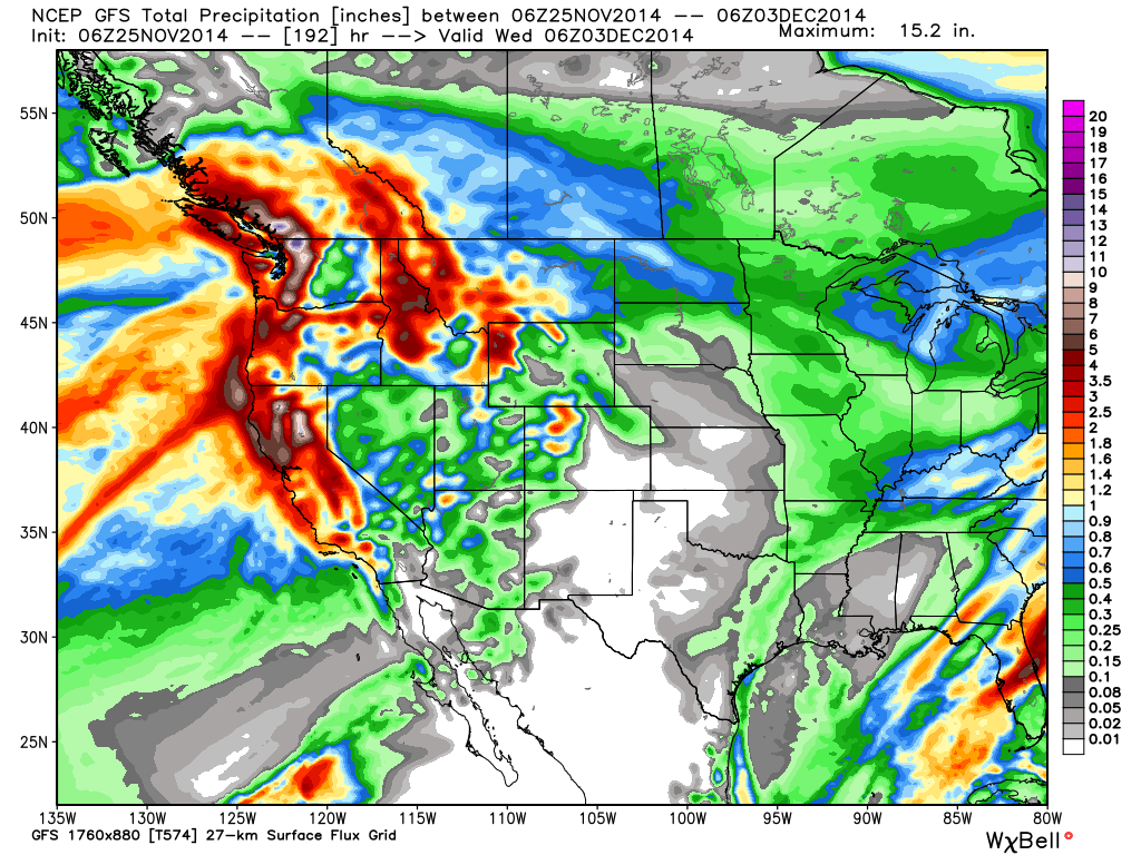
You can see that most of CA could get much needed rain and snow. Just to give a general idea 6-7 days out, the GFS and European forecast models are showing enough liquid for 1-2 feet at lake level and 2-3 feet on the mountains with up to 4 along the crest. Again, this is outside the 5 day confidence window and could change, but the consistency and agreement among the forecast models is building confidence by the day.
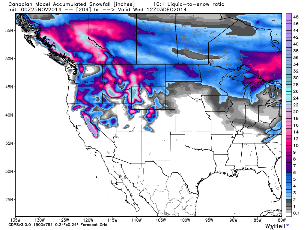
The Canadian model looks way overdone as usual, but shows there is a high end potential for more with a slower moving system that taps the subtropical jet.
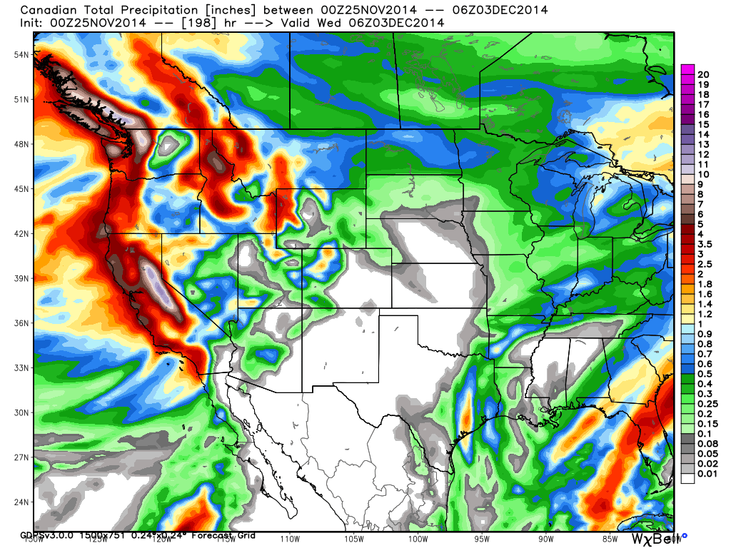
It makes for a pretty snowfall forecast though...
Like the rest of you I am trying not to get too excited. My heart has been pretty beat up the past few seasons. If the forecast looks the same in 2 days I'll be feeling much better.
Long-Range:
Let's hope this storm happens not only because we need snow to get the season started, but because it looks like the ridge may build off the coast again by the middle of next week. Looking at the long-range model runs they only keep it there about a week before we could go back into a stormy pattern by the 10th. That is in the fantasy range though.
The climate models continue to show above average precip amounts for CA for the month of December so hopes are still high for a good month.
Stay tuned....BA
About Our Forecaster
Bryan Allegretto
Forecaster
Bryan Allegretto has been writing insightful posts about snow storms for over the last 15 years and is known as Tahoe's go-to snow forecaster. BA grew up in south Jersey, surfing, snowboarding, and chasing down the storms creating the epic conditions for both.
Free OpenSnow App


