Tahoe Daily Snow

By Bryan Allegretto, Forecaster Posted 9 years ago December 22, 2014
White Christmas...
Summary:
Mild and dry weather will start the week. On Wednesday a cold storm will approach bringing winds. Christmas Eve into early Christmas morning snow will fall associated with the cold system and cold front. A general 3-6 inches of snow could fall across the Tahoe basin. This will begin a colder pattern through the end of the year, but no significant snows expected. The first week of January we may see a pattern change and an increased chance for more significant storms.
Details:
The GFS really flipped on the track of the storm for Wednesday night starting with the 0z run last night. It is now digging the storm down further South off the coast before pushing it inland, which is what the European model had been suggesting all along. It continued on the 6z run. That would bring a nice blanket of snow across the basin for Santa. Here is the GFS at 4 a.m. on Christmas Day.
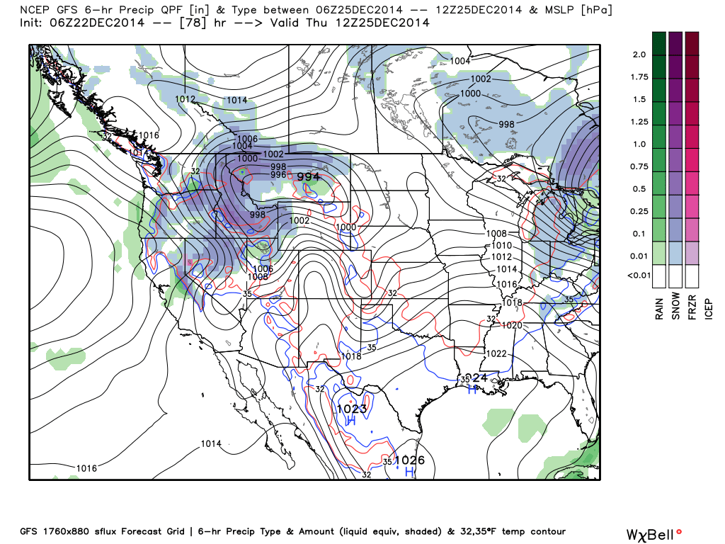
The GFS is now the wettest model showing up to an inch of liquid along the crest.
I'm not sure I'm ready to change the forecast from an inch to fifteen inches along the crest overnight. Looking through the other model runs the European model brings .5 - .75 inches of liquid across the basin, and the Canadian & NAM models bring .25 - .5 inches. They are not showing much shadowing as the strong cold front quickly sweeps a heavy band of snow across the basin overnight. For now I am going to keep the snowfall forecast in line with the lower end which the HPC is doing as well, and watch the trend the next 2 days.
This would bring a general 3-6 inches across the basin with maybe up to 4-8 inches above 7000 ft. along the crest.
This system also comes with a pattern change for about a week as the high pressure ridge builds further North towards the Gulf of Alaska, and is further off the Coast. After a warm December so far for much of the country, much colder air will be pouring down from the North into much of the U.S. It looks like it will push far enough West for much colder weather for us if the ridge is far enough off the coast as forecast. Highs in the 40's and 50's will be replaced by highs in the 20's and 30's. That should allow the ski resorts to aim the snow guns at areas where they need to boost their base.
The pattern is a dry one later Christmas Day through New Years Day, but we could see some light snow from systems dropping down from the North and reinforcing the colder air. The first system that could do that is Sunday.
Long-Range:
I began to talk about the beginning of the long range with the dry start to week 2. We are still watching for a pattern change the first week of January. There is still low confidence in when we will see the next significant snow storm. The forecast model runs continue to see something happening the first week of January though.
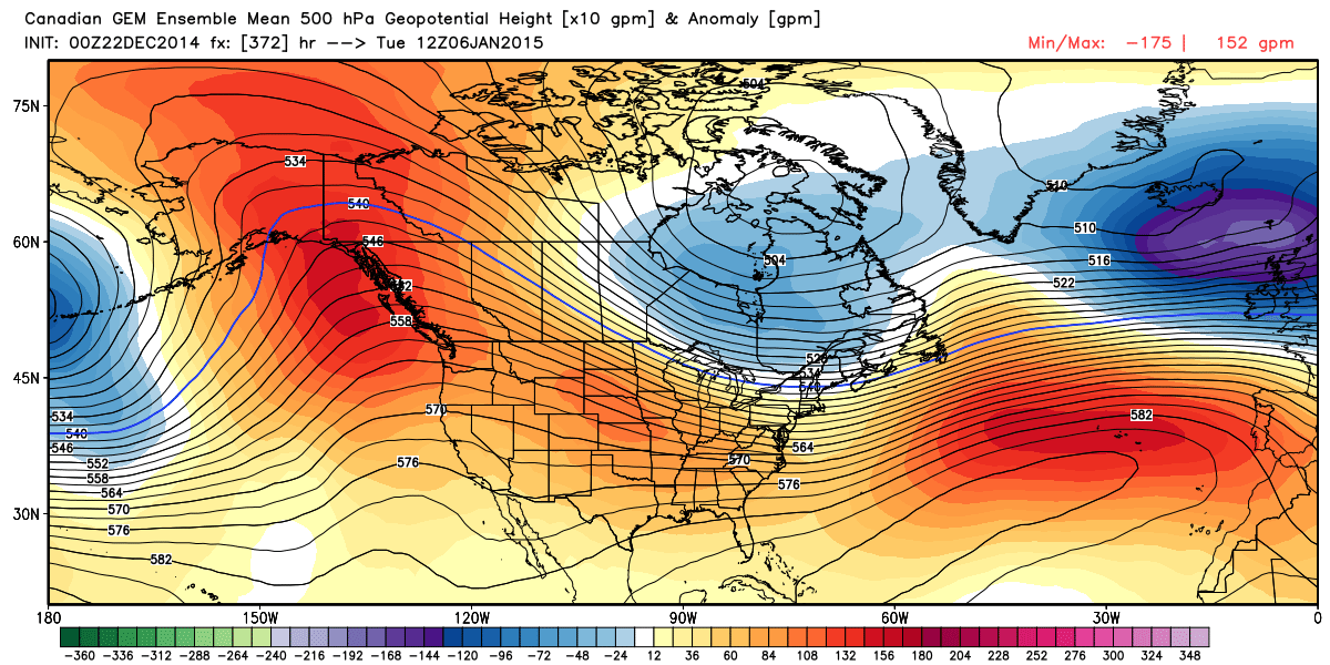
Looking through the ensemble runs and ensemble control runs of the GFS, Canadian, and European models, they are now showing retrogression of the ridge out to around 160w the first week of January. That is different than they were showing before with the ridge in the Gulf of Alaska or further North over Alaska. The operational runs of the GFS and European models also show this with some stronger colder storms showing up as a trough digs down the West Coast. Again, not much confidence yet without multi-day consistency, but they are seeing something and mostly in agreement this morning.
The only run that didn't show the pattern this morning was the Canadian ensemble run. I feel like I should hear the buzzer from family feud when I see the ridge over the West Coast.
But the control run of the same model shows this...
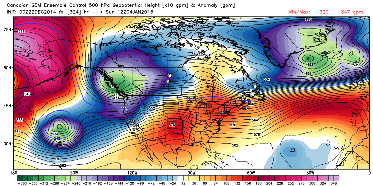
Those look the same?!?!.........
The CFSv2 for the first week of January has been flipping around too, and for the month. It was consistent on a wet January for weeks and then started showing a dry January the last several days.
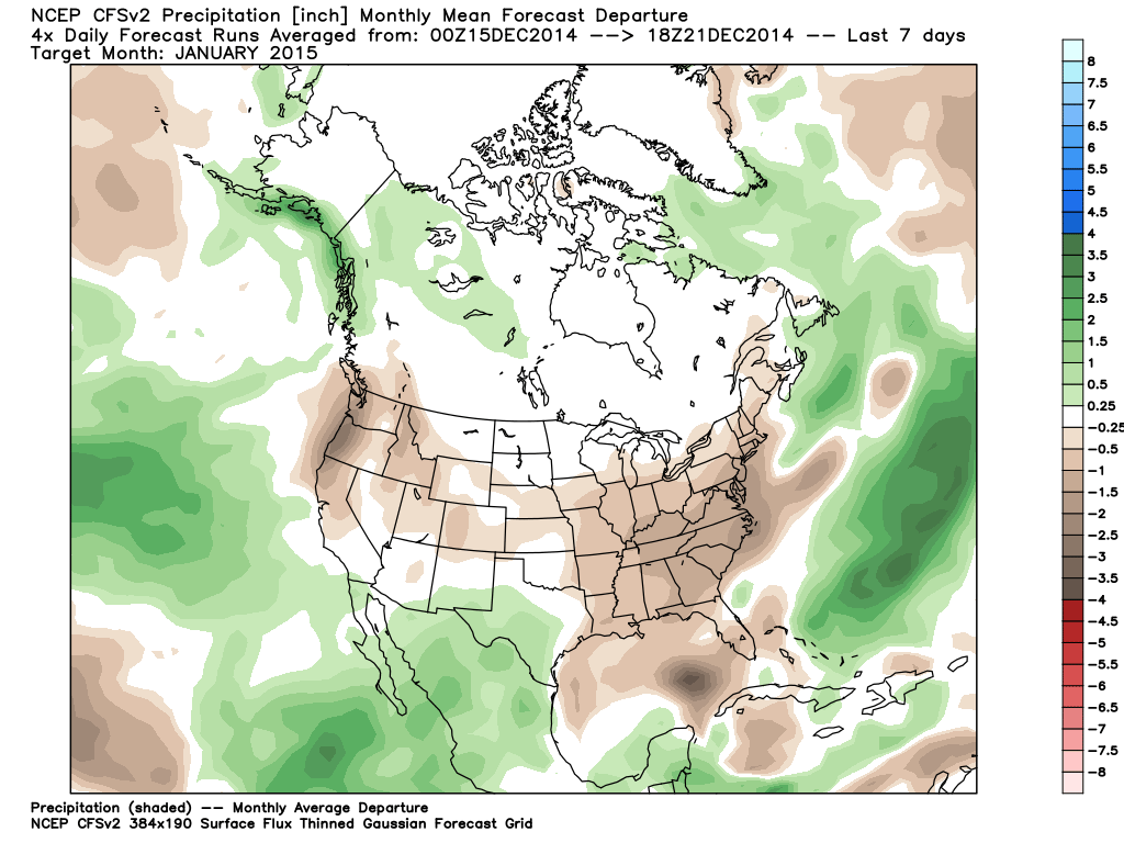
But the most recent runs are trending back towards the original idea of a wet month...

Looking at the teleconnection forecasts they are all over the place with the forecasts for the AO and NAO, and the PNA is flat lining near neutral. The MJO is spinning circles in phase 3 as it is stalled out in the Indian Ocean. So not much help in the long range pattern forecast. Usually all the inconsistency in the models means they are struggling to catch onto a big pattern change. Let's hope that it's going to be one that brings us snow. The QBO is negative which lines up with the cold forecast coming up for the country.
So some snow for Christmas, a colder pattern to follow, and maybe a pattern that brings bigger storms in January.......
Stay tuned...BA
About Our Forecaster
Bryan Allegretto
Forecaster
Bryan Allegretto has been writing insightful posts about snow storms for over the last 15 years and is known as Tahoe's go-to snow forecaster. BA grew up in south Jersey, surfing, snowboarding, and chasing down the storms creating the epic conditions for both.
Free OpenSnow App


