Tahoe Daily Snow

By Bryan Allegretto, Forecaster Posted 9 years ago January 30, 2015
At Least it is Friday....
Summary:
A quiet weekend ahead. Next week storms will move into the Pacific Northwest. The precip looks like it will stay just to our North through the week but we could see some clouds. By the end of the week a large area of low pressure in the Northeast Pacific will stream subtropical moisture into the Pacific NW and Northern CA. That will bring heavy rains very close to the Tahoe basin next weekend. It looks like the heaviest precip will stay just to the North.
Details:
Not much change to the forecast over the next week as storms stay just to the North and we have highs in the 50's at lake level with sun and clouds.
Long-Range:
Still watching next weekend. The trough will try to push into the ridge over the West. The low in the Northeast Pacific is going to tap subtropical moisture and point it at the Pacific NW and Northern CA. Confidence has been low that much precip will be able to push into the Tahoe basin. The trend of the models the last 2 days is to push the precip a little closer.
Here is a look at the GFS Friday night. Plenty of shadowing from the crest as the front doesn't push the precip through.
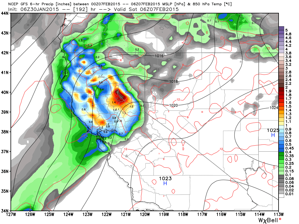
Just showing this because if you are just running the GFS run after run the last week it looks promising, but like with the "storm of the century" the precip can sit over Northern CA without pushing into the basin. The other problem is that this is subtropical warm moisture being pulled in, and without the front pushing through the snow levels will stay above 9000-10000 feet. So any precip would be rain.
Here is the total precip forecast. Still early to look at a week away, but backs up the point.
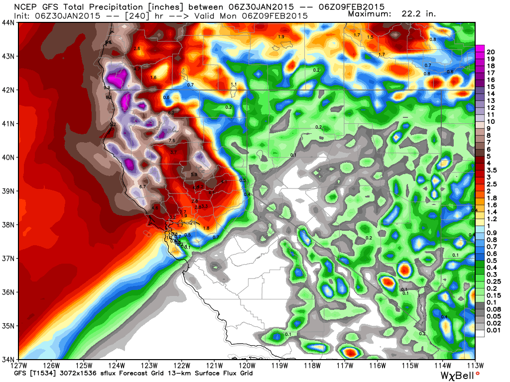
The precip amounts over Northern CA are impressive, but only light amounts for the Tahoe basin. The Control run of the European model has the ridge over the West slightly weaker and further East and does push the front through over the weekend with more precip for the basin and falling snow levels. It is the outlier right now though.
We will keep watching the trend with this over the next week. The confidence has been low with this storm from the start with the strong ridge over the West next weekend. If anything it looks more likely we could get some rain than snow.
The ridge rebuilds over the West Coast going into the 2nd weekend of February. Storms may try to push into the West Coast again around mid-month.
Meanwhile:
If you are looking for something to do on Tuesday or Thursday I thought maybe we would bring back the snowcoming events, even though the snow may not be coming. I am going to host one with Tahoe Ski Bum at the 50/50 Brewery in Truckee Tuesday night at 8, and at the Himmel Haus in South Lake Thursday night at 8. So if you want to come out and have a drink and watch some skiing and boarding films I'll see you there. There will also be items raffled off to go to the Tahoe fund. Just click the name of the venue above to RSVP.
Stay tuned....BA
About Our Forecaster
Bryan Allegretto
Forecaster
Bryan Allegretto has been writing insightful posts about snow storms for over the last 15 years and is known as Tahoe's go-to snow forecaster. BA grew up in south Jersey, surfing, snowboarding, and chasing down the storms creating the epic conditions for both.
Free OpenSnow App


