Tahoe Daily Snow

By Bryan Allegretto, Forecaster Posted 9 years ago March 5, 2015
March.....
Summary:
Sunny weather will continue into early next week with high temps in the 50's at lake level and 40's in the higher elevations. Next week an upper low spinning off the coast may start to send precip into CA by Wednesday. The low itself will make its way towards the West Coast by the end of the week. The question will be where does it come ashore and how strong is it when it does. The low could bring continued precip into the end of the week with mountain snows.
In the long-range it looks like we could see the ridge rebuild over NW North America with another break in storms.
Details:
The models have flipped around a little more today. Two days ago I posted on the possibility that the trough and the low next week may stay to our North as high pressure is reluctant to budge from the West Coast. Yesterday the models were playing with the idea of an AR event about 10 days out with the trough behind the low by the weekend of the 13th interacting with the next low near Hawaii, but on the latest runs the trough not digging down the West Coast anymore.
All season the ridge has wanted to be over NW North America and the West Coast and the thinking is that is due to the warm SST pattern in the Eastern Pacific. We thought maybe with the Spring season that would have less of an impact on the weather pattern but it doesn't look like that is the case. The long-range models continue to try and dig troughs down the West Coast and then within a week of the forecasted trough they reverse.
All week the forecast models were showing the trough digging into the Eastern Pacific and kicking the low inland next Wednesday and then the trough pushing into the West Coast with more storms by the end of the week. Now it looks like the trough will stay to the North. That will keep the low off the coast longer next week. The good news is that we still have a chance for precip as a wave of moisture ahead of the upper low moves inland Wedneday into Thursday, and then the low itself works its way inland by the end of the week. That could bring several days of precip.
The GFS weakens the wave and the low as they move inland and encounter the high pressure. Very light precip amounts on the forecast, but it is still 6+ days out so the confidence in any precip forecast is low at this point.
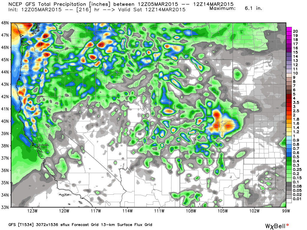
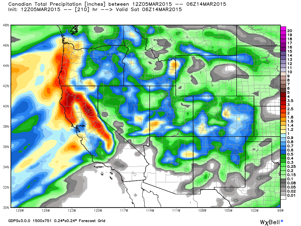
the Canadian and European model runs are much wetter with the system
So a different scenario than what we had been thinking and no AR (Atmospheric River) event behind the low, but still a chance we could see mountain snows next week. It's too early to over analyze it other than to say there is a chance for a storm. We will have a better handle on it this weekend. My fear is still having the precip move in to our North or have it weakened by the time it reaches us.
Long-Range
It looks like the ridge will try to build over Northwest North America by day 10. The only model run still showing a trough connecting with the low near Hawaii is the EPS control. A good model, but the rest of the ensemble blends of the models show the ridge. Another low looks like it could be sitting off the coast week 2 trying to send more precip inland. If the ridge shifts North enough we may be able to get some precip underneath week 2. Of course this is all out in fantasy range. Definitely trusting any forecast for a NW North America ridge more than trough though.
Stay tuned....BA
About Our Forecaster
Bryan Allegretto
Forecaster
Bryan Allegretto has been writing insightful posts about snow storms for over the last 15 years and is known as Tahoe's go-to snow forecaster. BA grew up in south Jersey, surfing, snowboarding, and chasing down the storms creating the epic conditions for both.
Free OpenSnow App


