Tahoe Daily Snow

By Bryan Allegretto, Forecaster Posted 9 years ago April 23, 2015
One More Snowfall Report....
Summary:
Showers will be around again this afternoon and again Friday afternoon. Friday night into Saturday a cold trough will drop through the area bringing heavier precip and falling snow levels to near lake level. We could see several inches of snow above 7000 feet. By Sunday we clear out and warm up into next week. There will be another system off the coast next week but it may stay to our North.
Details:
Some changes over the last 48 hours. The trough for Friday is once again looking like it will drop further South bringing lower snow levels and steadier precip.
We have been seeing showers develop during the afternoon the last couple of days with the trough and moisture over the area. That will continue into Friday. Snow levels have been running 8000-9000+ feet. It is hard to know the exact levels without anyone in the higher elevations reporting. I was driving back from Fresno over Sonora pass Tuesday evening and it was snowing at 8000 feet and sticking at 8500 feet. Sonora pass is normally not open this time of year but the extremely low snowpack has it allowed it to open in April.
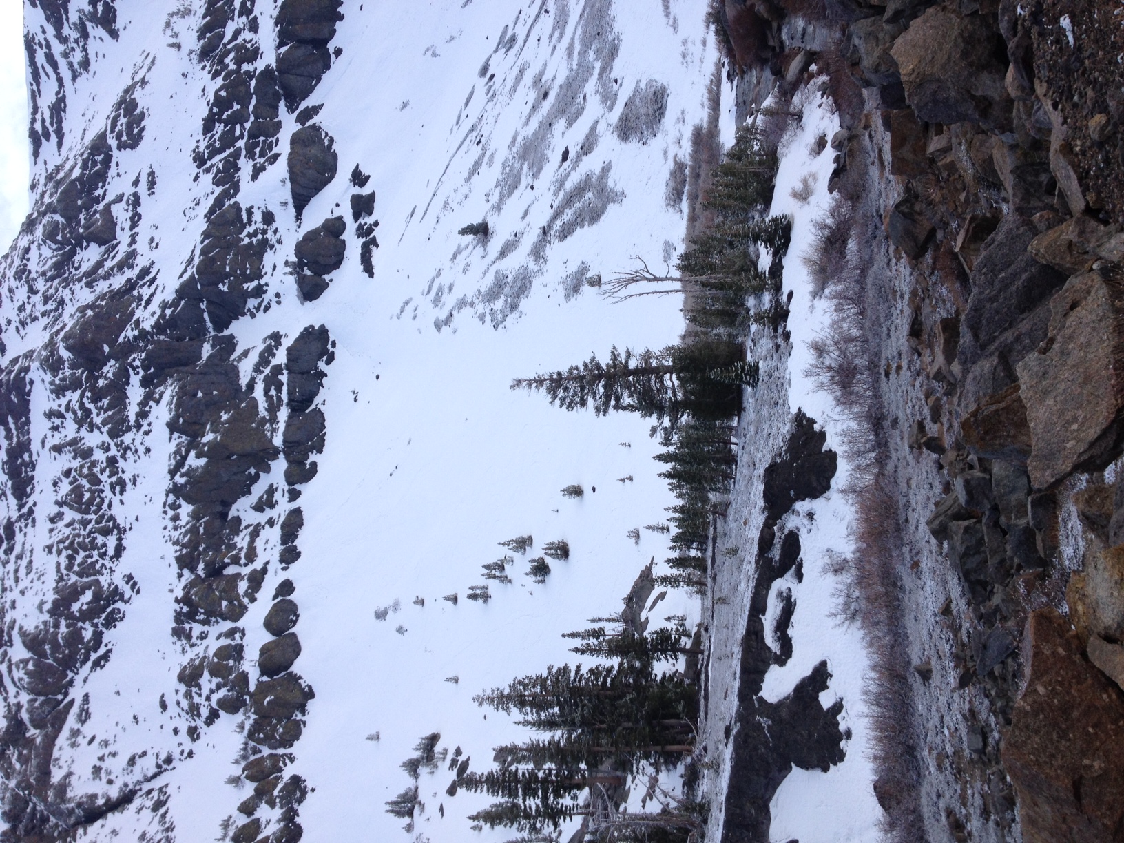
For some reason the photo won't upload right side up...
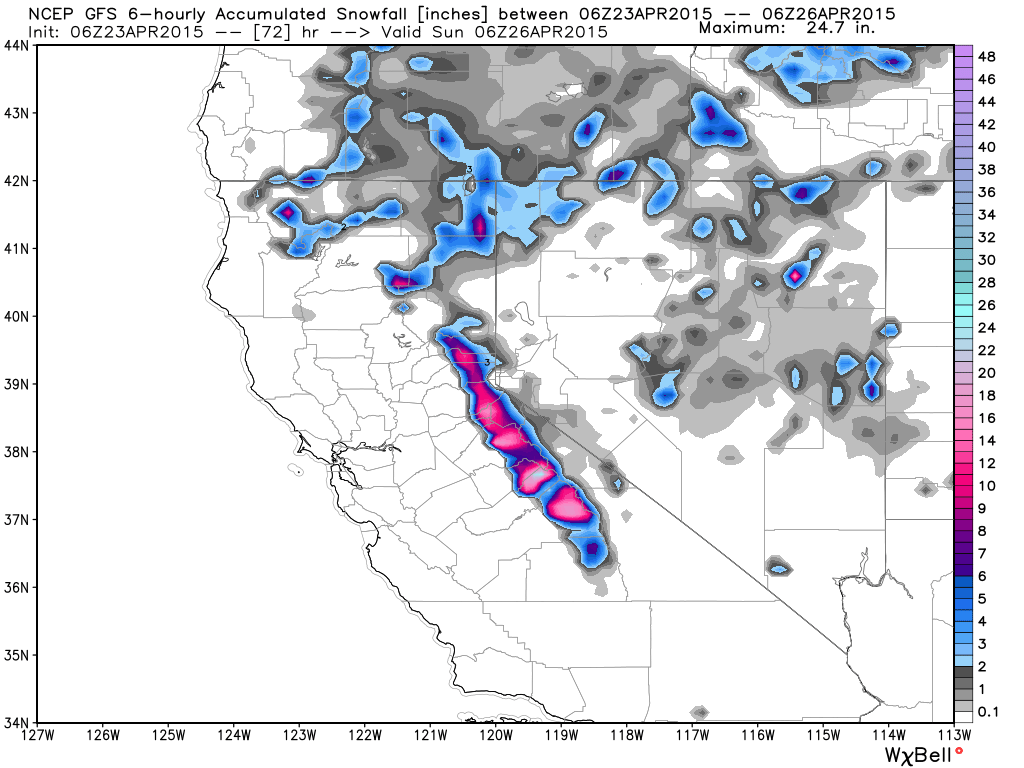
The trough for Friday night into Saturday now looks like it will dig a little further South instead of staying North. This is what the models were showing earlier this week and then trended North. Now they have trended back South. This will bring in more cold air Friday night into Saturday and heavier precip as the trough has some moisture tap from the Pacific.
We could see snow levels fall near lake level by Saturday morning. Snowfall amounts along the crest above 7000 feet could be 6-12 inches. The GFS seems to be the most aggressive. Squaw is the only mountain open that will give a report on Saturday morning, so this will be the last resort snowfall report of the season. Snow could fall into the afternoon on Saturday before the system shifts out.
Another update tomorrow on the track of this system and potential snowfall amounts for the mountains. I am heading to Redding today for the kool April nights car show. Hoping the rain clears out up there by Saturday morning, and kind of glad it will only be in the 70's.
This will be the last snow storm we track for resort purposes as Squaw is the only resort still open and they close on Sunday. This site is aimed at forecasting snowfall for skiers and we mainly focus on snowfall at ski resorts. My posts will drop off next week, but I will be posting if more snow shows up in the forecast in May. During the Summer I do post from time to time on what we are seeing develop that could affect next season.
Next week a trough approaches the West Coast. It may push more precip into the area by the end of the week. Some model runs keep the precip to our North with a dry week.
Stay tuned....BA
About Our Forecaster
Bryan Allegretto
Forecaster
Bryan Allegretto has been writing insightful posts about snow storms for over the last 15 years and is known as Tahoe's go-to snow forecaster. BA grew up in south Jersey, surfing, snowboarding, and chasing down the storms creating the epic conditions for both.
Free OpenSnow App


