Upper Midwest Daily Snow

By Andrew Murray, Technical Founder & Meteorologist Posted 10 years ago November 5, 2013
Still looking on track for the first measurable snowfall of the season tonight, but even 12 hours out the forecast is still tricky.
The best chance of heavy snow will be in a band that will be no more than 50 miles across, narrowing as it stretches into northern Wisconsin. Areas within the band should get between 3-5 inches of snow, while those outside will only get 1-2”.
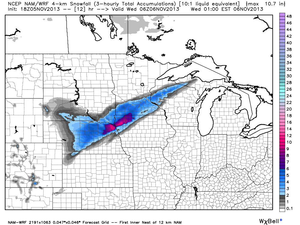
12-hour model snowfall accumulation for the Upper Midwest. Credit: WeatherBell
Right now, the band looks to set up on a line between Mankato to just south of the Twin Cities, and then following the St Croix River into Wisconsin. The band should taper off towards the north leaving ski area in extreme northern Wisconsin and in the UP with little or no snow accumulation.
Snow should taper off a bit earlier in the morning, with most accumulation ending around daybreak with clearing skies.
Besides the positioning of the band, the rest of the forecast from yesterday’s Daily Snow looks to be holding mostly true with a milder end to the week.
About Our Forecaster
Andrew Murray
Technical Founder & Meteorologist
Andrew manages the technology that powers OpenSnow, and he also keeps an eye on the weather for the Upper Midwest from his home base in Minneapolis since 2015.
Free OpenSnow App


