Upper Midwest Daily Snow

By Andrew Murray, Technical Founder & Meteorologist Posted 9 years ago December 16, 2014
Less snow, and then sun!
Just a quick update on this rainy Monday night, it looks like the switchover to snow is taking longer than expected. Additionally, the storm moving northeast looks to be interacting with the northern storm much further west and north of where the models were hinting yesterday.
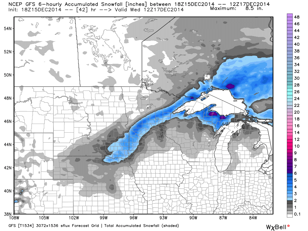
So what does this mean for snowfall? The band forecasted to be over central Minnesota and northern Wisconsin now looks to be set up over north-central Minnesota and the North Shore of MN. These areas should have the best chance of seeing 3+" now, while other areas will struggle to get a inch of accumulations (especially on the very wet ground).
As for changes to the lake effect, the more northern low track will allow for a longer timeframe of favorable winds, especially in the eastern UP. Areas could see snow in the 6-12" range depending on direction, but the northern snowbells should do best. As for further west and into the South Shore, the lake effect will struggle to last beyond tomorrow afternoon, limiting accumulation.
Here is the updated model from noon today for snowfall totals through Wednesday morning:
After the snow on Tuesday, it looks like clearer skies will finally return to the Upper Midwest, as cold(er) arctic air moves back into the region bringing sun and more normal temperatures still.
About Our Forecaster
Andrew Murray
Technical Founder & Meteorologist
Andrew manages the technology that powers OpenSnow, and he also keeps an eye on the weather for the Upper Midwest from his home base in Minneapolis since 2015.
Free OpenSnow App


