News

By Joel Gratz, Founding Meteorologist Posted 10 years ago October 23, 2013
Beautiful weather image
Below is a satellite image taken of the western US on Wednesday morning October 23rd, from about 22,500 miles up in space. The satellite is sensing water vapor. Water vapor is invisible, but it's everywhere throughout our atmosphere. Looking at water vapor is useful because it shows us the motion of the air even where clouds are not present. The colors show the amount of water vapor. Black and light brown colors show less water vapor, while grey and blue colors show more.
The main point of this image is simply to show how complex the atmosphere is on a daily basis. Even though there's not much interesting weather going on in the western US, the air over this part of the country is still swirling, pushing, flowing, etc. It's incredible that our satellites and weather models can even come close to showing the complexity of our atmosphere!
Swirling maps are fun to look at, but want to know where the snow is falling?
Check out our Powder Finder!
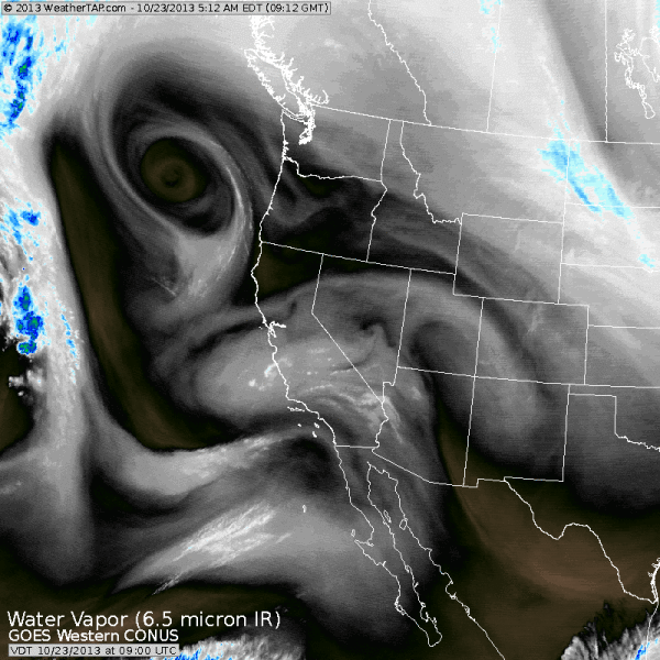
Source: WeatherTap.com
About The Author
Joel Gratz
Founding Meteorologist
Joel Gratz is the Founding Meteorologist of OpenSnow and has lived in Boulder, Colorado since 2003. Before moving to Colorado, he spent his childhood as a (not very fast) ski racer in eastern Pennsylvania.
Free OpenSnow App


