News

By Joel Gratz, Founding Meteorologist Posted 9 years ago September 8, 2014
Snow in September
There will be two interesting weather events this week.
First, a surge of moisture will bring 1-3 inches of rain to southern California, Nevada, Arizona, southern Utah, and Colorado. Many of these areas need the moisture, so aside from flooding concerns, this is a good thing.
Second, and likely more interesting to snow lovers, a surge of cold air and snow will move south from Canada during the middle and end of the week.
The cold air will start the week in Alberta and will then move south to Montana on Tuesday, Wyoming on Wednesday, and Colorado on Thursday. Notice in the images below that the coldest air will stay east of the mountains, so the east side of the continental divide and the plains will feel the coolest readings.
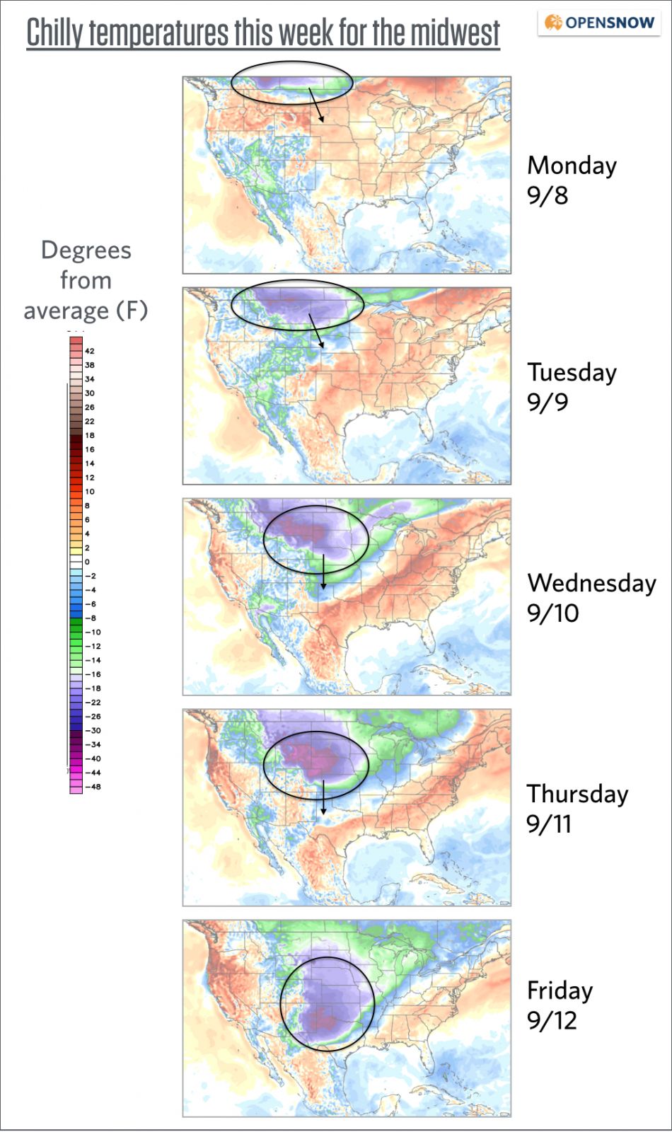
Forecast temperature difference from average. Source: Weatherbell.com
This airmass will be cold and somewhat moist. This means snow for areas along and east of the continental divide, with the best accumulations likely to fall in Alberta Canada, Montana, and Wyoming. The eastern foothills and plains of Colorado could also see a few flakes Thursday night into Friday ... maybe.
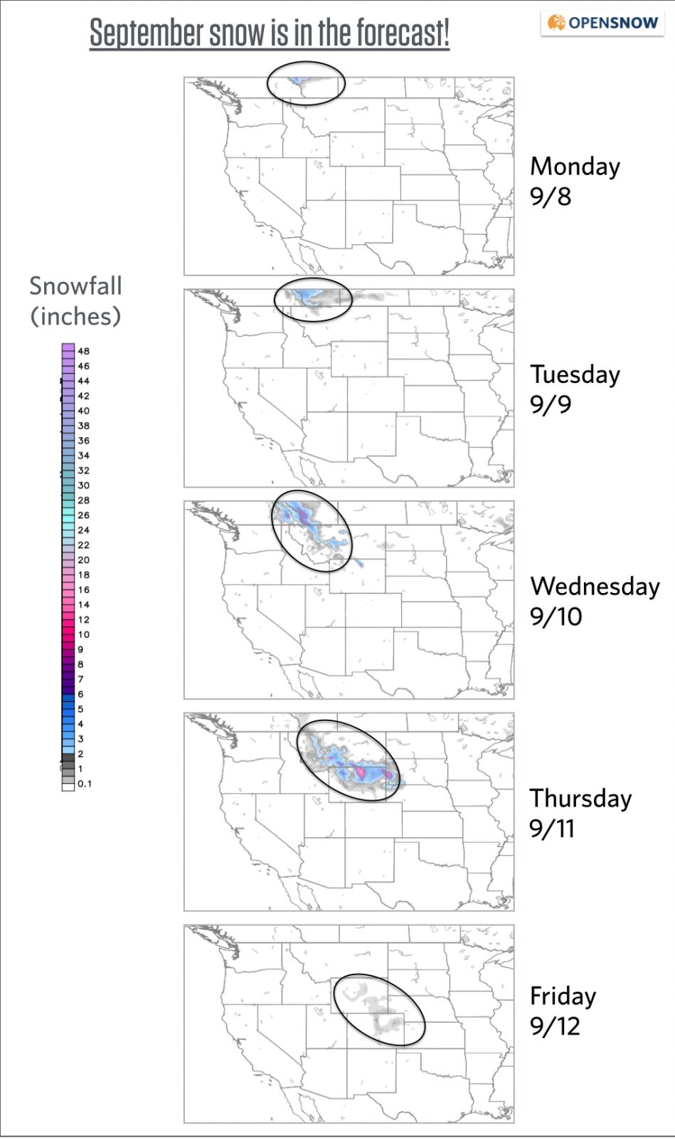
Snow forecast for 24 hour periods from Monday through Friday. Source: Weatherbell.com
For most of the rest of the month, the long-range forecasts show the coldest air staying east of the mountains, similar to the path of the cold air above. While this may be disappointing, I'd rather have this pattern occur now and hope for a switch to a more western storm track when ski season cranks up in another two months.
JOEL GRATZ
About The Author
Joel Gratz
Founding Meteorologist
Joel Gratz is the Founding Meteorologist of OpenSnow and has lived in Boulder, Colorado since 2003. Before moving to Colorado, he spent his childhood as a (not very fast) ski racer in eastern Pennsylvania.
Free OpenSnow App


