News

By Joel Gratz, Founding Meteorologist Posted 10 years ago October 24, 2013
Weather for next week - Oct 27 to Nov 1, 2013
After a cold week in the east and a warm week in the west, the weather will flip-flop for the week of Halloween. Folks in the Rockies will be thankful to see snow once again.
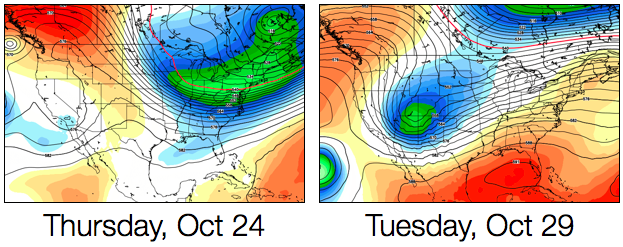
The American GFS model shows a shift in the storminess comparing this week to next week. Source: WeatherBell.com
If we only look at the American GFS model, it shows plentiful snow over Montana from Sunday into Monday, then snow moving into Wyoming and Colorado on Tuesday into Wednesday. At first glance, it seems that a snowy forecast for the Rockies is a given.
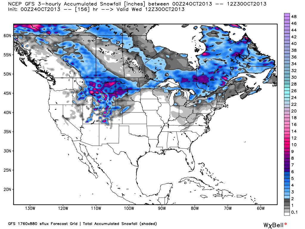
Snow forecast from the American GFS model for this weekend through next Wednesday. Source: WeatherBell.com
Unfortunately, we can't feel good about looking at just one model. There are many models, and to have confidence in a forecast, it's best if there is agreement between the models.
The map below compares the American model in green with the European model in red. On Monday, the models are in general agreement that the center of the storm will be over Idaho-ish. This adds confidence to the forecast of heavy snow over Montana and northern Wyoming on Sunday night into Monday.
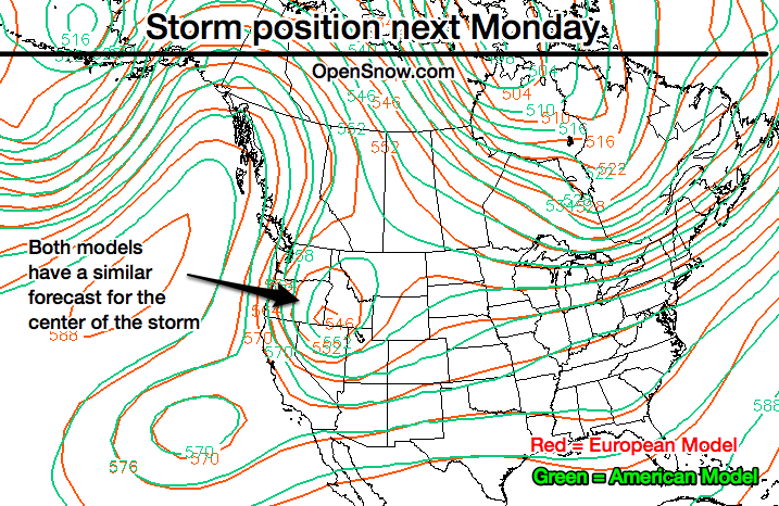
Both models agree about the position of the storm on Monday. Source: San Jose State University
By Wednesday, though, the models are showing completely different forecasts. The European is holding the storm further west with better chances of snow in Utah and even Tahoe, while the American GFS moves the storm quickly through Colorado and into the midwest with the best snow focusing on Colorado.
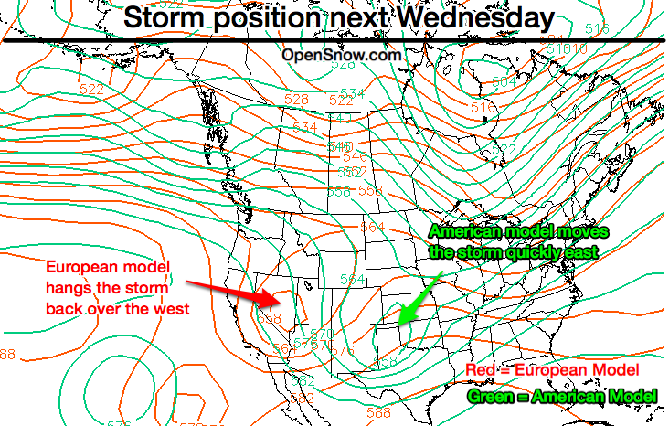
Both models do NOT agree about the position of the storm on Wednesday. Source: San Jose State University
What's worse than the models not agreeing? Flip-flopping! For the last few days, the models have swapped forecasts every 12 hours when the new model runs are released. If the European model speeds up its prediction, the American GFS shifts back to forecasting a slower storm that is further west. And vice versa.
What does this tell us? We know there will be a storm in the west next week, and many mountains will see much cooler air and good snowfall. But the details about the storm are very uncertain. This isn't always the case as there is usually more agreement between the models on five-day forecasts. But not this time, so we'll have to wait and see!
JOEL GRATZ
About The Author
Joel Gratz
Founding Meteorologist
Joel Gratz is the Founding Meteorologist of OpenSnow and has lived in Boulder, Colorado since 2003. Before moving to Colorado, he spent his childhood as a (not very fast) ski racer in eastern Pennsylvania.
Free OpenSnow App


