News

By Sam Collentine, Meteorologist Posted 10 years ago April 14, 2014
Weather for the week - April 14 to April 18, 2014
Excellent conditions are in play across the northern and central Rockies this week as the primary storm track continues to hammer down powder into mid-April. This week will be closing week for numerous ski areas throughout the Rockies and it will not disappoint. This past weekend left many areas looking like mid-winter and after a dry Monday and Tuesday, another system will unload on the Rockies with moderate to heavy snow through Wednesday. Even though most areas in the Upper Midwest are closed for the season, Old Man Winter will once again come out from the shadows to give them a winter surprise. With mid-April conditions this good, how could you even think about putting away your skis and snowboards?
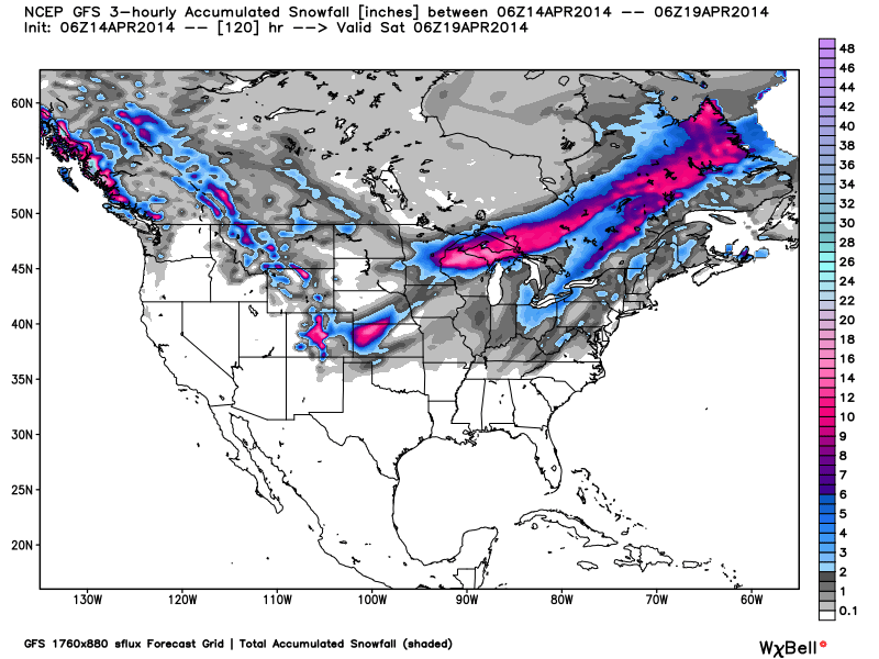
Total accumulated snowfall, according to the American GFS, through Friday. Source: WeatherBell.com
The primary storm track will once again take aim at the northern and central Rockies this week. Western Montana, Wyoming, and Colorado will be the winners with 4-8" likely throughout the week. Areas along and east of the Continental Divide in Colorado will be enhanced by an upslope flow on Wednesday so higher totals can be expected. Thursday morning will provide the best skiing this week with fresh tracks and clearing skies. Wednesday will be a storm skiing day but expect "crunch" underneith as the sun will bake any remaining fresh snow from this past weekend. Utah will see a few scattered showers on Wednesday but it will only amount to a dusting at best within the highly elevated areas. Take advantage of the fantastic late season conditions because they will not disappoint! Evan and Joel will have the latest in the Utah and Colorado Daily Snow.
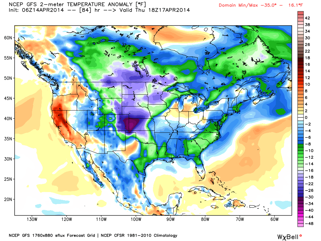
The temperature anomaly, or the departure from the long-term average, as of Thursday afternoon. Source: WeatherBell.com
Our Upper Midwest and New England Meteorologists are done updating for the season but this does not mean the snow will stop falling! Northern Michigan and Wisconsin will experience on and off snow throughout the week with heavy snow on Wednesday and into Thursday. Rain will be the main type of precip the further south we look but the northern areas of the Upper Midwest will experience a good dose of mid-winter like weather. Another wave of moderate to heavy snow is also possible on Friday. The highly elevated areas of northern New England will receive light snow late Tuesday and into Wednesday as a system passes along the Canadian border. This will not be a big snowmaker but it will certainly add to the already steller late-season conditions across the region. Check to see what ski areas are still open and head to the hills!
When you're up on the hill this week post pictures and updates using "LiveSnow", one of the features of our FREE iPhone and Android app.
Always check our Powder Finder and the forecasts for each mountain throughout the week for more details.
Sam Collentine | OpenSnow
> Checkout Liftopia for Discount Lift Tickets
About The Author
Sam Collentine
Meteorologist
Sam Collentine is the Chief Operating Officer of OpenSnow and lives in Basalt, Colorado. Before joining OpenSnow, he studied Atmospheric Science at the University of Colorado, spent time at Channel 7 News in Denver, and at the National Weather Service in Boulder.
Free OpenSnow App


