News

By Sam Collentine, Meteorologist Posted 10 years ago April 7, 2014
Weather for the week - April 7 to April 11, 2014
As we enter the second week of April, the United States will see a quiet week in terms of fresh snow. The northern and central Rockies will see a few lingering showers on Monday before warm and dry conditions settle in for the week. A weak system will pass over the Northeast on Tuesday with the higher elevated resorts to the north likely being the only locations to receive any snow accumulation. A very weak system could produce a few stray showers for the Northwest early Wednesday and for the northern and central Rockies on Thursday but accumulations will be trace to two inches at best. Load up on the sunscreen and grab your sunglasses because this week will be spring skiing at it's finest!
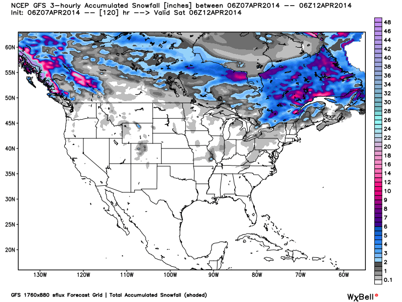
Total accumulated snowfall, according to the American GFS, through Friday. Source: WeatherBell.com
British Columbia. That is where you will find the goods this week as a high pressure builds across the western United States. A few lingering showers will be found across the northern and central Rockies on Monday before very warm and dry conditions take hold. Temperatures will reach into the upper 40's and low 50's in the high country on Tuesday and Wednesday. A weak system will slip across the northern Cascades late Tuesday and early Wednesday with a rain/snow mix across the lower elevations. This system will then creep across the Rockies on Thursday with minimal accumulations expected. Spring conditions are excellent all across the West so don't let the lack of fresh snow keep you away. As always, our team of local forecasters will keep you updated every morning in the Tahoe, Northwest, Utah, and Colorado Daily Snow.
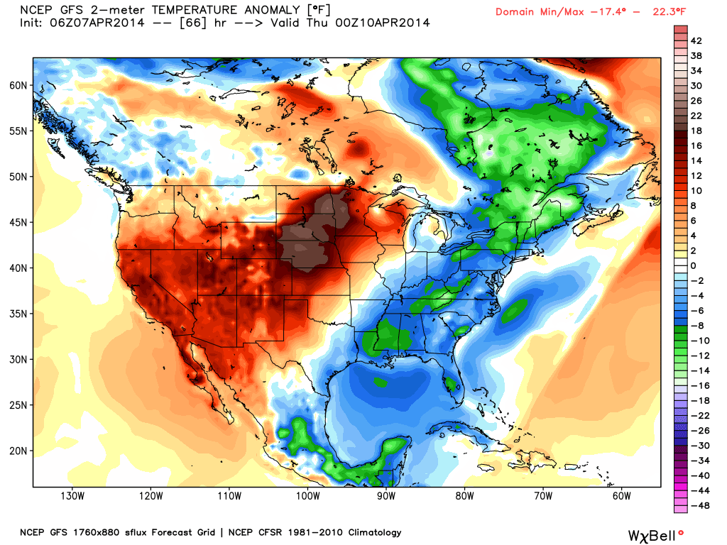
Temperature anomaly, or the departure from the long-term average, as of Wednesday afternoon. Source: WeatherBell.com
A storm will develop in the southeast on Monday and track north towards New England on Tuesday. This will primarily be a rain maker with any snow accumulation limited to the higher elevated resorts of northern New England. Temperatures will remain slightly below average for the majority of the week as warmer air dominates the West. Again, head north if you are searching for fresh snow as we transition deeper into spring. The Upper Midwest will be in on the warmer temperatures and dry conditions this week with no new snow likely through Friday. After a brutal winter, I'm sure the region won't mind. Andrew and Brian will have the latest details in the Upper Midwest and New England Daily Snow.
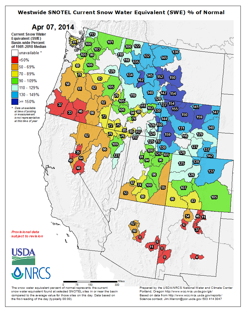
The latest snowpack analysis for the West. As you can see, the northern and central Rockies are well above-average after a very beneficial northern storm track this winter. Even with all the recent snow, Lake Tahoe and Oregon still sit well below-average. Source: NRCS
When you're up on the hill this week post pictures and updates using "LiveSnow", one of the features of our FREE iPhone and Android app.
Always check our Powder Finder and the forecasts for each mountain throughout the week for more details.
Sam Collentine | OpenSnow
> Checkout Liftopia for Discount Lift Tickets
About The Author
Sam Collentine
Meteorologist
Sam Collentine is the Chief Operating Officer of OpenSnow and lives in Basalt, Colorado. Before joining OpenSnow, he studied Atmospheric Science at the University of Colorado, spent time at Channel 7 News in Denver, and at the National Weather Service in Boulder.
Free OpenSnow App


