News

By Sam Collentine, Meteorologist Posted 10 years ago February 3, 2014
Weather for the week - Feb 3 to Feb 7, 2014
For this week, the entire United States will stay under a cold and active pattern bringing fresh snow from coast to coast. The West will see light to moderate snow accumulations Monday through Tuesday and again on Thursday through Friday. The East on the other hand will look for moderate to heavy accumulations Wednesday into Thursday as a strong system tracks up the East Coast. In all, fresh powder conditions will be in play from the Sierra Nevada's of California to the White Mountains of New Hampshire.
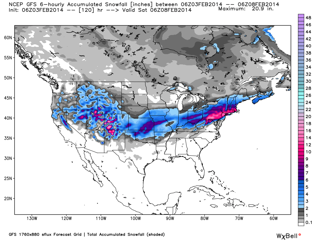
Total accumulated snowfall, according to the American GFS, through Friday night. Source: WeatherBell.com
We will start in the West where cold temperatures and chances for snow look to be in place throughout the entire week. What great news for many areas of the West who are sitting well below seasonal snowpack averages. The Lake Tahoe region will see a cold front push through the region on Monday bringing a slight chance for snow. A dusting looks to be all they will squeeze out of this system. Their focus will then turn to Thursday where a stronger system will begin to effect the region. This system will be in place through Saturday with moderate to heavy accumulations expected depending on the exact loaction. Brian will have all the details in The Tahoe Daily Snow.
Utah will be in a slightly better position this week as snow showers take aim at the state Monday through Tuesday and again beginning on Thursday and into the weekend. Total accumulations through Tuesday will be in the range of 5-10 inches with a stronger system moving in on Thursday. As for Colorado, a storm on Monday and into Tuesday will bring moderate to heavy accumulations to the central and southern mountains as the system tracks across the Southwest. There will then be a break on Wednesday before the next system begins to push snow into Utah and Colorado. Joel and Evan will break it all down in The Colorado and Utah Daily Snow.
The Pacific Northwest, though cold, will stay dry this week before a system takes aim at the region this weekend. Larry will provide updates throughout the entire week in The Northwest Daily Snow.
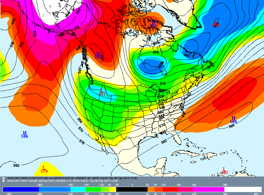
This week's weather pattern will provide chances for snow throughout the entire United States. The Northeast will see a strong system move through on Wednesday while the West keeps it's eye on Thursday for it's next strong system. Source: Meteostar.
We now turn to the Mid-Atlantic and New England where two storms will effect the region this week. The first will stay further south bringing light accumulations to the Mid-Atlantic. Northern West Virginia and southern Pennsylvania will be the winner's on Monday as 3-6 inches look to add up throughout the region. The focus then turns to Wednesday where a stronger system looks to move throughout the entire Northeast. Depending on the exact track, upwards of a foot is possible through Thursday for many areas of the Northeast. Brian and Justin will have all the details in The New England and Mid-Atlantic Daily Snow.
When you're up on the hill this week post pictures and updates using "LiveSnow", one of the features of our FREE iPhone and Android app.
Always check our Powder Finder and the forecasts for each mountain throughout the week for more details.
Sam Collentine | OpenSnow
About The Author
Sam Collentine
Meteorologist
Sam Collentine is the Chief Operating Officer of OpenSnow and lives in Basalt, Colorado. Before joining OpenSnow, he studied Atmospheric Science at the University of Colorado, spent time at Channel 7 News in Denver, and at the National Weather Service in Boulder.
Free OpenSnow App


