News

By Sam Collentine, Meteorologist Posted 10 years ago January 6, 2014
Weather for the week - Jan 6 to Jan 10, 2014
Looking into this week, the Arctic airmass that brought blistering cold to much of the United States over this past weekend will continue it's push east throughout the middle of the week. The West Coast high pressure ridge will see a minor breakdown allowing for a slight chance of snow for the Lake Tahoe region while moderate to heavy accumulations take aim at the Pacific Northwest and much of the inner West.
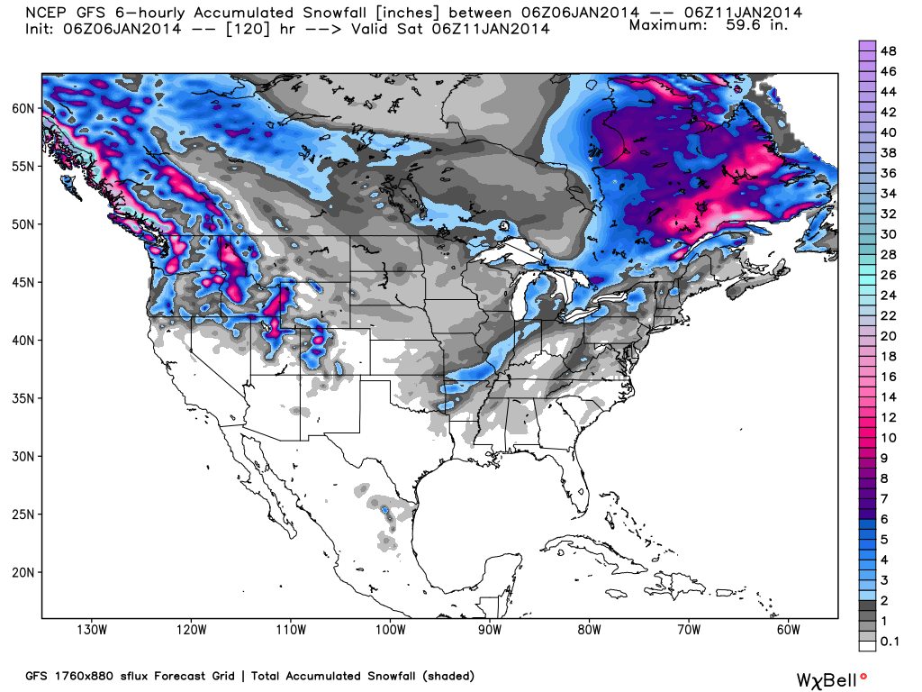
Total accumulated snowfall, according to the American GFS, as of Friday night. Source: WeatherBell.com
For the upper Midwest, lake effect snow will bring light to moderate accumulations to parts of northern and central Michigan during the day Monday and into Monday night. Temperatures will still be brutally cold so bundle up if your headed to the hill. Grab the latest details in The Upper Midwest Daily Snow.
As the Arctic airmass pushes east, the Northeast will continue to see chances for snow on Monday night and into Tuesday morning. The northern tiers of New York and Vermont will see the best chances with lake effect snow bringing locally heavy amounts to the Tug Hill region of New York. The latter half of the week will also see chances for snow but lighter accumulations are expected. Brian Clark will have the latest details in The New England Daily Snow.
As for the West, a series of systems will make their way through this week bringing moderate to heavy accumulations to the Pacific Northwest and the inner West. This will finally include the resorts of Washington and Oregon who have primarily missed out so far this season.
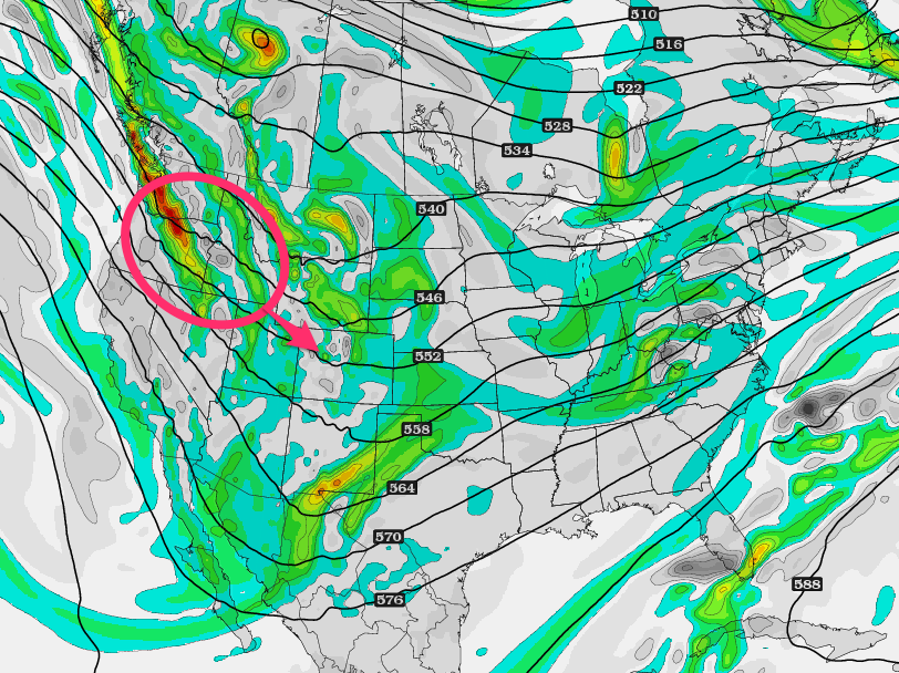
Area of energy, vorticity, that will bring heavy snow to much of the Pacific Northwest and inner West during the second half of the week. Source: WeatherBell.com, analysis by OpenSnow.
The first system will push through Tuesday into Wednesday bringing lighter amounts to much of the West. The second and stronger system will make it's way into the Pacific Northwest late Wednesday into Thursday. Thursday looks to be the best powder day of the week for much of the West with Oregon likely coming away with the highest totals. The panhandle of Idaho, western Montana, Wyoming, Utah, and Colorado will also see moderate to heavy accumulations during the second half of the week. Grab the latest details for the inner West via The Utah Daily Snow and The Colorado Daily Snow.
In regards to the Lake Tahoe region, the models have continually given us poor run-to-run consistency. This leaves us with a dusting possible on Tuesday night and still much uncertainty for Wednesday into Thursday. Our Tahoe Forecaster Bryan Allegretto is providing excellent updates so check out The Tahoe Daily Snow for the latest details throughout the week.
When you're up on the hill this week post pictures and updates using "LiveSnow", one of the features of our new iPhone app. If your haven't already, download it here.
Always check our Powder Finder, forecasts for each mountain, and our Daily Snow posts throughout the week for more details.
Sam Collentine | OpenSnow
About The Author
Sam Collentine
Meteorologist
Sam Collentine is the Chief Operating Officer of OpenSnow and lives in Basalt, Colorado. Before joining OpenSnow, he studied Atmospheric Science at the University of Colorado, spent time at Channel 7 News in Denver, and at the National Weather Service in Boulder.
Free OpenSnow App


