News

By Sam Collentine, Meteorologist Posted 10 years ago March 24, 2014
Weather for the week - March 24 to March 28, 2014
An active pattern of weather will take place across the United States this week as two large systems bring snow to every region of the country. Double digit accumulations will take aim at the Central Rockies from Wednesday night through Friday morning while Lake Tahoe eyes it's first measurable snowfall in over two weeks. This will be much more than just a measurable snowfall for Lake Tahoe though as 2-3 FEET is possible through Friday night. Cold temperatures will once again move across the Upper Midwest and Northeast this week with light to moderate snowfall. Is ski season over yet? Not even close.
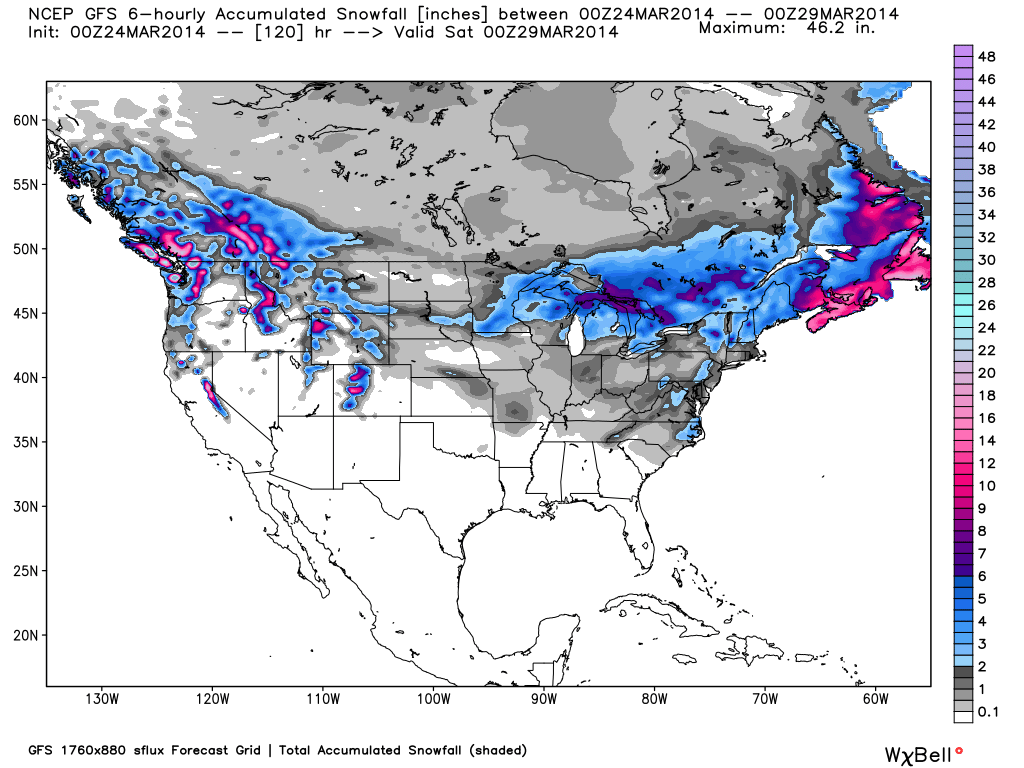
Total accumulated snowfall, according to the American GFS, through Friday night. Source: WeatherBell.com
After one more day of warm spring weather, winter will return full steam ahead across much of the western United States. Lake Tahoe will see steady snowfall Tuesday afternoon through Thursday morning with moderate to heavy accumulations. 6-12 inches on the East side with 1-2 feet on the West side seems to be the general concensus at this point. After a break on Thursday, another system will likely move into the region on Friday with BIG totals possible. Brian will have the latest details every morning in The Tahoe Daily Snow. The Northwest will also experience fresh powder this week as a series of systems move through the region. Wednesday and Thursday will provide the best conditions with lower snow levels the farther north you go. Larry will break down the latest details in The Northwest Daily Snow.
Utah and Colorado will break away from the spring weather as well this week as decent totals take aim at the two states. Utah will begin to see snow develop on Wednesday morning while Colorado will begin to see snow on Wednesday afternoon. Utah will experience a break in the action on Wednesday night before another round of snow moves in Thursday morning. Two day totals will likely range from 6-12 inches through Thursday for Utah with Thursday aiming to be the best ski day of the week. Evan has the details in The Utah Daily Snow. Colorado will likely accumulate double digit totals through Friday morning with Thursday being the best day to hit the slopes. Sunny skies will then set in on Friday with great conditions in place across the state. Joel will break down the latest details in The Colorado Daily Snow.
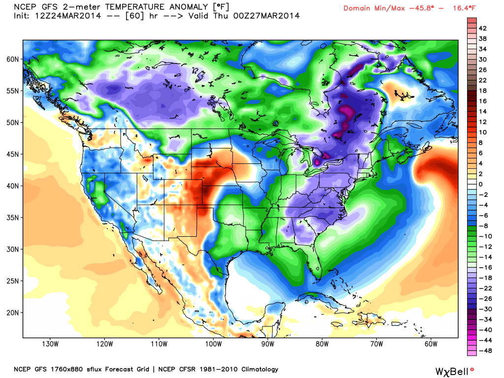
Temperature anomaly, or the departure from the long-term average, on Wednesday evening. Source: WeatherBell.com
The Upper Midwest and Northeast will also experience mid-winter like weather this week as below-average temperatures and decent accumulations move into both regions. A very deep system will move across the Upper Midwest on Wednesday with decent moisture and energy. Most areas will likely see 2-4 inches with higher totals the further north you go. The northern areas of Wisconsion, Minnesota, and Michigan will be the most likely winners come Thursday morning. Cold temperatures will also accompany this system so don't be shocked when it feels more like January when you step outside on Wednesday and Thursday. Click over to The Upper Midwest Daily Snow for the latest details. A significant coastal storm will push into the Northeast on Tuesday with the major resorts of New England likely missing out on any monster totals. It will be very cold throughout the week with temperatures well below-average for this time of year. There will be a sharp difference in where the heaviest snow will fall as a slight change in the storm track will cause significant difference in snow intensity. If the storm tracks further West many areas will see significant totals but as of right now, the storm is forecasted to track too far off the coast for any of the major resorts to receive big powder totals. As always, turn to Brian in The New England Daily Snow for the details.
When you're up on the hill this week post pictures and updates using "LiveSnow", one of the features of our FREE iPhone and Android app.
Always check our Powder Finder and the forecasts for each mountain throughout the week for more details.
Sam Collentine | OpenSnow
> Checkout Liftopia for Discount Lift Tickets
About The Author
Sam Collentine
Meteorologist
Sam Collentine is the Chief Operating Officer of OpenSnow and lives in Basalt, Colorado. Before joining OpenSnow, he studied Atmospheric Science at the University of Colorado, spent time at Channel 7 News in Denver, and at the National Weather Service in Boulder.
Free OpenSnow App


