News

By Sam Collentine, Meteorologist Posted 10 years ago December 26, 2013
Weather for the weekend - Dec 27 to Dec 29, 2013
For this weekend, the northern Rockies will see light to moderate snow behind a blast of Arctic air, while the Upper Midwest and New England regions continue their December pattern of snow. This pattern has stayed relatively consistent through the month of December and is likely to continue into 2014. With that in mind, here's a quick look at the United States snow depth and coverage.

Source: National Operational Hydrologic Remote Sensing Center.
Not bad considering it is only the first official week of winter. Now back to the weather. For Friday, a quick moving area of storminess will pass through the Pacific Northwest bringing significant snow totals to British Columbia, while more moderate snow accumulations take place across the northern Cascades of Washington. This system will then begin to make it's push into the northern Rockies late Friday into Saturday. Even though it will be relatively moisture starved, it will be accompanied by a blast of Arctic air. This will allow for light to moderate snow accumulations along the Idaho panhandle and into western Montana.
Northern Colorado will then see it's chances for snow beginning Saturday night. This pattern looks to stay through the New Years holiday but totals will be on the lighter side due to the lack of moisture accompanying it. Joel will have the latest details in The Colorado Daily Snow.
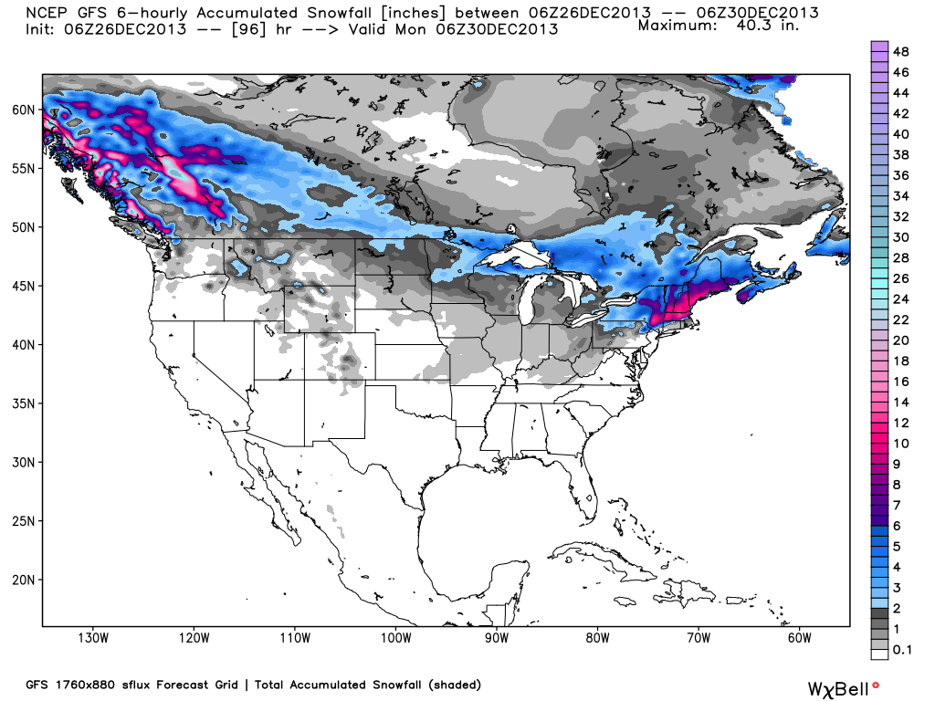
Total accumulated snowfall, according to the American GFS, through Sunday. Source: WeatherBell.com
As for the Upper Midwest and New England, snow will move through late Saturday night into Sunday. Accumulations won't be significant but lake effect snow could bring locally higher amounts to the shores of Lake Superior and Erie. This pattern of snow and cold is shown to continue well into 2014. Grab the latest details in The Upper Midwest Daily Snow and in The New England Daily Snow.
In regards to the Lake Tahoe region, it seems they will be relatively quiet through the first week of 2014 but there may be light at the end of the tunnel. If the long term outlooks hold true, snow could be headed back to the Lake Tahoe region during the second week of 2014. Always stay up-to-date on the latest details for the Lake Tahoe region with Snow Forecaster Bryan Allegretto in The Tahoe Daily Snow.
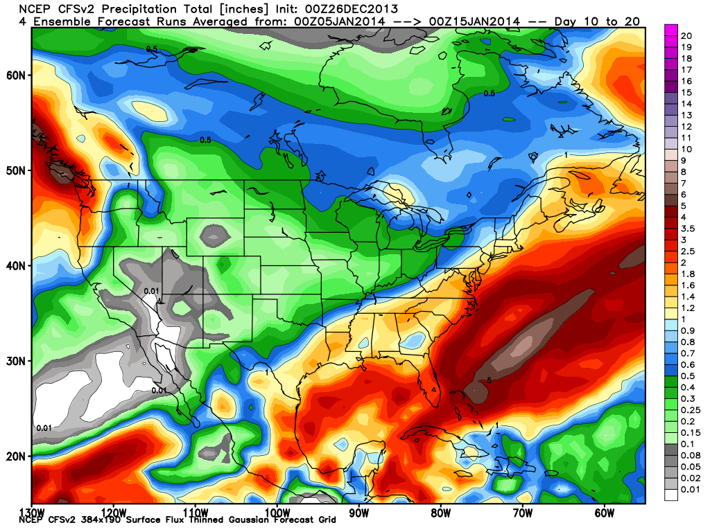
CFSv2 precipitation ensemble forecast. January 5 through January 15, 2014. Source: WeatherBell.com
When your up on the hill this weekend consider posting pictures and updates using "LiveSnow", one of the features of our new iPhone app. If your haven't already, download it here.
Check our Powder Finder, forecasts for each mountain, and our Daily Snow posts throughout the weekend for more details!
SAM COLLENTINE
About The Author
Sam Collentine
Meteorologist
Sam Collentine is the Chief Operating Officer of OpenSnow and lives in Basalt, Colorado. Before joining OpenSnow, he studied Atmospheric Science at the University of Colorado, spent time at Channel 7 News in Denver, and at the National Weather Service in Boulder.
Free OpenSnow App


