News

By Sam Collentine, Meteorologist Posted 10 years ago January 16, 2014
Weather for the weekend - Jan 17 to Jan 19, 2014
The dominating weather pattern this weekend will be a high amplitude ridge over the West while a series of weak storm systems move through the Upper Midwest and Northeast. This weekend's outlook provides a completely different story compared to last weekend where the West was inundated with deep powder. As the high pressure ridge parks itself over the West, it will allow for a series of Alberta clippers to dive down out of Canada creating an active pattern for the eastern half of the United States.
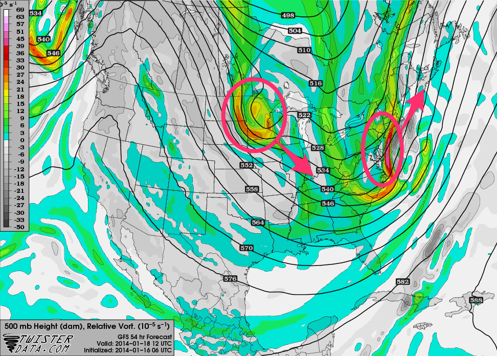
This 500mb vorticity map, as modeled by the American GFS, shows a series of systems pushing into the eastern US over the course of the weekend. Source: TwisterData.com, analysis by OpenSnow.
In regards to the West, there really isn't many details to discuss for the weekend ahead. Bluebird days and clear nights are to be expected with temperatures near average. Valley inversions will once again begin to set in for many parts of Utah and Colorado. This weekend provides the perfect opportunity to remind yourself and your friends to apply sunscreen before heading up onto the mountain. The albedo, or reflection, of snow is very high and a sunburn can set in quickly under this weekend's weather conditions. Unless your aiming for a goggle tan, apply a quick shot of sunscreen to the neck and face before heading out. As always, Brian, Evan, and Joel will have the latest details for the West in the Tahoe, Utah, and Colorado Daily Snow.
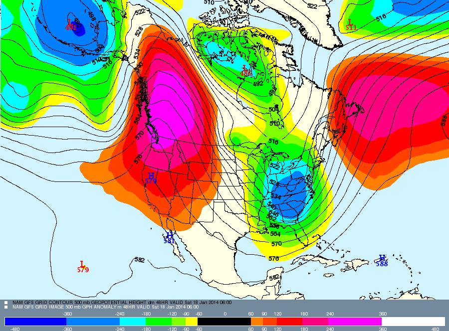
The weather forecast for Saturday, January 18th. The ridge (warm colors) over the West will provide dry conditions while the trough over the East provides a much more active weather pattern. Source: Meteostar
Moving east, the Upper Midwest will see a series of Alberta clippers dive southeast out of Canada. These systems are looking to stay further north primary effecting northern Wisconsin and Minnesota. Alberta clippers are moisture limited and fast moving systems so snow accumulations will be on the lighter side. They do pack a punch of strong winds so expect difficult driving conditions during each system passage. According to our Upper Midwest Meteorologist Andrew Murray, most areas could see total accumulations from all of these clippers hitting the 6-8” range bringing one week totals over the foot mark. Grab the latest details in the Upper Midwest Daily Snow.
As for the Northeast, the series of systems to effect the Upper Midwest will also make their way through New England. As I mentioned above, these types of systems typically bring light snowfall due to the lack of moisture and due to their quick moving nature. However, according to our Northeast Meteorologist Brian Clark, the shear number of them could create decent snowfall for some parts of the region. This is especially true for the more highly elevated resorts of New Hampshire and Vermont. Check out the New England Daily Snow for the latest details.
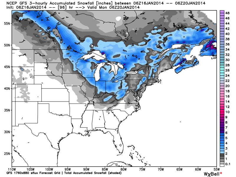
Total snow accumulation, according to the American GFS, through Sunday night. Source: WeatherBell.com
Last but not least, the Mid-Atlantic region will also see a shot for light snow accumulation throughout the weekend. Depending on the exact track that the series of clippers decides to take, accumulations could be decent by the weekend's end. The region of northwestern West Virginia and southern Pennsylvania is forecasted to have the best accumulations. Justin Berk will have the latest details in the Mid-Atlantic Daily Snow.
When you're up on the hill this weekend post pictures and updates using "LiveSnow", one of the features of our new iPhone app. If your haven't already, download it here. Android coming soon!
Always check our Powder Finder and the forecasts for each mountain throughout the weekend for more details.
Sam Collentine | OpenSnow
About The Author
Sam Collentine
Meteorologist
Sam Collentine is the Chief Operating Officer of OpenSnow and lives in Basalt, Colorado. Before joining OpenSnow, he studied Atmospheric Science at the University of Colorado, spent time at Channel 7 News in Denver, and at the National Weather Service in Boulder.
Free OpenSnow App


