News

By Sam Collentine, Meteorologist Posted 10 years ago January 30, 2014
Weather for the weekend - Jan 31 to Feb 2, 2014
This weekend will reign in a new month and also a complelety different weather pattern from what we saw for the majority of January. A broad low-pressure trough will slowly push east across the central United States keeping the West in a cool, active pattern. The moist winter storm that brought copious amounts of snow to the West will push east ushing in another storm off of the southern California coast favoring the Southwest. Saturday and into Sunday will also bring a quick hitting storm to the upper reaches of New England favoring northern New York and Vermont.
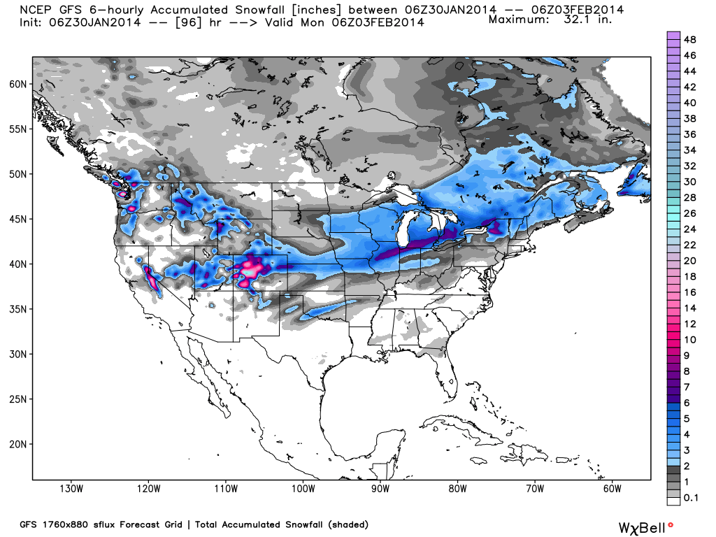
Total accumulated snowfall, according to the American GFS, through Sunday night. Source: WeatherBell.com
We will begin in the West where a monster winter storm will continue to refill tracked powder lines well into Friday and Saturday. An atmospheric river of moisture, originating from Hawaii, will continue to push in off the Pacfic ushering in unseasonably high amounts of moisture into Colorado. While the northern and central mountains were favored on Thursday, Friday will bring heavy snow to the southern mountains. Another wave of energy will bring light to moderate snow back to the northern mountains on Friday and into Saturday. Friday will be the best powder day for the northern and central mountains of Colorado while Saturday looks to the best powder day for the southern mountains. To say the least, Colorado will be skiing amazing this weekend so get up to the mountains if you can. Joel will have all the latest details in The Colorado Daily Snow.
The Lake Tahoe region is finally receiving some much needed love with deep powder accumulating all across the region. Friday will look to receive another 1-3 inches bringing the storm totals close to two feet. This is exactly what the doctor ordered in regards to a good accumulating storm. Another system will track down the California coast Saturday and into Sunday which could ignite another round of snow but this will be a close call. Brian will break it all down in The Tahoe Daily Snow.
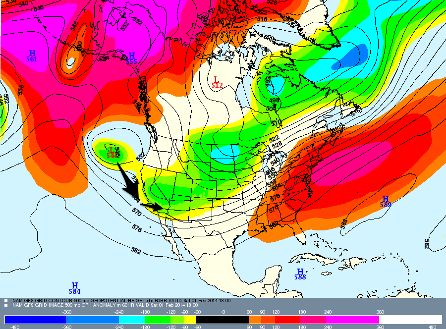
This weekend's weather pattern will keep cool and active weather across the West. Source: Meteostar, analysis by OpenSnow.
Our attention now turns to the Northwest where we welcome our newest Meteorologist Larry Schick. He spent 25 years as a TV Meteorologist in Seattle where he received national awards for his snowsports reporting. Known as The Grand Poobah of Powder, he will focus on all areas of the Pacific Northwest including British Columbia. For this weekend, the Northwest will be primarily dry as the main system tracks to the south. A few quick disturbances could drop a stray snow shower or two but after 5-15 inches falling on Wednesday and Thursday, conditions look to be very nice. Check out The Northwest Daily Snow for the latest details.
As for Utah, this weekend will consist of a few quick hitting systems that will leave light snow accumulations. With 10-20 inches falling on Wedneday and Thursday, this weekend will feature some great skiing. Evan will deal out all the details in The Utah Daily Snow.
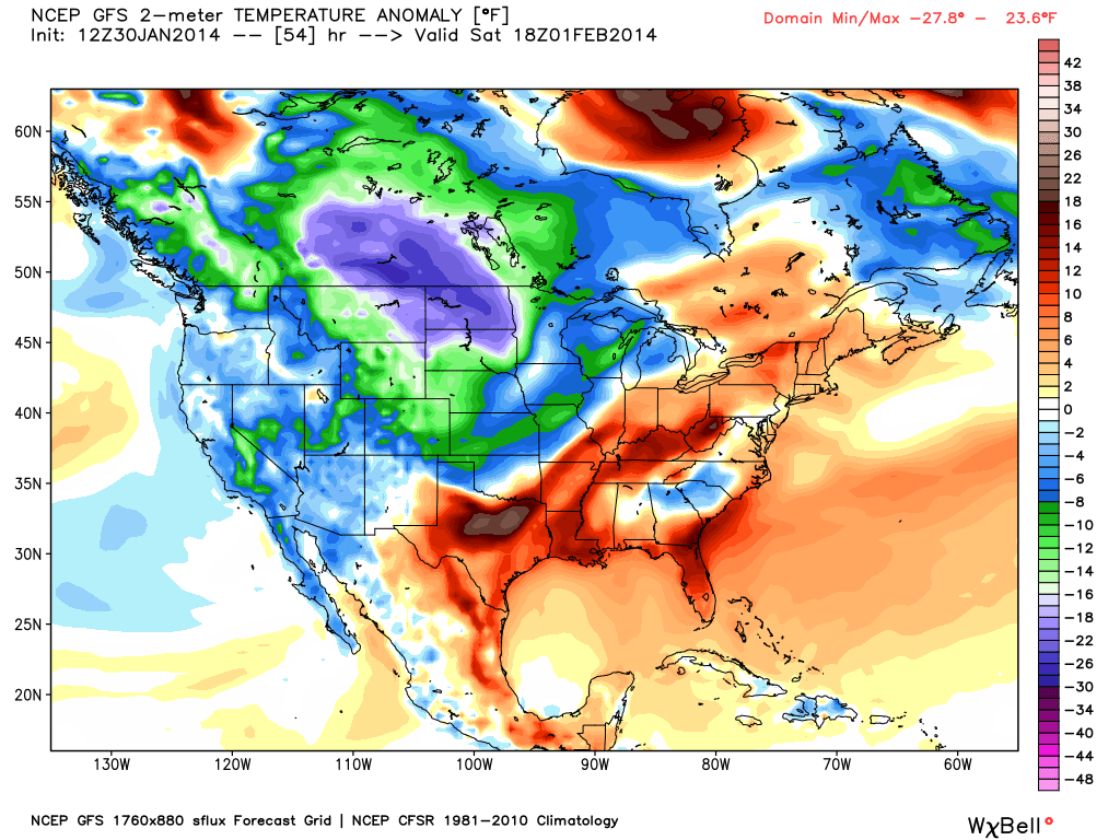
Temperature anomaly, or departure from the long-term average, as of Saturday afternoon. Source: WeatherBell.com
Looking into the Northeast, a system will move through the region Saturday night and into Sunday bringing snow to the northern reaches of New England. Our Northeast Meteorologist is calling for 3-6 inches to fall in northern Vermont and in the northern Adirondaks mountains. The White Mountains of New Hampshire and western Maine will also see snow accumulations but in the range of 1-4 inches depending on how far south the rain can turn over into snow. Click over to The New England Daily Snow for the latest details.
The Upper Midwest will be calm with temperatures warming up into the teens. This is a big improvement from the sub-zero temperatures that they have been seeing all week. Andrew Murray will have all the details in The Upper Midwest Daily Snow.
Super Bowl Forecast
After a lot of flip-flopping throughout the week, the game looks to be dry with temperatures in the 30's. It should be a great game nonetheless!
When you're up on the hill this weekend post pictures and updates using "LiveSnow", one of the features of our FREE iPhone and Android app.
Always check our Powder Finder and the forecasts for each mountain throughout the weekend for more details.
Sam Collentine | OpenSnow
About The Author
Sam Collentine
Meteorologist
Sam Collentine is the Chief Operating Officer of OpenSnow and lives in Basalt, Colorado. Before joining OpenSnow, he studied Atmospheric Science at the University of Colorado, spent time at Channel 7 News in Denver, and at the National Weather Service in Boulder.
Free OpenSnow App


