Colorado Daily Snow

By Joel Gratz, Founding Meteorologist Posted 4 years ago September 9, 2019
Three cool-ish storms, possibly a dusting of high-elevation snow
Summary
Three storms will skim Colorado between September 8-17 and our highest peaks could see a dusting of snow during each event. This is normal for September and has no bearing on the upcoming ski season, but it’s still fun to talk about the chance for snow!
Short Term Forecast
Every day I take a look at our snow forecast overview map here on OpenSnow.
You can see the free 5-day snow forecast map at that link or click on over to the extended 10-day snow forecast map (All-Access only). All maps can show a view of the northern hemisphere, just Asia, just North America, or zoomed to Europe.
The latest 10-day outlook for North America caught my eye as there is now some snow to talk about both in Canada and in the United States.

The 10-day totals above will come from three systems, and all models are in basic agreement concerning the timing of each storm, with slight variations in the strength and amount of cold air.
Storm #1: September 8-9
This system will track to our north and bring showers on Sunday evening into Sunday night.

There might be a few snowflakes on the highest mountains on Sunday night, but the coldest air will arrive after most of the precipitation is over, so it’ll take some luck for a shower to linger until the colder air moves in.
The snow forecast map shows the best chances for light accumulations to the north and west of Colorado.

Monday should be dry and cooler in the wake of the storm.
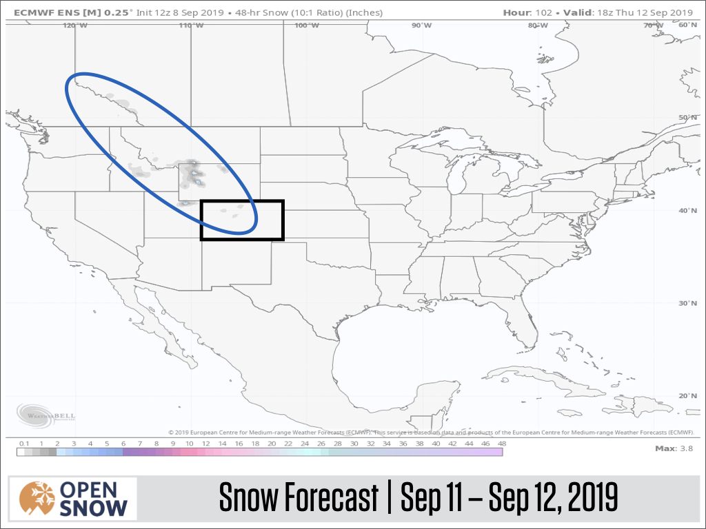
Storm #2: September 11-12
This system has a better shot of bringing a little bit of snow to the higher elevations of Colorado. The track of the storm will be a bit closer to Colorado.

The air might be cold enough for the freezing level to drop below 10,000 feet on Wednesday night and Thursday morning. However, the problem will be the same as Storm #1 – the coldest air will come after most of the precipitation falls on Wednesday afternoon. So the snow forecast is still very light, with the best chance for accumulating flakes farther north in Wyoming.
Extended Forecast
It looks like Storm #3 will arrive around September 17. That’s too far away (about 8-9 days) for much confidence in the track of the system, though most models do keep it to our north yet again.
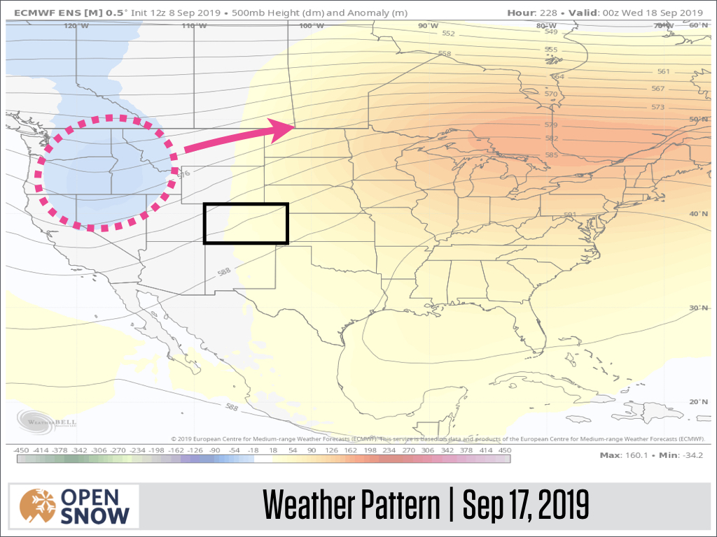
If the track stays to our north, Colorado will likely just get a glancing blow of cooler air and maybe a few high-elevation flakes.
The 15-day temperature forecast for the summit of Copper Mountain shows the cooler air associated with each of the three storms, and then readings trending toward average later in September.

The summary is that we’ll see three storms that will bring cooler temperatures during the next 10 days, but none of the storms will be notable here in Colorado.
Instead, the best chance of a few inches of snow will be to the north of us.
That’s fine. We’ll let the beautiful fall weather continue and hope that the snow and cold air arrive in the second half of October when there’s a chance that the snow could actually stick around and not melt.
Unless the forecast maps show a chance for widespread snow or very cold air, I’ll stick to a weekly update schedule through September.
Thanks for reading!
JOEL GRATZ
About Our Forecaster
Joel Gratz
Founding Meteorologist
Joel Gratz is the Founding Meteorologist of OpenSnow and has lived in Boulder, Colorado since 2003. Before moving to Colorado, he spent his childhood as a (not very fast) ski racer in eastern Pennsylvania.
Free OpenSnow App


