Colorado Daily Snow

By Joel Gratz, Founding Meteorologist Posted 9 years ago March 2, 2015
Heavy snow Monday night through Tuesday
Summary:
- Lull in the snowfall on Monday
- Then very heavy snow and wind Monday night, possible road closures
- Snow continues on Tuesday, winds down by Wednesday morning
- Dry from Thursday through most of next week
- Snow may return starting around March 14/15-ish
Details:
Snow totals have been impressive during the series of storms we've seen over the last five days:
- Taos, NM: 48"
- Wolf Creek, CO: 42"
- Monarch, CO: 33"
- Telluride, CO: 31"
- Silverton, CO: 30"
- Crested Butte, CO: 29"
- Purgatory, CO: 25"
- Snowmass, CO: 25"
- Beaver Creek, CO: 22"
- Vail, CO: 21"
And we're not done yet!
Monday:
There will be a lull in the snowfall for much of the day. There could still be clouds and snow flakes in the air, but the intensity of the snow will be lower than it has been over the past few days. But then...
Monday night:
A cold front will push a band of heavy snow and gusty winds through all of Colorado, hitting the western border around 5pm and pushing through all mountains by midnight. Between 5pm and midnight, look for very heavy snow and wind gusts of 30-50mph. This combination of snow + wind usually means that there will be road closures as visibility drops and snowplows can't keep up with the accumulations, so watch for this. I am forecasting 5-8 inches of snow for most areas on Monday night, but totals for some mountains could be higher as the intensity of this band should be impressive.
On the Monday morning radar image, you can already see the area of heavier snow (and rain) taking shape over western Arizona and extending north into Utah. This area of heavy precipitation will move northeast toward Colorado through the day on Monday.
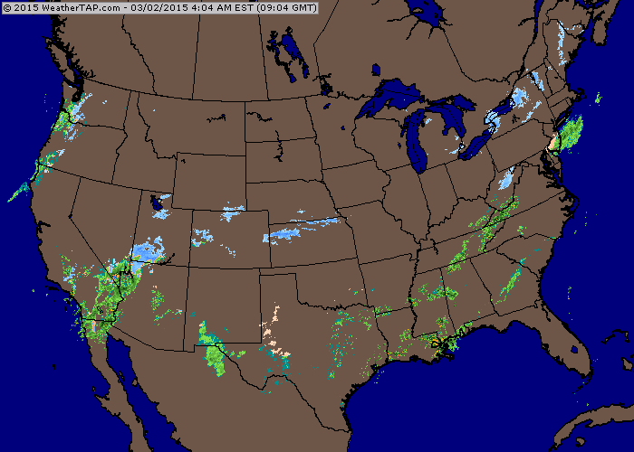
Source: Weathertap.com
The forecast radar for Monday at 7pm shows this band of heavier snow moving through Colorado from west-to-east. It's going to be fun to watch this unfold!
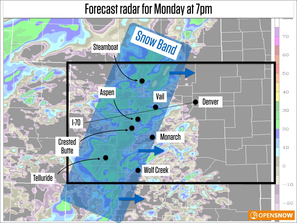
Source: CAIC
Tuesday:
Moderate snow will continue for most mountains as colder temperatures will create fluffier snow than we've seen over the last 48 hours. Winds will blow from the west during most of the day, which usually favors the central mountains around Aspen as well as Steamboat in the north and Telluride in the south. But the wind direction won't be the only predictor of where the heaviest snow will fall. With colder air moving into the state, especially well up into the atmosphere above our heads, the snow will likely take on some showery characteristics through the midday and afternoon hours. This means that there could be cells of intense snowfall followed by brief lulls in the snow, so random chance will also help direct the deepest accumulations. Most areas should see 3-6 additional inches through the day, perhaps more in spots.
Tuesday night into Wednesday morning:
Another cold front should push through northern and central Colorado on Tuesday evening, and this might touch off another burst of heavier snow. Behind this front, winds will blow from the northwest, which is a favorable direction for the I-70 corridor, so watch out in this area for additional accumulations after lifts close on Tuesday. However, in addition to being colder, the air behind the front will also be drier, so I'm not that optimistic for big accumulations on Tuesday night in northern Colorado.
Overall, the best powder days for most of the state will be Tuesday and perhaps first chair on Wednesday morning in northern Colorado.
Wednesday afternoon through most of next week:
It looks like we'll see dry weather for most of this time with warmer temperatures for next week. There could be a weak system or two during the upcoming weekend (March 7-8) which could bring light snow to the northern mountains, but I have low confidence that this will be an impactful storm, if it happens at all.
Our next chance of snow will likely be around or after the weekend of March 14-15. Most models are trending toward a return to stormier weather for the western US beginning around the middle of March, but of course this is two weeks away, so we won't be able to trust the details of the forecast for at least another 5-7 days.
Thanks for reading, and enjoy this snow early this week!
JOEL GRATZ
-----
Geography Key:
Northern Mountains
Steamboat, Granby, Beaver Creek, Vail, Ski Cooper, Copper, Breckenridge, Keystone, Loveland, Abasin, Winter Park, Berthoud Pass, Eldora, Rocky Mountain National Park, Cameron Pass
Along the Divide
Loveland, Abasin, Winter Park, Berthoud Pass
East of the Divide
Eldora, Rocky Mountain National Park, Cameron Pass
Central Mountains
Aspen, Sunlight, Monarch, Crested Butte, Irwin, Powderhorn
Southern Mountains
Telluride, Silverton, Durango, Wolf Creek (Telluride and Silverton are on the northern side of the southern mountains)
About Our Forecaster
Joel Gratz
Founding Meteorologist
Joel Gratz is the Founding Meteorologist of OpenSnow and has lived in Boulder, Colorado since 2003. Before moving to Colorado, he spent his childhood as a (not very fast) ski racer in eastern Pennsylvania.
Free OpenSnow App


