By Luke Stone, Forecaster Posted 4 days ago July 16, 2025
Active, but Not Deep, Pattern Continues
Summary
Some light to moderate snow moved through the central zone on Tuesday, but the webcams didn't look too deep. Two additional storms are expected to bring more precipitation later this week and early next week, favoring the central zone again. The first storm looks warm, and neither looks particularly strong.
Short Term Forecast
The webcams in the central zone showed frequent snow showers on Tuesday, but as of early Wednesday morning, the resorts weren't reporting any new snow. I would estimate that less than 15 cm of snow fell at the Chilean resorts in the central zone during this time.
Wednesday through Friday should be warm and dry in the northern and central zones, as a ridge develops across the area. The southern zone, especially around El Fraile, will likely remain wet during this time and through part of the weekend, as the storm track remains farther south. A warm atmospheric river will bring heavy precipitation, likely in the form of rain, as snow levels climb through Friday morning. In addition to the ample moisture from the atmospheric river, winds are expected to remain strong through Saturday.
This storm is expected to arrive in the central zone on Friday/Friday night, with high snow levels and rain to start. Another storm is expected to move in later in the weekend, accompanied by a cold front that will bring snow levels back down below resort bases. This would present an opportunity for some accumulating snow. At this time, this appears to be another small storm with potential snow totals in the 5-15 cm range.
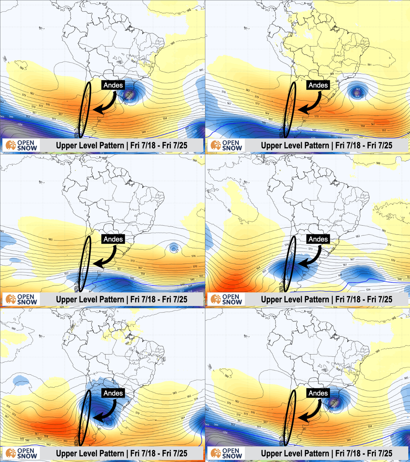
This storm is still more than five days away, however, so we'll have to give the models a few more days before confidence can increase. You can see these two potential storms in the upper-level forecast below. The first one is expected to take a more southerly track, with cold air remaining south of the resorts. The weekend storm, based on the latest guidance, should track farther north with more widespread impacts and colder temps.

Extended Forecast
The long-range models show some signs of hope with another storm possible around July 25th, but that is nearly ten days out, so confidence isn't high at this time. Both the deterministic and ensemble models have a storm in this time frame, though, which is undoubtedly better than the models showing a return to dry weather.
Next post on Friday.
Thanks for reading the South America Daily Snow!
Luke Stone
Forecaster, OpenSnow
Announcements

NEW: Forecast Range Graphs

You can now view individual forecasts from global and regional high-resolution weather models in OpenSnow. This includes forecasts from the GFS, ECMWF, HRRR, and ICON models, as well as the OpenSnow blend.
The graphs give you a behind-the-scenes look at the forecast and make it easier to see if the forecast models are in tight agreement or if there is a wide range of potential outcomes over the next 10 days.
Note: This is currently only available in the OpenSnow iOS app and website (OpenSnow.com). Android will be available soon.
Getting Started
- Go to any location screen.
- Scroll down under "Weather" or "Snow Summary".
- Tap "View Interactive Chart" in the app.
- Adjust the model, timeframe, or data view.

Why is the Forecast Range helpful?
Understand if there is high or low confidence in the forecast. If all models show a similar forecast, there is higher confidence in the forecast, and vice versa.
Dig into the details. If you have experience looking at weather model data and trust certain models or higher-resolution models, you'll be able to isolate your favorite data.
View → Forecast Range Graphs