Tahoe Daily Snow

By Bryan Allegretto, Forecaster Posted 9 years ago November 28, 2014
Snowy Weekend
Summary:
Today we will have breezy conditions and mild temperatures as a storm approaches for the weekend. Starting tonight and through the weekend we expect periods of rain and snow. Snow levels will fluctuate throughout the weekend between 6000-7000 feet. By Monday morning total snowfall above 7000 ft. could be 6-12 inches, with 12-18 inches West of the basin along the Sierra Crest. We should see a break on Monday as a stronger storm approaches the coast. Tuesday through Thursday we should see more rain and snow with snow levels around 7000 feet. We could pick up 1-2+ feet from this system on the mountains.
Details:
Not too many changes to the forecast from yesterday. On radar you can see the band of precip already pushing into the NW corner of CA. That band will spread SE towards the basin arriving tonight. Moisture will stream into Northern CA through the weekend. The first push of steady precip will be later tonight into Saturday and the second on Sunday. Snow levels may dip to lake level with the heaviest precip Saturday and again Sunday, but on average through the weekend they should be closer to 7000 feet.
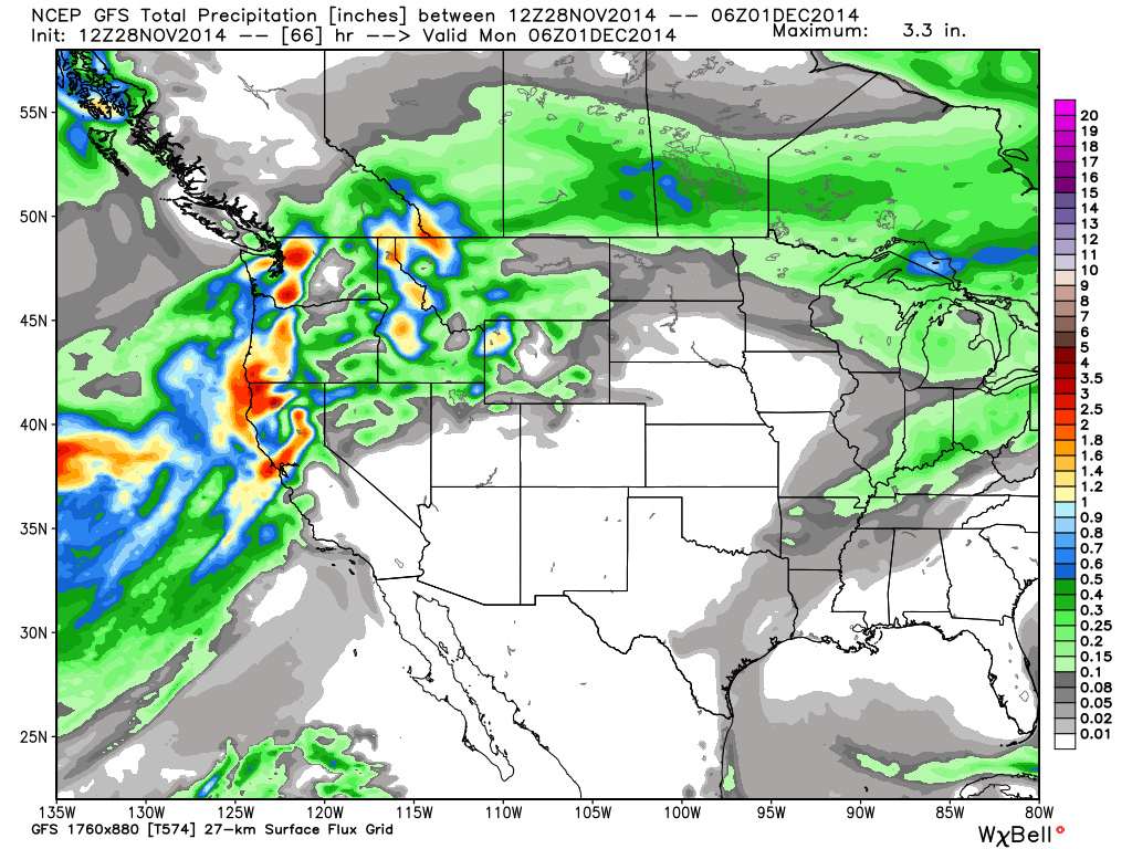
The GFS forecast model has continued to be consistent with limiting the amount of precip that pushes into the Tahoe basin over the weekend. It keeps the precip light and only brings 3-6 inches of snow to the mountains.
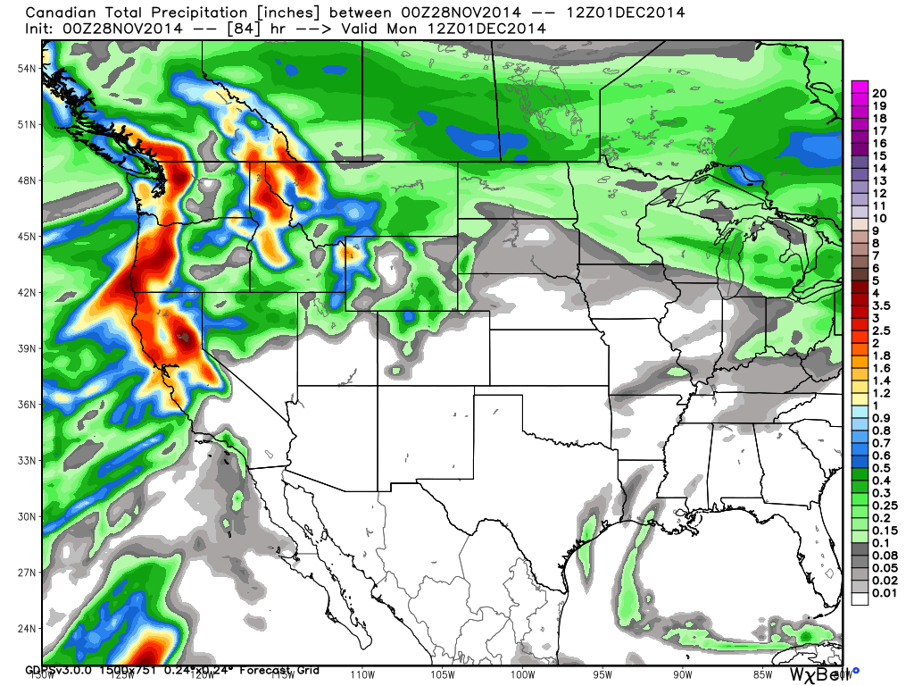
The European and Canadian models have also been consistent though in bringing more significant amounts of precip into the Tahoe basin over the weekend. They show enough liquid for 12+ inches on the mountains in the basin and 18+ inches West of the basin along the crest.
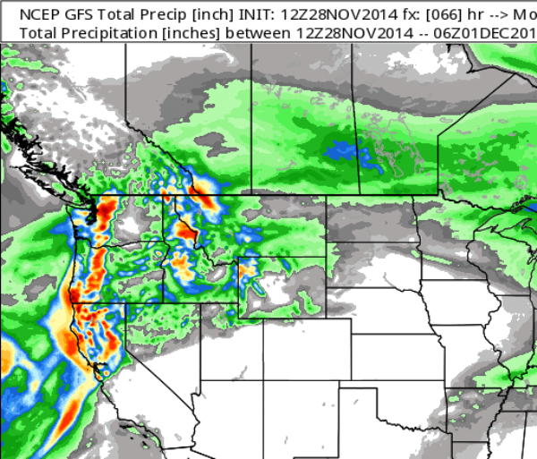
What I am liking this morning is that the new updated GFS shows more than the GFS, although it doesn't push much moisture over the crest into the basin.
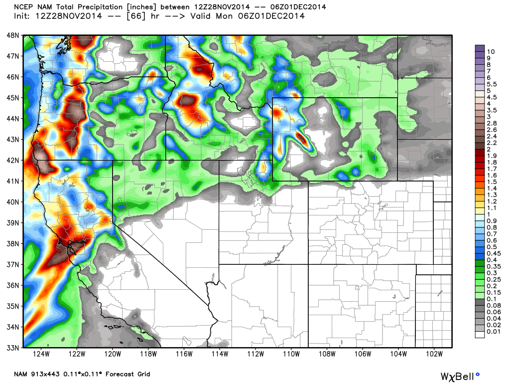
The NAM which was in line with the GFS yesterday now shows a narrow band of moisture streaming in aimed right at the Tahoe basin with a bulls eye West of the basin along the crest.
The HPC (hydrometeorological prediction center) at the NWS looks at all of the models and puts together a total precipitation forecast. It's a may on the NWS site that a lot of you use when posting comments. Here is their forecast this morning for the weekend.
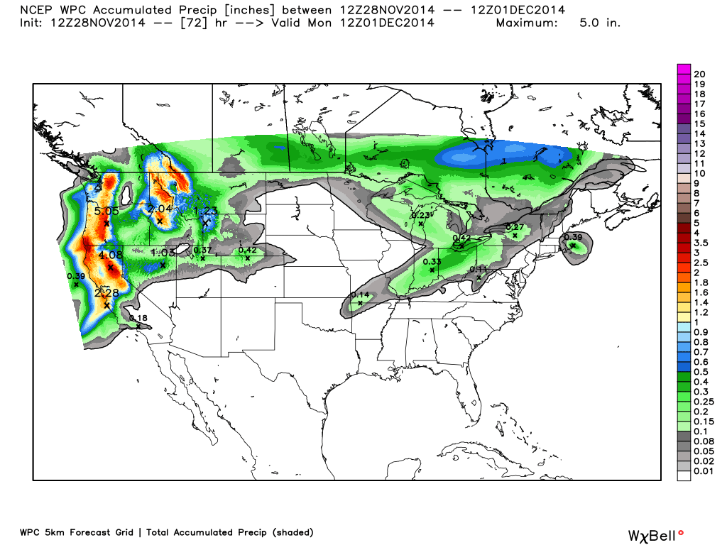
It looks most similar to the Canadian model, which is on the higher end. I am sticking with my forecast through the weekend for 3-6 inches above 7000 ft. Friday night through Saturday, and 6-9 inches West of the basin along the crest. Then the same amounts Saturday night through Sunday before the precip tapers off Sunday night. Totals of 6-12 inches above 7000 ft. in the basin, and 12-18 inches along the crest. Between 6000-7000 ft. it will depend on how low and how long the snow levels drop to various elevations throughout the weekend. We could see anywhere from a coating up to 6 inches depending on location and elevation. During storms please comment your totals, it is helpful for everyone as we can all only be in one spot at time.
By Monday the moisture feed off the Pacific is cutoff as brief ridging builds in ahead of the main low sitting off the coast. The forecast models have come into better agreement this morning with how they handle the low. It looks like by Tuesday afternoon a slug of subtropical moisture could be drawn up from the South ahead of the approaching low. This will bring in some heavier precip. It may also bring up snow levels close to 8000 ft.
By Wednesday area of low pressure off the coast pushes inland continuing a period of heavier precip. Snow levels should drop near 7000 ft. as the low moves in. Some of the models clear us out on Thursday while others keep precip going before we clear out for the weekend. Total precip with this storm could be up to an inch over the basin and 2 inches along the crest. We will most likely see more variation in the forecast as we get closer.
Here is the HPC precip forecast for the next 7 days.
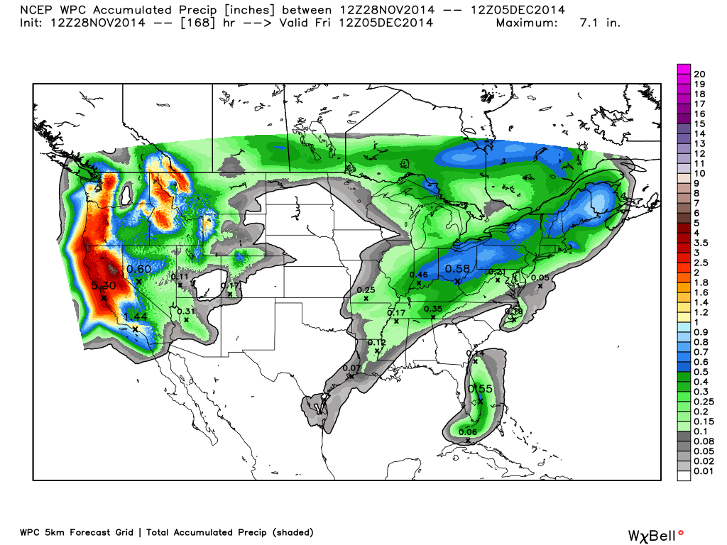
If the current model runs were to hold we could see another foot or more on the mountains above the snow line with the storm mid-week, and up to 2 more feet West of the basin along the crest. The question will be the snow levels. They don't look to be more than 8000 ft. to start and should drop to 7000 ft. for most of the storm on Wednesday, according to the latest model runs.
Not the worst scenario as we could see inversions setup after the storm moves through and high pressure builds back in. That keeps the coldest air in the valleys and at the base of the mountains. So they make snow down low while there is a nice base up top.
Long-Range:
Looking at where the MJO is headed and the PNA forecast through the 12th of December, the forecast models look correct in building a ridge along the West Coast by the end of the week. That may keep us dry for a week or more. The CFSv2 climate model continues to show above average precip for December and the forecast models continue to show a potential pattern shift back to a stormy pattern beyond the 10th.
Stay tuned for updates throughout the weekend. Myself and Powder Chef, my snow reporter, will be posting live updates and pictures througout the storm this weekend on the Facebook page and Twitter. Also, check out the new "Live Snow" link above and on our Apps, where skiers and boarders will be posting live updates from the mountains through the phone app. You should too!
Stay tuned....BA
About Our Forecaster
Bryan Allegretto
Forecaster
Bryan Allegretto has been writing insightful posts about snow storms for over the last 15 years and is known as Tahoe's go-to snow forecaster. BA grew up in south Jersey, surfing, snowboarding, and chasing down the storms creating the epic conditions for both.
Free OpenSnow App


