Tahoe Daily Snow

By Bryan Allegretto, Forecaster Posted 9 years ago February 27, 2015
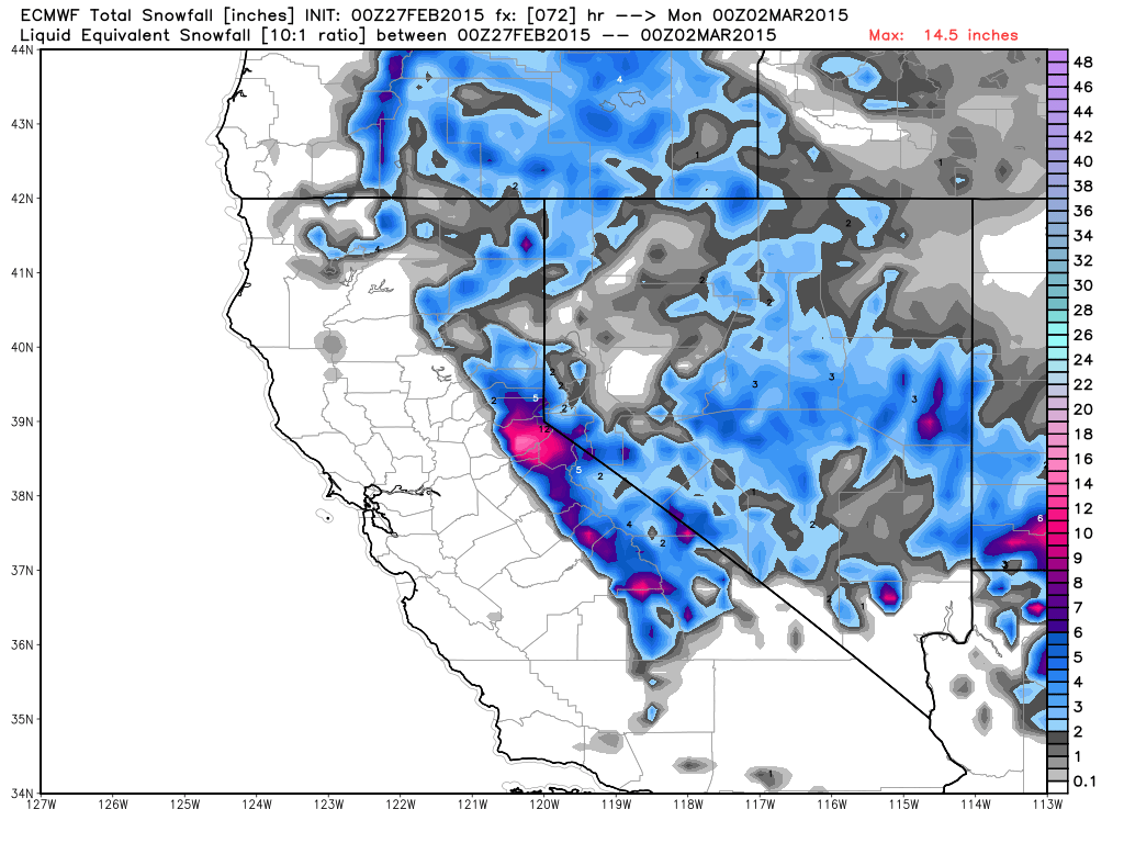
Bullseye...
Summary:
A cold storm is currently dropping down the West Coast into the region. The snow showers will pick up by this afternoon and last through the day on Saturday. Total snowfall of 3-6 inches expected around the lake with 6-12 inches possible on the mountains by Saturday night. Sunday we clear out with cold air in place. Then on Monday another cold system will drop down from the North. That could bring more snow later Monday into Tuesday. We could see anything from a dusting to a few more inches of snow with this storm. Then next Wednesday it looks like high pressure will build in with dry weather for about a week, before the pattern could change with more storms starting around the 10th-12th.
Details:
Clouds have been pushing in all morning and some very light snow showers are starting to pop up on the mountains. The snow showers should increase through the day as the low approaches the area. As the low moves through we should see snow through the day on Saturday before the low moves away Saturday night.
Not much change to the forecast. Sticking with the forecast from the week of 2-5 inches at lake level, 4-8 inches above 7000 feet, and 8-12 inches above 8000 feet around the basin. It looks like the deformation band will sit over the lake for a time tonight into Saturday so we may be on the higher end of the totals if that happens. Still watching for a possible bullseye of heavier snow if a heavier snowband forms and sits over an area. The forecast models are picking up in this still but still vary on where it sits.
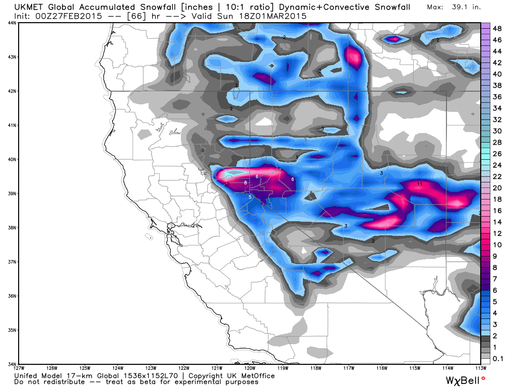
Here is the 0z UKMET snowfall forecast showing a bullseye of heavier snowfall North of the lake.
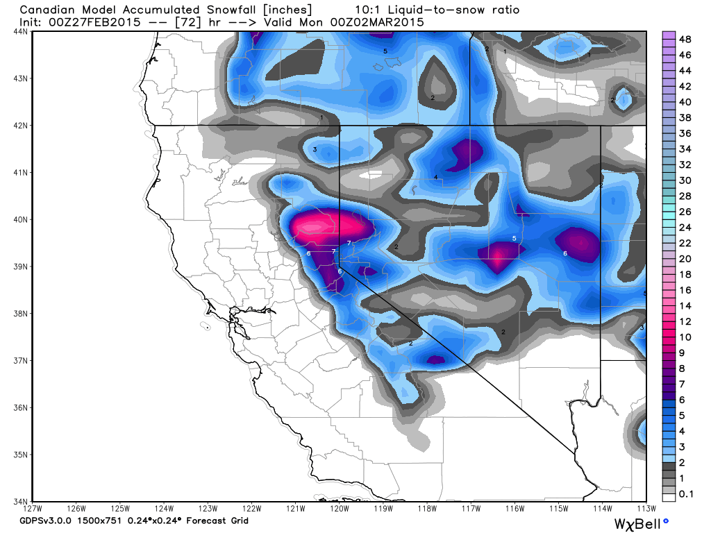
The 0z Canadian shows the bullseye in a similar spot to the North of the area...
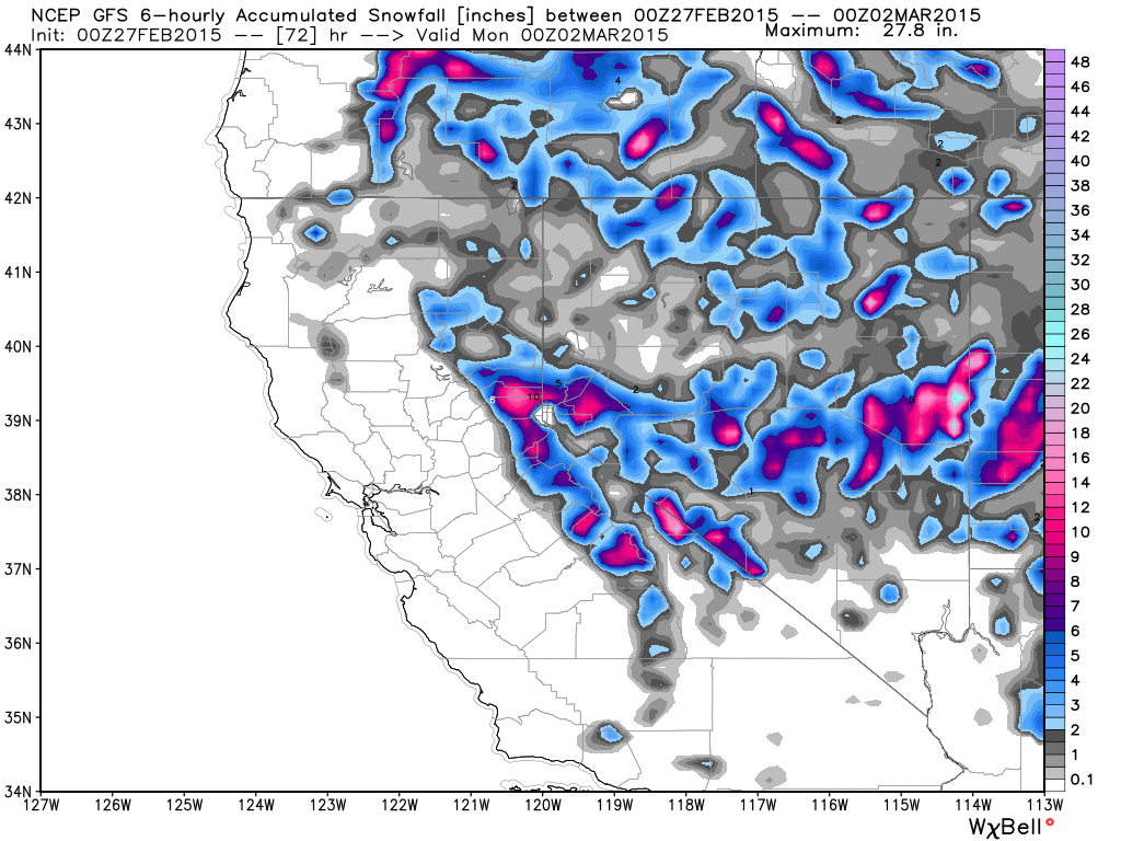
The 0z GFS showed it a bit further South near Donner Summit...
The 6z run has it near Echo summit...
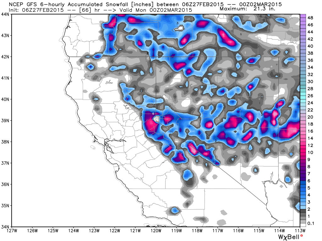
which is similar to what the 0z European is showing...
I don't normally post all of the model snowfall forecasts, but I think it is going to be interesting to see if the resorts in a certain area pick up more than everyone else. So I will be watching the radar over the next 36 hours to see if a heavier band sets up.
Winds will be slightly gusty today out of the Southwest to around 25 mph as the low approaches. They may calm down tonight into Saturday as the low pressure is overhead. Then gust out of the Northeast Saturday night as the low moves Southeast away from the area.
We will have a break on Sunday before the next system dive down from the North on Monday. The models are still not in agreement on the track of the low. The GFS has been trending East of us with a dusting of snow at best. The Canadian and European model runs still bring the low down over the Sierra with several more inches of snow possible on the mountains.
The ridge pushes East over the West Coast by Wednesday as we go into another dry period for 5+ days.
Long-Range:
Low pressure will spin in the East Pacific next week as high pressure sits from the West Coast to the Aleutians, with the low stuck underneath. The models are still showing retrogression of the ridge by the week of the 9th, possibly allowing the low to kick East into the West Coast. The timing is between the 9th-12th. After that we could see a couple of systems as the trough digs along the West Coast.
Stay tuned for storm updates on the Facebook page, and post your own observations during the storm on our Live Snow app. You can see the reports on the Live Snow page.
Stay tuned....BA
PS - We're giving away a ski jacket from the company NWT3K. The cool part is that you can customize the jacket's colors and zipper layout. Click here to enter the contest: http://opensnow.com/contest Ends today!
P.S.S. Backcountry film festival tonight at 7pm at Granlibakken. Tickets are $10 and there will be a fundraiser for the Murnane family after the sudden passing of Kevin Murnane on Tuesday. Kevin was responsible for the operation of Tahoe XC. He left behind a wife and 2 children.
About Our Forecaster
Bryan Allegretto
Forecaster
Bryan Allegretto has been writing insightful posts about snow storms for over the last 15 years and is known as Tahoe's go-to snow forecaster. BA grew up in south Jersey, surfing, snowboarding, and chasing down the storms creating the epic conditions for both.
Free OpenSnow App


