News

By Sam Collentine, Meteorologist Posted 10 years ago February 6, 2014
Weather for the weekend - Feb 7 to Feb 9, 2014
The dominating story this weekend will be an abundance of snow across the Sierra Nevada mountains of Northern California. Through Sunday, many locations across the Lake Tahoe region may be measuring their snow totals not in inches, but in feet. This storm is going to be a blessing for the drought that is currently effecting Northern California. The rest of the West will also see heavy amounts of snow through the weekend as a series of systems control the weather pattern across the West.
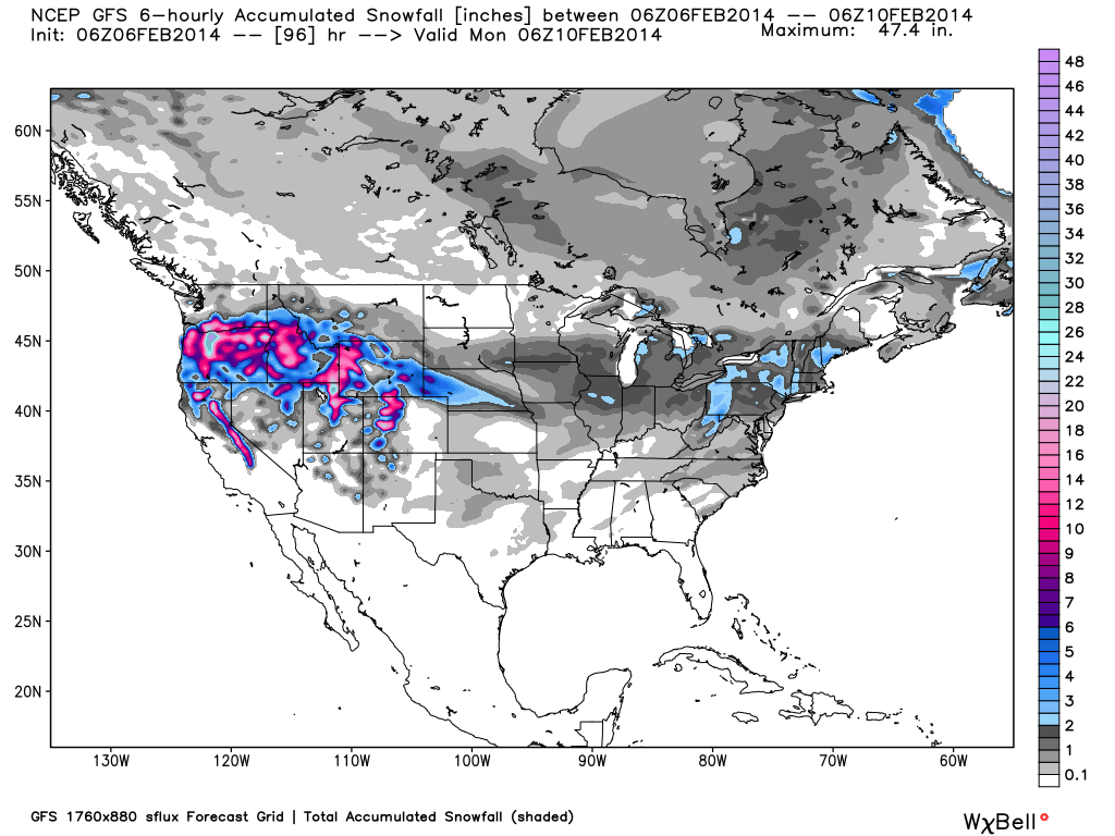
Total accumulated snowfall, according to the American GFS, through Sunday night. Source: WeatherBell.com
Beginning on Friday, an atmospheric river of moisture will move in off the Pacific bringing heavy snow accumulations to the Cascades of Oregon and to the Sierra Nevada of California. The tough aspect of this forecast will be forecasting the elevation in which the rain will turn over into snow. Since this system originates from the tropics, warmer temperatures will accompany it off the coast pushing the areas of rain into higher elevations. Though this will be interesting to observe, upwards of three feet of total snow accumulations will be found through Sunday across the Tahoe Basin and along many locations across the Cascades of Oregon. It will be very dependent on where the jet stream decides to set up so turn to our local forecasters, Brian and Larry, for the latest details in the Tahoe and Northwest Daily Snow.
As for Utah and Colorado, "an impressive event is on tap for this weekend" according to our Utah Snow Forecaster Evan Thayer. Snow will continuously fall throughout the entire weekend with 2-4 feet likely for Utah and 1-2 feet likely for Colorado through Monday. The highest accumulating time period will be Saturday through Sunday as the atmospheric river arrives. Utah and Colorado will also see snow levels rise due to warmer temperatures but all ski areas will be free of rain. Conditions will be great with plenty of deep powder to be found but use heavy caution if you are headed into the backcountry. The Utah and Colorado Avalanche Centers provide excellent avalanche forecasts and analysis so grab the latest details before heading out. This will be a great weekend for skiing and snowboarding all across the West so head up to the mountains if you can! Joel and Evan will break it all down throughout the weekend in the Colorado and Utah Daily Snow.
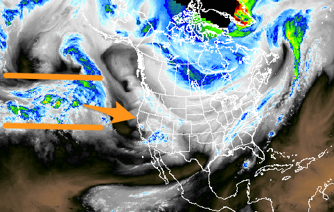
The atmospheric river of moisture, as shown on Thursday morning, moving through the Hawaiian Island's toward the California coast. Source: WeatherTAP.com
The Upper Midwest will stay primarily quiet as the West dominates the storm track. Temperatures are looking to slightly improve with daytime highs getting out of the negatives by Sunday. Andrew will have the details in the Upper Midwest Daily Snow.
After a big week, the Mid-Atlantic and New England look to stay primarily quiet with the exception of a slight chance of snow for Western Pennsylvania and Upstate New York. Most areas of the Northeast saw anywhere between 8-14 inches of snow on Wednesday so conditions will be great across the entire region. Justin and Brian will have all the details in the Mid-Atlantic and New England Daily Snow.
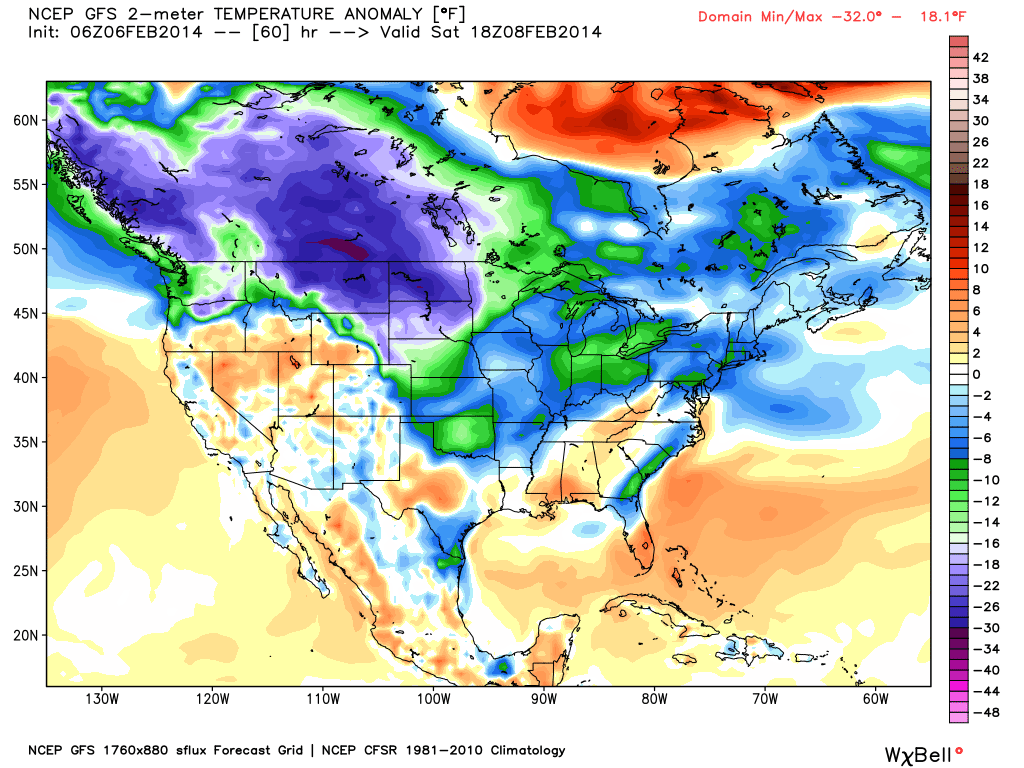
Temperature anomaly, or departure from the long-term average, as of Saturday afternoon. Source: WeatherBell.com
When you're up on the hill this weekend post pictures and updates using "LiveSnow", one of the features of our FREE iPhone and Android app.
Always check our Powder Finder and the forecasts for each mountain throughout the weekend for more details.
Sam Collentine | OpenSnow
About The Author
Sam Collentine
Meteorologist
Sam Collentine is the Chief Operating Officer of OpenSnow and lives in Basalt, Colorado. Before joining OpenSnow, he studied Atmospheric Science at the University of Colorado, spent time at Channel 7 News in Denver, and at the National Weather Service in Boulder.
Free OpenSnow App


