
By Luke Stone, Forecaster Posted 2 days ago July 18, 2025
Storms Stay South Until Later Next Week
Summary
The storm track will remain south of the South American resorts for the most part through the weekend and much of next week. Resorts in the southern zone could see some shower activity but it won’t amount to much. The models are starting to more consistently show a storm around Friday the 25th.
Short Term Forecast
It’s been a rough stretch for the last month across most of the resorts in the Andes. Some resorts on the Argentinian side in the central zone may have to close due to a lack of snow. The resorts in the north had significant snow in early June but haven’t had much since.
The storm track will continue to remain south of the resorts. A weak system may bring some rain and snow showers to the southern zone at El Fraile and La Hoya, but it won’t amount to much. Perhaps a few cm are possible at El Fraile.
Otherwise, warm and dry conditions are expected through the weekend and into much of next week. My attention is on the latter part of the week. The models have been showing a storm approaching on Wednesday with snow moving into the central zone late Thursday or Friday.
It’s pretty early, with the impacts still a week away, but at least there’s some potential here. So far, the models show decent snowfall in the central and northern zones, but I’m not overly confident in the details yet. The models have also been struggling outside of five days this season, so keep that in mind.
I will show the upper-level patterns from the American and European ensembles, which both show a low-pressure system tracking through the central zone later next week.
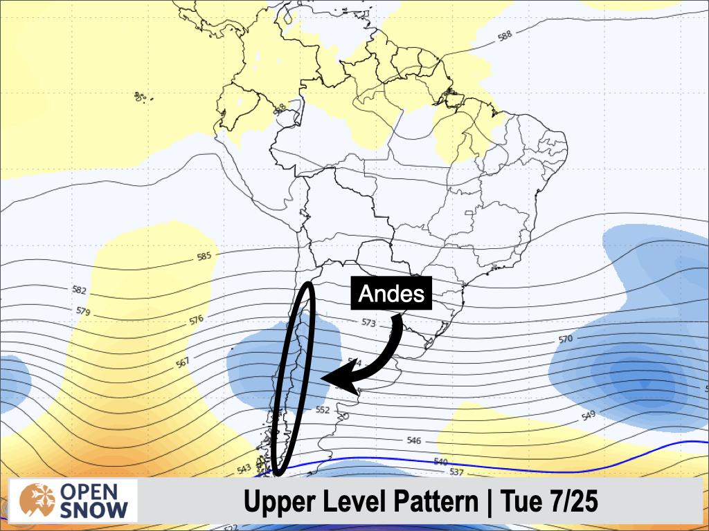
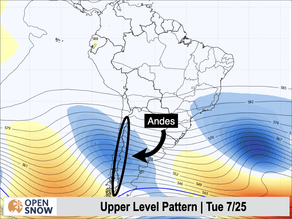
This storm track would be good for the central and northern zones, so let’s hope something close to this ends up happening.
Extended Forecast
The long-range models do keep an active pattern into the following week, which is another good sign. It’s certainly better than a forecast of high pressure in the long range.
Next post on Monday.
Thanks for reading the South America Daily Snow!
Luke Stone
Forecaster, OpenSnow
Announcements

NEW: Forecast Range Graphs

You can now view individual forecasts from global and regional high-resolution weather models in OpenSnow. This includes forecasts from the GFS, ECMWF, HRRR, and ICON models, as well as the OpenSnow blend.
The graphs give you a behind-the-scenes look at the forecast and make it easier to see if the forecast models are in tight agreement or if there is a wide range of potential outcomes over the next 10 days.
Note: This is currently only available in the OpenSnow iOS app and website (OpenSnow.com). Android will be available soon.
Getting Started
- Go to any location screen.
- Scroll down under "Weather" or "Snow Summary".
- Tap "View Interactive Chart" in the app.
- Adjust the model, timeframe, or data view.

Why is the Forecast Range helpful?
Understand if there is high or low confidence in the forecast. If all models show a similar forecast, there is higher confidence in the forecast, and vice versa.
Dig into the details. If you have experience looking at weather model data and trust certain models or higher-resolution models, you'll be able to isolate your favorite data.
View → Forecast Range Graphs