9 hours ago Alan Smith 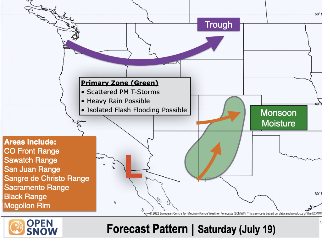
A consistent monsoon pattern will settle in across Colorado, New Mexico, & Eastern Arizona this weekend & next week, while Northern Arizona & Utah will see a trend toward drier air & fewer t-storms heading into next week. A low pressure trough will also track across the Northwest Mon-Tue with showers & t-storms expected, some of which will produce heavy downpours.


