News

By Joel Gratz, Founding Meteorologist Posted 12 years ago January 3, 2013
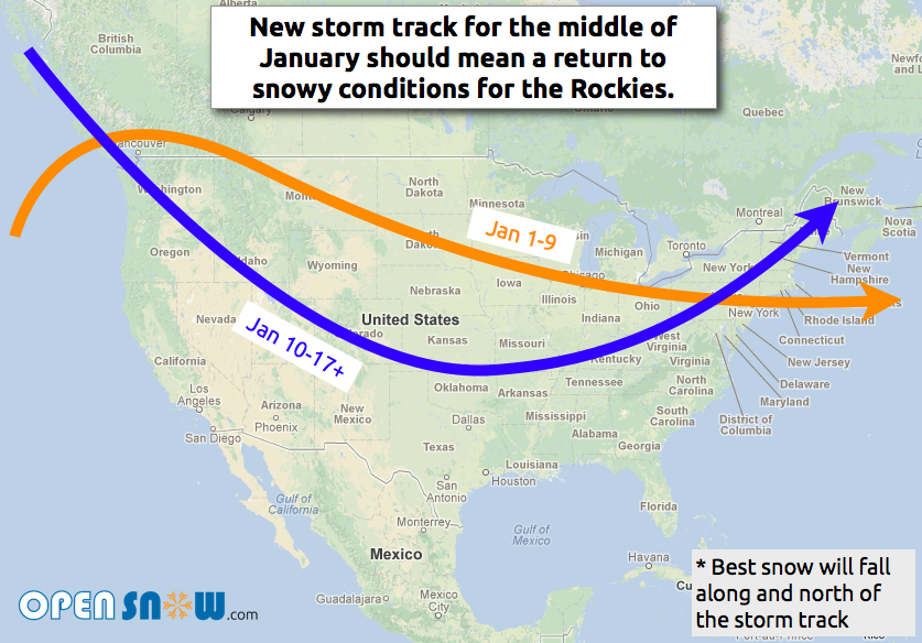
Snowier weather pattern for mid January
Many areas of the country saw excellent snow during December with some Tahoe locations seeing over 10 feet during the month and Steamboat, CO adding over 100 inches to their snowfall log. The new year is starting on the dry side with very little fresh powder falling across the country, but that's going to change as we head into the middle of January.

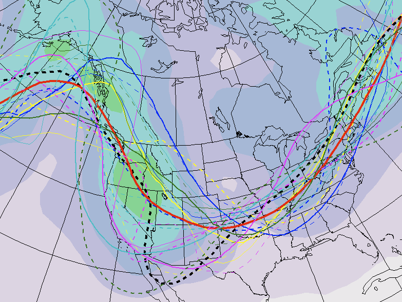
As a quick behind-the-scenes, here's the 11-day forecast from the Canadian model which shows the storm track on January 14th. The various lines show potential storm tracks, and the red line is the average of all these possibilities. While this is still a long range forecast and it's likely not 100% correct, it's still a good indication that things will be getting snowier by the middle of the month.

Hallelujah for more snow! Check the forecast for your favorite locations across the country.
JOEL GRATZ
About The Author


