News

By Joel Gratz, Founding Meteorologist Posted 10 years ago October 6, 2014
SCIENCE: Typhoons and Snow storms
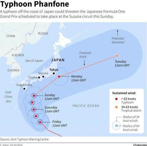
Typhoon Phanfone moved near Japan over the weekend and is now on its way into the north Pacific Ocean. Source: Reuters
The forecast for a potential snow storm next weekend in the US and Canada depends upon the strength and track of Typhoon Phanfone. This Typhoon is currently near Japan, and just as a bit of background, a Typhoon is the same as a hurricane yet has a different name because it is located in a different part of the world.
Forecasting the strength and position of this Typhoon holds the key to the exact track of the cold air and snow which could hit North American in about a week. Both the Canaidan and the European weather models show the Typhoon tracking into the north Pacific Ocean this week, and the models forecast that the storm will stay strong enough to power past another storm in the north Pacific and force its way into the western US by next Sunday/Monday.
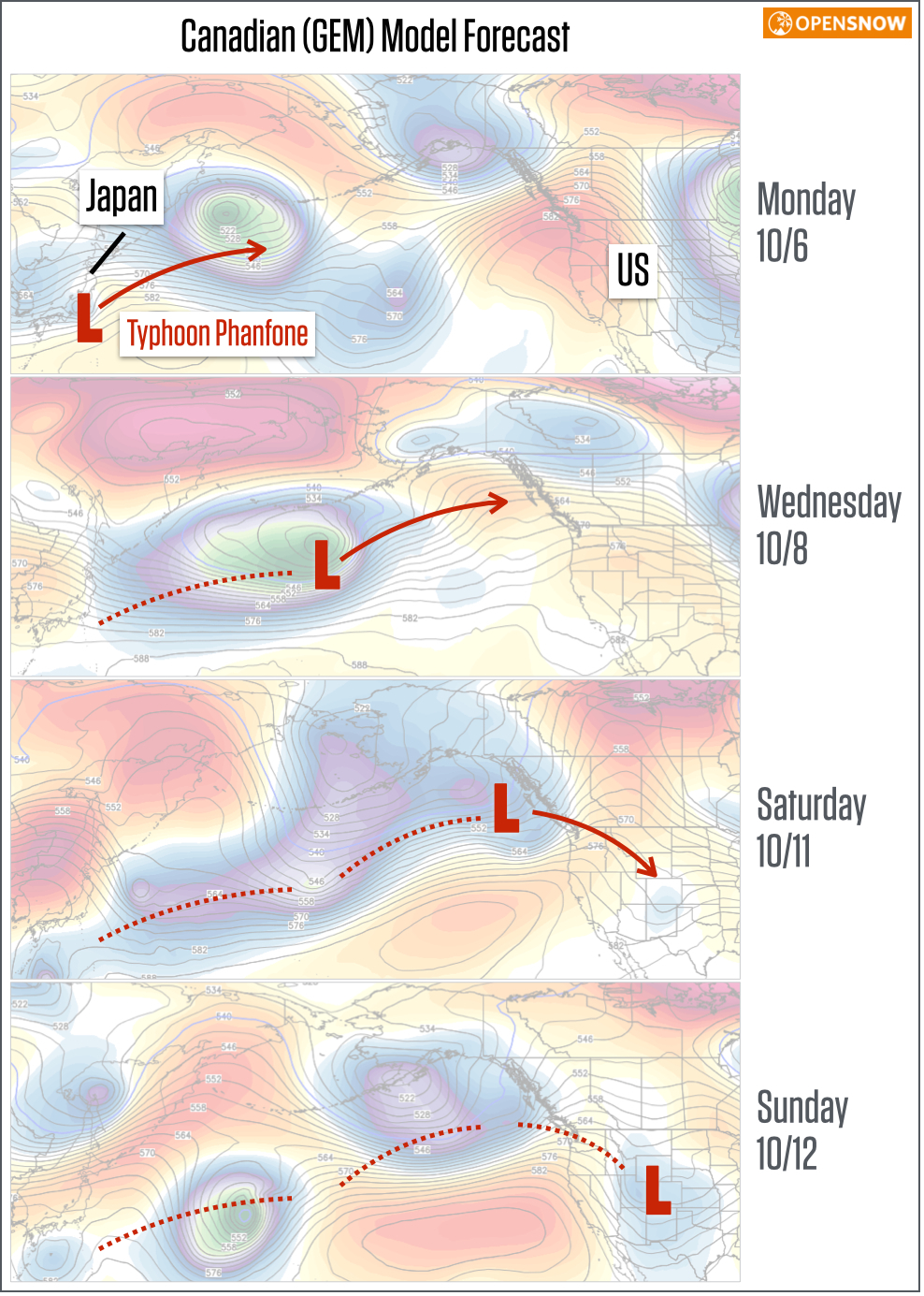
Canadian model forecast for Typhoon Phanfone over the next week. This model's forecast is similar to the European model and shows a snowstorm for the Rocky Mountains next Sunday and Monday. Source: Weatherbell.com
On the other hand, the American GFS model shows the Typhoon weakening so much as it cross the Pacific Ocean that it gets caught up with another north Pacific storm. The result is a much weaker storm that moves through northern Canada late next weekend.
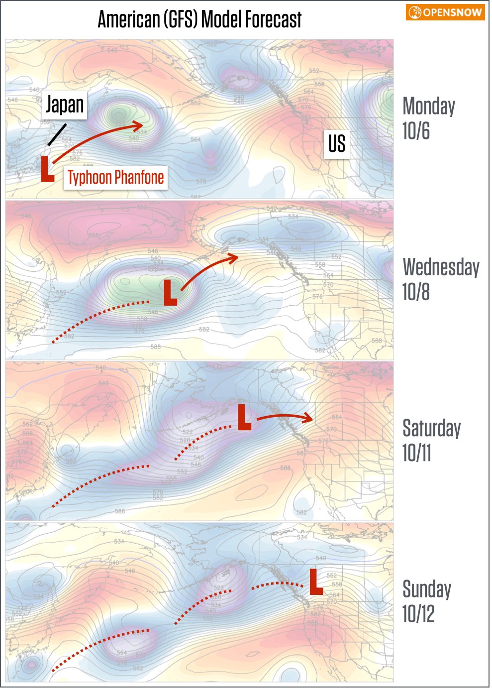
American model forecast for Typhoon Phanfone over the next week. This model's forecast is much different than the European and Canadian model and does NOT show a snowstorm for the Rocky Mountains next Sunday and Monday. Source: Weatherbell.com
It's incredible that making an accurate prediction of a typhoon's strength 5,000 miles to the west is the key to figuring out if next Sunday and Monday will be snowy in the northern Rockies, but that's the reality of what the computer weather models deal with every day. The Canadian and European weather models are often more accurate than the American GFS weather model, so my money is on them. This would mean that British Columbia, Alberta, Montana, Wyoming, and Colorado would see at least a few inches of snow around October 12-13th.
JOEL GRATZ
About The Author


