Colorado Daily Snow

By Joel Gratz, Founding Meteorologist Posted 9 years ago August 2, 2014
Summary
We've seen average to above average precipitation across most of Colorado during the month of July, including the heavy rain on the front range during the last week. This weekend should be drier, except for southern Colorado where afternoon showers will persist. Next week, temperatures will continue to be average or below average.
Details
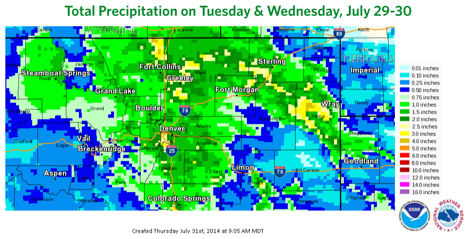
Earlier this week I talked about the potential for heavy rain east of the divide and north of I-70. The forecast generally panned out, with 2-3 inches of rain falling for many locations, and up to 4-6 inches in a few towns that saw heavy showers on Tuesday afternoon. The radar estimated rainfall shows the area of heaviest precipitation.
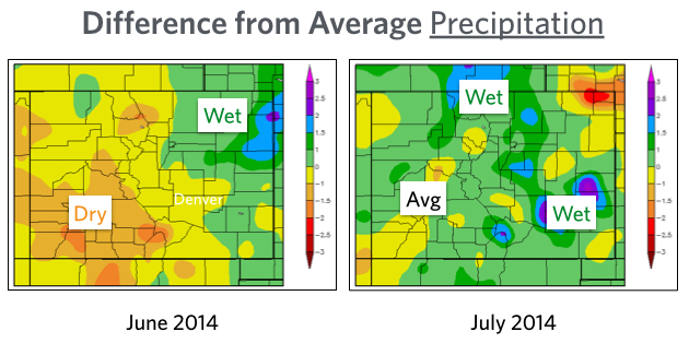
This most recent precipitation helped to ensure that totals for July were above average for most of Colorado, including the mountains. It was great to see the monsoon-induced rainfall during July, because many areas were drier than average during the month of June.
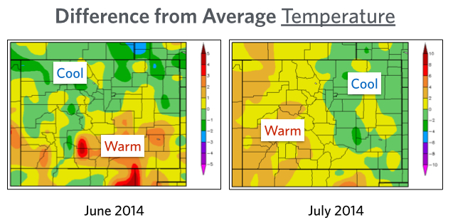
Looking at temperatures over the last two months, there is nothing remarkable to report. Though after the past two very warm summers I suppose what's remarkable about this summer is that it has been close to average. The mountains recorded hotter-than-average readings during parts of July, but overall the state has been right around normal.
To the forecast...
The next few days look great! Most areas will see minimal rainfall this weekend (except for the San Juans), so enjoy your time playing outside! As for temperatures, they should stay around average or cooler than average through the first week of August.
JOEL GRATZ
About Our Forecaster
Joel Gratz
Founding Meteorologist
Joel Gratz is the Founding Meteorologist of OpenSnow and has lived in Boulder, Colorado since 2003. Before moving to Colorado, he spent his childhood as a (not very fast) ski racer in eastern Pennsylvania.
Free OpenSnow App


