Colorado Daily Snow

By Joel Gratz, Founding Meteorologist Posted 9 years ago August 27, 2014
Summary:
Cloudy skies with rain showers will continue on Wednesday, Wednesday night, and Thursday with snow possible over 13,000ft. Friday and Saturday will be sunnier and mostly dry, then the next storm will quickly push a band of rain and thunderstorms through northern Colorado on Sunday afternoon.
Details:
We're still dealing with the storm that is cut-off from the main flow of weather. In fact, the center of the storm isn't yet into Colorado, and this won't happen later today. We started talking about it when it was over Oregon on Monday, and it's moved about 700 miles since then (48 hours), which means it's moving around 15mph. This is roughly half the speed of a "normal" storm that is pushed along by the jet stream.
As of Wednesday morning, the storm is swirling over Utah with waves of energy pushing through Colorado. One of these waves is moving through eastern Colorado (bright blue colors) while another one is just about to push into western Colorado.
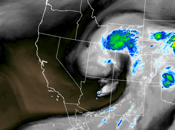
Wednesday morning water vapor satellite image. Source: Weathertap.com
Over the last 24 hours, most locations have seen at least 0.25 inches of rain, with a few spots reporting between 0.50 and 1.00 inch.
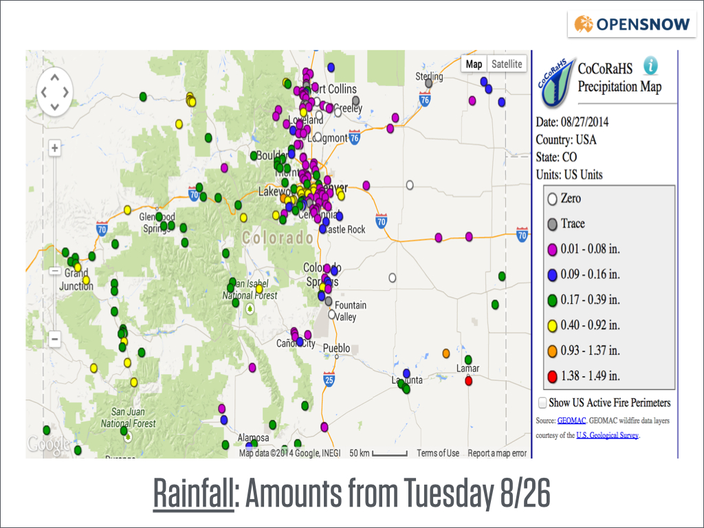
Rainfall amounts from Tuesday AM through Wednesday AM. Source: CoCoRahs.org
More rain will fall today on Wednesday as the next wave of showers and storms enter western Colorado.
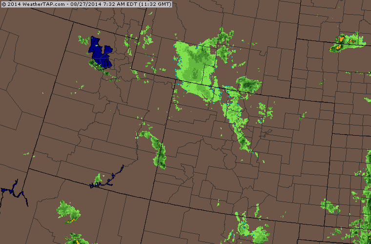
Wednesday morning radar. Source: Weathertap.com
It will take this storm another two days to fully move through Colorado. I grabbed this animated gif (maybe I'll show one everyday this winter; it works for Buzzfeed!) showing the forecast for the storm's moisture and wind starting on Wednesday morning and continuing through Friday morning. Notice how it swirls through Colorado very slowly, then finally moves east of the state by the final image.
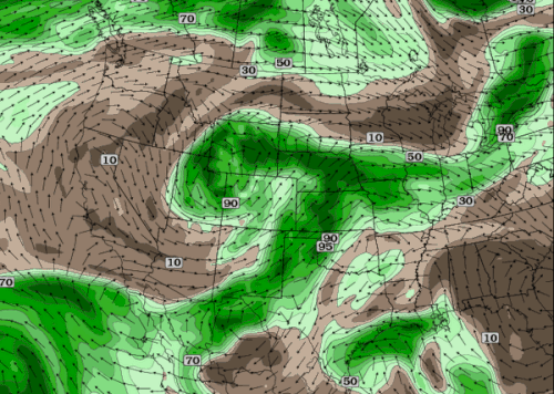
Forecast moisture and winds at around 18,000ft from the American GFS model. Source: Twisterdata.com
While the storm is over our state through Thursday, expect temperatures cool enough to support snow over 13,000ft (the highest mountain peaks go to about 14,000ft while most of the ski resorts top out between 11,000ft-12,000ft). The coldest temperatures I found this morning were in the mid to upper 30s around 12k, so a snow level between 13-14k seems about right.
On Friday and Saturday, the weather will improve with mostly sunny skies to start each day and then a few clouds dotting the peaks by afternoon. I doubt we'll see any significant showers either day, though there could be some drops over the northern mountains.
Then a quick-moving storm will push through Wyoming on Sunday, and it will send energy into northern Colorado as well. Look for gusty winds on Sunday with a line of showers and storms on Sunday afternoon and evening.
Once that precipitation moves out, Monday through Friday of next week should be mostly dry with average temperatures in the mountains and perhaps a bit cooler-than-average temperatures east of the mountains.
The next storm will likely affect us around Saturday September 6th - ish. There could be a tropical system somewhere close to Mexico during this time, and it might send moisture north into Colorado which would set the stage for another day or two of clouds and numerous rain showers during the first full weekend of September.
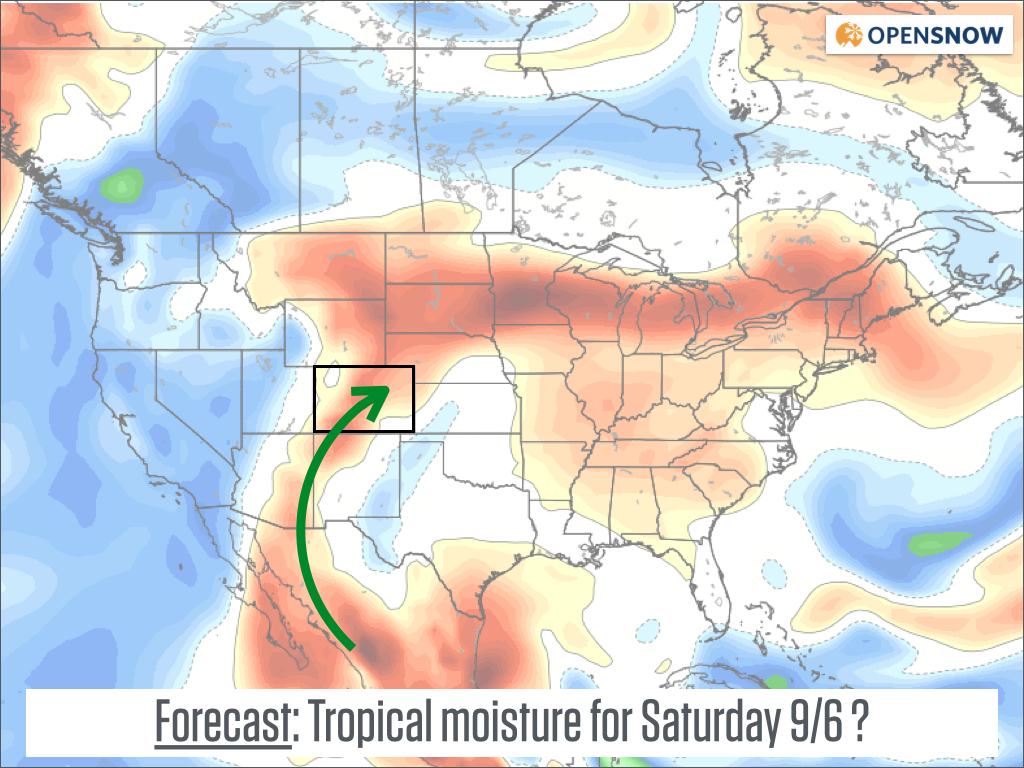
Surface forecast with red showing above average moisture. Source: Weatherbell.com
Enjoy the fall-like cool weather today, and thanks for reading!
JOEL GRATZ
About Our Forecaster
Joel Gratz
Founding Meteorologist
Joel Gratz is the Founding Meteorologist of OpenSnow and has lived in Boulder, Colorado since 2003. Before moving to Colorado, he spent his childhood as a (not very fast) ski racer in eastern Pennsylvania.
Free OpenSnow App


