Colorado Daily Snow

By Joel Gratz, Founding Meteorologist Posted 9 years ago October 26, 2014
Cold front will hit northern Colorado on Sunday night
Summary:
A band of snow will drop 2-4 inches on Sunday night for areas north of I-70 and about 1-3 inches from Aspen to mountains along I-70. Monday will be chilly and cloudy across northern Colorado with a few snow showers, then the rest of the week will be dry and warmer. Our next chance of snow will be with a storm on Sunday/Monday November 2-3.
Details:
While Saturday was a nearly perfect day across Colorado with warm temperatures and sunny skies, conditions will change on Sunday as clouds and winds will increase throughout the day.
Showers will develop late Sunday afternoon, and then a band of snow and rain associated with a cold front will move across the northern half of Colorado (roughly from Aspen north to Wyoming) between about 9pm-6am Sunday night. This band will drop the most snow north of I-70 with 2-4+ inches likely over the the higher elevations near Steamboat and along the northern continental divide. Mountains along I-70 should see about 1-3 inches with less south of Aspen. The snow level will drop rapidly down to about 8,000ft as the snow band moves through, so look for snowpacked mountain passes on Monday morning.
Monday will be a cool day with mostly cloudy skies north of I-70 and I can't rule out a few lingering snow showers. Tuesday will clear out but stay on the chilly side with highs around freezing at 11,000ft. Then Wednesday through Saturday continues the streak of dry weather as temperatures warm up. For snowmaking, Monday and Tuesday will allow crews to crank the guns, then overnight temperatures will return to marginal readings later in the week.
Between Sunday and Friday most of the precipitation across the country will target the northwest with just our quick Sunday night shot for Colorado.
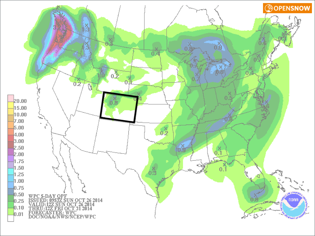
Source: NOAA
However, the weather pattern will change a bit next weekend (during the first few days of November) as a storm should drop further south and bring moderate to significant precipitation to Tahoe. It looks like this storm will then move east and impact Colorado on Sunday November 2nd or Monday November 3rd, but we may see only a glancing blow instead of a direct hit. Stay tuned...
JOEL GRATZ
About Our Forecaster
Joel Gratz
Founding Meteorologist
Joel Gratz is the Founding Meteorologist of OpenSnow and has lived in Boulder, Colorado since 2003. Before moving to Colorado, he spent his childhood as a (not very fast) ski racer in eastern Pennsylvania.
Free OpenSnow App


