Colorado Daily Snow

By Joel Gratz, Founding Meteorologist Posted 9 years ago October 28, 2014
Snowmaking continues
Summary:
- Cool temps for snowmaking continue through Wednesday
- Dry and mostly sunny through Friday
- Next storm gives us only a glancing blow with light snow Sat/Sun/Mon
Details:
Snow showers on Monday produced another 1-2 inches after the Sunday-night snow band moved through, so many mountains along I-70 wound up with about 3 inches of snow from this storm while locations further north like Steamboat received up to 8 inches.
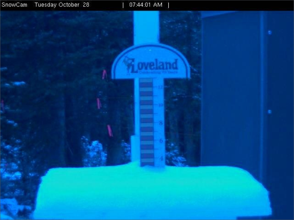
Loveland snowstake as of Tuesday morning. Source: Loveland Ski Area
Tuesday through Friday will be dry and mostly sunny across the entire state. Temperatures will be great for snowmaking on Tuesday morning and again Tuesday night into Wednesday morning, so look for the snow guns to be cranking. Overnight lows on Thursday, Friday, and Saturday night won't be as chilly but I think they will be cool enough to allow for continued snowmaking at higher elevations.
The next storm will bring scattered snow and rain showers to Colorado on Saturday (perhaps a few heavier showers over the San Juans), then there will be another round of showers on Sunday and again on Monday. The brunt of the storm will miss us and track over Utah, Wyoming, and Montana, so we'll be left with a few waves of weaker energy that will likely only produce a few inches of snow (though there could be some upside surprises, we'll see).
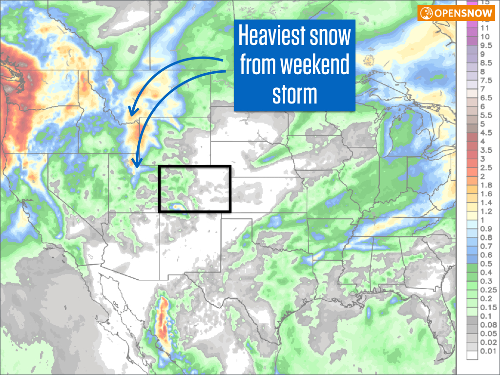
Forecasted liquid equivalent precipitation shows the heaviest precip missing Colorado. Source: Weatherbell.com
Even though the upcoming weekend storm will not bring a lot of snow, it will bring back cool temperatures for later on Sunday through the middle of next week, and this should allow for productive snowmaking.
In the longer range, the west coast looks active starting around November 10th through the middle of the month, but I don't know if this activity will be able to push east into Colorado. Time will tell of course!
JOEL GRATZ
About Our Forecaster
Joel Gratz
Founding Meteorologist
Joel Gratz is the Founding Meteorologist of OpenSnow and has lived in Boulder, Colorado since 2003. Before moving to Colorado, he spent his childhood as a (not very fast) ski racer in eastern Pennsylvania.
Free OpenSnow App


